 |
Home Search OKRoads: |
|
|
Home Search OKRoads: |
Interstate 40 North Carolina
Eastbound - Interstate 85 North to
Interstate 95
|
Highway Information |
|
| Miles | 419.40 |
| Counties Traveled Through |
Haywood, Buncombe, McDowell, Burke, Catawba, Iredell, Davie, Forsyth, Guilford, Alamance, Orange, Durham, Wake, Johnston, Sampson, Duplin, Pender, New Hanover |
| Cities |
Asheville, Morganton, Hickory, Statesville, Winston-Salem, Greensboro, Burlington, Durham, Raleigh, Smithfield, Wilmington |
| Major Junctions |
Interstate 26/ Interstate 240 (Exits 46A-B)
Interstate 77 Interstate 85 Interstate 540 Interstate 440 Interstate 95 |
| OKRoads Coverage | |
| Miles Driven by OKRoads (Percentage) |
419 (100%) |
| Western End of Interstate Driven |
Tennessee State Line |
| Eastern End of Interstate Driven |
North Carolina 132 |
Pictures
Eastbound:
Tennessee State Line to Canton
Interstate 40/Interstate 85 duplex
Interstate 85 North to Interstate 95
| Interstate 40 East | |
 |
Interstate 40 East approaching Exit 261 - Hillsborough - 1 3/4 miles. Exit 261 serves old North Carolina 86. For the first time since Winston-Salem, Interstate 40 is not duplexed with any other highway. (Photo taken 7/6/05) |
 |
Interstate 40 East approaching Exit 261 - Hillsborough - 1 mile. The town of Hillsborough, three miles to the north, had an estimated population of 5,302 in 2004. (Photo taken 7/6/05) |
 |
Interstate 40 East at Exit 261 - Hillsborough. The downtown area includes the Alexander Dickson House, the Occaneeci Indian Village, and the Ruffin-Roulhac House. For more information on historic Hillsborough, visit the Alliance for Historic Hillsborough website. (Photo taken 7/6/05) |
 |
Interstate 40 East approaching Exit 263 - New Hope Church Road - 1 mile. New Hope Church Road is 4.1 miles between the former alignment of North Carolina 10 and the old alignment of North Carolina 86. (Photo taken 7/6/05) |
 |
Interstate 40 East at Exit 263 - New Hope Church Road. (Photo taken 7/6/05) |
 |
Interstate 40 East approaching Exit 266 - North Carolina 86 - 2 miles. North Carolina 86 begins at U.S. 15/U.S. 501 in Chapel Hill and heads northward to the Virginia state line. (Photo taken 7/6/05) |
 |
Use North Carolina 86 South to the town of Carrboro, a western suburb of Chapel Hill with a 2004 estimated population of 16,429. (Photo taken 7/6/05) |
 |
Interstate 40 East approaching Exit 266 - North Carolina 86 - 1 mile. (Photo taken 7/6/05) |
 |
Interstate 40 East at Exit 266 - North Carolina 86 - Chapel Hill. The city is known for being home to the University of North Carolina. (Photo taken 7/6/05) |
 |
The next three exits serve west Durham. The "City of Medicine" is North Carolina's 4th largest city with a population of 201,726 in 2004. For more about the city of Durham, visit the city's website. (Photo taken 7/6/05) |
 |
Interstate 40 East approaching Exit 270 - U.S. 15/U.S. 501 - 2 miles. The two federal highways share a 107-mile duplex between Laurinburg and Durham. (Photo taken 7/6/05) |
 |
Many signs in this area refer to the rival universities of Duke University and the University of North Carolina. The two are separated by just eight miles, and Interstate 40 is between the two. (Photo taken 7/6/05) |
 |
Kenan Stadium is home of the University of North Carolina's football team. The Dean Smith Center, named after the legendary coach, is the base arena for the Tar Heels' basketball teams. (Photo taken 7/6/05) |
 |
Interstate 40 East approaching Exit 270 - U.S. 15/U.S. 501 - 1 mile. Exit 270 is right on the Orange-Durham county line. (Photo taken 7/6/05) |
 |
Use U.S. 15/U.S. 501 north to the state historic sites of Bennett Place and the Duke Homestead and Tobacco Museum. (Photo taken 7/6/05) |
 |
Both the University of North Carolina and Duke University have medical facilities near U.S. 15/U.S. 501. (Photo taken 7/6/05) |
 |
Interstate 40 East widens to three lanes as this sign indicates that the next nine interchanges serve the city of Durham. That will take us through Exit 282, which is just before the Interstate 540 juncture at Exit 283. (Photo taken 7/6/05) |
 |
Interstate 40 East at Exit 270 - U.S. 15/U.S. 501 - Chapel Hill/Durham. (Photo taken 7/6/05) |
 |
Interstate 40 East approaching Exit 273 - North Carolina 54 - 1 1/2 miles. North Carolina 54 and Interstate 40 have met before; they intersect at Exit 148 in Graham along the duplex with Interstate 85. They will meet once more after this at Exit 290 in Cary. (Photo taken 7/6/05) |
 |
Interstate 40 East approaching Exit 273 - North Carolina 54 - 1 mile. A variable message sign also appears on the sign bridge. (Photo taken 7/6/05) |
 |
Interstate 40 East at Exit 273 - North Carolina 54 - Chapel Hill/Durham. Use North Carolina 54 east and North Carolina 751 north to Duke University. (Photo taken 7/6/05) |
 |
Interstate 40 East approaching Exit 274 - North Carolina 751 - 1/2 mile. Between Exits 273 and 274, the interstate travels through the northern section of the Jordan Lake State Recreation Area. (Photo taken 7/6/05) |
 |
Interstate 40 East at Exit 274 - North Carolina 751 - Jordan Lake. (Photo taken 7/6/05) |
 |
The next exit is Exit 276 for Fayetteville Road. Head north on the arterial to North Carolina Central University. The university is the first liberal arts institution founded for African-Americans. (Photo taken 7/6/05) |
 |
The next three exits (Exit 276, Fayetteville Road, 3/4 mile; Exit 278, North Carolina 55, 3 miles; and Exits 279A-B - Durham Freeway, 4 1/2 miles) serve the east side of Durham. (Photo taken 7/6/05) |
 |
Interstate 40 East approaching Exit 276 - Fayetteville Road/Southpoint - 1/2 mile. (Photo taken 7/6/05) |
 |
Interstate 40 East at Exit 276 - Fayetteville Road. Fayetteville Road is 9.3 miles long and connects North Carolina 751 to the south with Main Street near downtown Durham. (Photo taken 7/6/05) |
 |
Interstate 40 East approaching Exit 278 - North Carolina 55 - 1 mile. North Carolina 54 is mentioned here due to its existence 1/4 mile south of Exit 278. (Photo taken 7/6/05) |
 |
Interstate 40 East approaching Exit 288 - North Carolina 55 - 1/2 mile. North Carolina 55 will meet Interstate 40 again at Exit 341. (Photo taken 7/6/05) |
 |
Interstate 40 East at Exit 288 - North Carolina 55/TO North Carolina 54 - Apex. The town of Apex is home to 27,509 and is located at the confluence of U.S. 1, U.S. 64, and North Carolina 55. (Photo taken 7/6/05) |
 |
Use any of the next three exits to the Research Triangle Park, the largest of its kind in the world. (Photo taken 7/6/05) |
 |
Interstate 40 East approaching Exits 279A-B - North Carolina 147/Durham Freeway - 1/2 mile. North Carolina 147 connects Interstate 40 and Interstate 85 to Durham's business district. (Photo taken 7/6/05) |
 |
Interstate 40 East at Exit 279A - North Carolina 147/Durham Freeway South. Alexander Drive passes over the interstate here and intersects North Carolina 147 at its southern terminus less than one mile to the south. (Photo taken 7/6/05) |
 |
Interstate 40 East at Exit 279B - North Carolina 147/Durham Freeway North. Downtown Durham is seven miles to the north. (Photo taken 7/6/05) |
 |
Interstate 40 East approaching Exit 280 - Davis Drive - 1/4 mile. Davis Drive provides an alternate route between Apex and the Research Triangle Park. (Photo taken 7/6/05) |
 |
Interstate 40 East at Exit 280 - Davis Drive. The first warning of a ban on trucks with 3 or more axles in the left lane appears here, one mile prior to the start of the restriction. (Photo taken 7/6/05) |
 |
Interstate 40 East approaching Exit 281 - Miami Boulevard - 1/4 mile. The four-lane arterial connects North Carolina 54 to U.S. 70. (Photo taken 7/6/05) |
 |
Interstate 40 East at Exit 281 - Miami Boulevard. The next exit is just one-half mile away at Page Road. (Photo taken 7/6/05) |
 |
Interstate 40 East at Exit 282 - Page Road. Page Road constitutes 4.9 miles from Miami Boulevard (North Carolina 54) to U.S. 70. (Photo taken 7/6/05) |
 |
Interstate 40 East approaching Exit 283 - Interstate 540 TO U.S. 70 - 1/4 mile. Interstate 540 is what has been finished thus far of the future Raleigh outer loop, which will be signed as Interstate 640 upon its completion. (Photo taken 7/6/05) |
 |
Interstate 40 East at Exit 283 - Interstate 540 TO U.S. 70. Currently, Interstate 540 is 16 miles long and meets its other end at Triangle Town Boulevard, just east of U.S. 1. Interstate 40 will enter Wake County immediately after this interchange. (Photo taken 7/6/05) |
 |
A view of the Interstate 40/Interstate 540 interchange. The top level flyover carries traffic from eastbound Interstate 40 to Interstate 540. (Photo taken 7/6/05) |
 |
Interstate 40 East approaching Exits 284A-B - Airport Boulevard - 1/2 mile. The Raleigh-Durham International Airport is located just to the north of this interchange. (Photo taken 7/6/05) |
 |
Interstate 40 East at Exit 284A - Airport Boulevard westbound. Airport Boulevard connects North Carolina 54 and Interstate 40 to the airport. (Photo taken 7/6/05) |
 |
Interstate 40 East at Exit 284B - Airport Boulevard eastbound/RDU International Airport. (Photo taken 7/6/05) |
 |
Interstate 40 East approaching Exit 285 - Morrisville/Aviation Parkway - 1/2 mile. Aviation Parkway is the main connection between Interstate 540 and the airport, and is a freeway between Globe Road and Airport Boulevard. (Photo taken 7/6/05) |
 |
Interstate 40 East at Exit 285 - Morrisville/Aviation Parkway. Morrisville is three miles to the southwest. (Photo taken 7/6/05) |
 |
Interstate 40 East enters the town of Cary (pop. 101,265). Cary is the 7th largest city in North Carolina. Four exits serve the town; Exit 287 (Harrison Avenue), Exit 289 (Wade Avenue), and Exit 290 (North Carolina 54). (Photo taken 7/6/05) |
 |
Use Harrison Avenue northbound to William B. Umstead State Park. (Photo taken 7/6/05) |
 |
Interstate 40 East approaching Exit 287 - Harrison Avenue - 3/4 mile. Harrison Avenue is 5.6 miles long from the state park southward through downtown Cary to Heater Drive. (Photo taken 7/6/05) |
 |
Stay in the left two lanes to the Martin Luther King Memorial Gardens and the Raleigh State Farmers Market. The farmers market is located off of Exit 297. (Photo taken 7/6/05) |
 |
Interstate 40 East at Exit 287 - Harrison Avenue. (Photo taken 7/6/05) |
 |
The next nine interchanges serve the capital city of Raleigh. With a population of over 326,000, it is North Carolina's 2nd largest city, behind Charlotte. (Photo taken 7/6/05) |
 |
Interstate 40 East approaching Exit 289 - Wade Avenue - 1 mile. Wade Avenue is a freeway between Interstate 40 and Interstate 440, then transitions into a surface street east of the beltline. (Photo taken 7/6/05) |
 |
This directional sign indicates that traffic going to downtown Raleigh should remain on Interstate 40 East. If north Raleigh is your destination, use Wade Avenue east to Interstate 440. (Photo taken 7/6/05) |
 |
Wade Avenue's freeway section includes one exit between the ends at Edwards Mill Road. Near that interchange are Carter-Finley Stadium (home of the North Carolina State football team), the state fairgrounds, and the North Carolina State University College of Veterinary Medicine. (Photo taken 7/6/05) |
 |
Interstate 40 East approaching Exit 289 - Wade Avenue TO Interstate 440 and U.S. 1 North - 1/2 mile. (Photo taken 7/6/05) |
 |
Although difficult to see around the semi, a sign here indicates that the arena and stadium complex is also accessed via Wade Avenue. The complex is located at the Wade Avenue/Edwards Mill Road interchange and includes the RBC Center, home of the NHL's Carolina Hurricanes, and Carter-Finley Stadium. (Photo taken 7/6/05) |
 |
Interstate 40 East at Exit 289 - Wade Avenue TO Interstate 440/U.S. 1 North. Interstate 40 will meet Interstate 440 and U.S. 1 in four miles. (Photo taken 7/6/05) |
 |
Interstate 40 curves to the south-southwest as it approaches Exit 290 - North Carolina 54 - 3/4 mile. The signs on Interstate 40 between Exit 289 and Exit 301 appear to be original. The only state-named Interstate 40 assurance shields east of the Mississippi River appear on this stretch. (Photo taken 7/6/05) |
 |
There are three exits remaining to serve Cary; Exit 290 (North Carolina 54), Exit 291 (Cary Towne Boulevard), and Exit 293 (Interstate 440/U.S. 1/U.S. 64). (Photo taken 7/6/05) |
 |
Exit 298B (U.S. 70 West/U.S. 401 North/North Carolina 50 North) provides the main route into downtown Raleigh from Interstate 40. (Photo taken 7/6/05) |
 |
Interstate 40 East approaching Exit 290 - North Carolina 54 - 1/4 mile. (Photo taken 7/6/05) |
 |
Interstate 40 East at Exit 290 - North Carolina 54 - Cary. This is the 3rd and final time that Interstate 40 and North Carolina 54 meet, as the state highway ends three miles to the east at Interstate 440. (Photo taken 7/6/05) |
 |
Interstate 40 East approaching Exit 291 - Cary Towne Boulevard - 1/4 mile. Cary Towne Boulevard is a short route to the Cary Towne Center. (Photo taken 7/6/05) |
 |
Interstate 40 East at Exit 291 - Cary Towne Boulevard. (Photo taken 7/6/05) |
 |
Interstate 40 East approaching Exit 293 - U.S. 1/U.S. 64 West/Interstate 440 Inner - 3/4 mile. Interstate 440 is the Benson Beltline around Raleigh. Currently, it is duplexed with Interstate 40 along its southern section, but will be decommissioned from that duplex soon. (Photo taken 7/6/05) |
 |
Exit 293A serves U.S. 1 South and U.S. 64 West. Use U.S. 64 West to Asheboro (63 miles) and Jordan Lake (17 miles), and U.S. 1 South for 63 miles to Pinehurst, site of the 2005 U.S. Open golf championship. (Photo taken 7/6/05) |
 |
Interstate 40 East at Exit 293 - U.S. 1/U.S. 64 West/Interstate 440 Inner - Sanford/Wake Forest. Sanford is located 34 miles to the south along U.S. 1. The town of Wake Forest is 26 miles north of this cloverleaf interchange. However, Wake Forest University is actually based in Winston-Salem. (Photo taken 7/6/05) |
 |
Collector/distributor lanes help out the movements on both freeways at this interchange. Exit 293A for U.S. 1 South and U.S. 64 West departs in this view. An Interstate 440 shield assembly is also shown here. (Photo taken 7/6/05) |
 |
Interstate 40 East at Exit 293B - Interstate 440 Inner/U.S. 1 North - Wake Forest. Interstate 440 and U.S. 64 prepare to merge onto Interstate 40 ahead. (Photo taken 7/6/05) |
| Interstate 40 East, Interstate 440 Inner, and U.S. 64 East | |
 |
Interstate 40 East, U.S. 64 East, and Interstate 440 assurance shields just east of Exit 293. The three federal highways share the freeway between Exit 293 and Exit 301. (Photo taken 7/6/05) |
 |
Interstate 40 East, Interstate 440 Inner, and U.S. 64 East approaching Exit 295 - Gorman Street - 1 mile. Gorman Street is 3.4 miles long from Tryon Road just south of the freeway to North Carolina 54 (Hillsborough Street) west of downtown Raleigh. (Photo taken 7/6/05) |
 |
Use Gorman Street northbound to Meredith College, North Carolina State University, and the William Neal Reynolds Coliseum. (Photo taken 7/6/05) |
 |
Interstate 40 East, Interstate 440 Inner, and U.S. 64 East at Exit 295 - Gorman Street. For being in the 2nd largest city in the state and also its capital city, Interstate 40 seems fairly rural in comparison to other urban interstates we've been on. (Photo taken 7/6/05) |
 |
Interstate 40 East, Interstate 440 Inner, and U.S. 64 East approaching Exit 297 - Lake Wheeler Road - 3/4 mile. The arterial will pass by Lake Wheeler five miles south of the interstate. (Photo taken 7/6/05) |
 |
Use Lake Wheeler Road east to the Raleigh State Farmers Market and Dorothea Dix Hospital, a mental care facility. (Photo taken 7/6/05) |
 |
Prior to Exit 297, a guide sign appears advising those headed to Wake Technical Community College to use Exit 298A (U.S. 70/North Carolina 50 East/U.S. 401 South). (Photo taken 7/6/05) |
 |
Interstate 40 East, Interstate 440 Inner, and U.S. 64 East at Exit 297 - Lake Wheeler Road/Farmers Market. (Photo taken 7/6/05) |
 |
Interstate 40 East, Interstate 440 Inner, and U.S. 64 East approaching Exits 298A-B - U.S. 401/U.S. 70/North Carolina 50 - 3/4 mile. The three highways triplex for 4.8 miles through downtown Raleigh. (Photo taken 7/6/05) |
 |
An old button-copy sign provides the one-quarter mile advance notice of Exit 298A to U.S. 401 South, U.S. 70 East, and North Carolina 50 East. The right lane of this five-lane section of freeway is the exit only lane for Exit 298A. (Photo taken 7/6/05) |
 |
Interstate 40 East, Interstate 440 Inner, and U.S. 64 East at Exit 298A - U.S. 401 South/U.S. 70 East/North Carolina 50 East - Fayetteville/Garner. The city of Fayetteville is home to Fort Bragg and is a 58 mile drive south from here. Garner, on the other hand, is a suburb of Raleigh along U.S. 70 and is just six miles away. One last thing about this exit is that the pull-through panel includes U.S. 70 and North Carolina 50, yet those highways were routed along the freeway between 1984 and 1991. For more on this and other idiosyncrasies about the beltline, visit GribbleNation.com. (Photo taken 7/6/05) |
 |
Interstate 40 East, Interstate 440 Inner, and U.S. 64 East at Exit 298B - U.S. 70 & North Carolina 50 West & U.S. 401 North - South Saunders Street northbound. The state capitol building is just east of Saunders Street between Morgan and Edonton streets. (Photo taken 7/6/05) |
 |
The next exit, Exit 299, serves Person Street and Hammond Road. Use Hammond Road and Person Street northbound to Shaw University, the oldest African-American college in the South. Hammond Road becomes Person Street less than one mile north of the beltline at Hoke Street. (Photo taken 7/6/05) |
 |
Interstate 40 East, Interstate 440 Inner, and U.S. 64 East at Exit 299 - Person Street/Hammond Road. (Photo taken 7/6/05) |
 |
Interstate 40 East, Interstate 440 Inner, and U.S. 64 East approaching Exit 300 - Rock Quarry Road - 1/2 mile. Rock Quarry Road travels through southeast Wake County. (Photo taken 7/6/05) |
 |
Follow Rock Quarry Road and Tarboro Road north to St. Augustine's College. The Martin Luther King Memorial Gardens are in the middle of the intersection of Rock Quarry Road, Martin Luther King Jr. Boulevard, and Raleigh Boulevard. (Photo taken 7/6/05) |
 |
Interstate 40 East, Interstate 440 Inner, and U.S. 64 East at Exit 300 - Rock Quarry Road. (Photo taken 7/6/05) |
 |
Interstate 40 East, Interstate 440 Inner, and U.S. 64 East approaching Exit 301 - Interstate 440 West/U.S. 64 East - 1 mile. Suddenly, Interstate 440 is signed east-west instead of inner/outer. That will be the case once Interstate 440 is deleted from the southern section of the beltline. (Photo taken 7/6/05) |
 |
Interstate 40 East, Interstate 440 Inner, and U.S. 64 East approaching Exit 301 - Interstate 440 West/U.S. 64 East - 1/2 mile. The two right lanes continue on Interstate 40 East to Wilmington. From Exit 301 to Wilmington, Interstate 40 runs in a north-south direction, but is still signed east-west. (Photo taken 7/6/05) |
 |
Continue on Interstate 40 East to Smithfield (near the Interstate 40/Interstate 95 junction), Fayetteville (also located on Interstate 95), and Goldsboro, located at the confluence of U.S. 13, U.S. 70, and U.S. 117. (Photo taken 7/6/05) |
 |
Interstate 40 East, Interstate 440 Inner, and U.S. 64 East at Exit 301 - Interstate 440 West/U.S. 64 East. Rocky Mount is set at the Interstate 95/U.S. 64 juncture and is 52 miles away. (Photo taken 7/6/05) |
| Interstate 40 East | |
 |
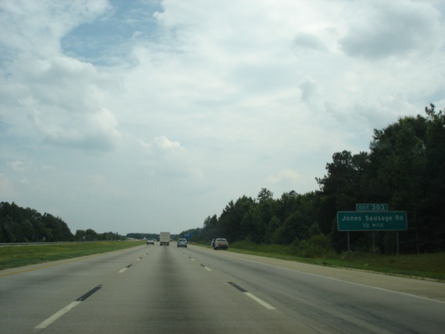
Interstate 40 East approaching Exit 303 - Jones Sausage Road - 1 mile. Two interchanges remain in Wake County, with the other one at U.S. 70 (Exit 306). The freeway gains an extra eastbound lane from Interstate 440 East. (Photo taken 7/6/05) |
 |
The Alltel Pavilion at Walnut Creek is located near the Interstate 40/Interstate 440 junction. Take Jones Sausage Road north to Rock Quarry Road north to the amphitheater. (Photo taken 7/6/05) |
 |
Interstate 40 East approaching Exit 303 - Jones Sausage Road - 1/2 mile. (Photo taken 7/6/05) |
 |
Interstate 40 East at Exit 303 - Jones Sausage Road. Jones Sausage Road is 3.5 miles long from U.S. 70 in east Garner to Rock Quarry Road. (Photo taken 7/6/05) |
 |
Interstate 40 East approaching Exit 306 - U.S. 70 - 1 1/2 miles. (Photo taken 7/6/05) |
 |
Interstate 40 East approaching Exit 306 - U.S. 70 - 1 mile. Fayetteville is added as a control city for Interstate 40 East, even though it stays over 30 miles to its north. (Photo taken 7/6/05) |
 |
An extra lane is added for the single off-ramp that will split into separate directions of U.S. 70. Garner Road crosses the interstate ahead of the interchange. (Photo taken 7/6/05) |
 |
Use U.S. 70 East to Goldsboro (42 miles) and Clayton, seven miles away. (Photo taken 7/6/05) |
 |
Interstate 40 East at Exit 306 - U.S. 70 - Garner/Smithfield/Goldsboro. The North Carolina Railroad travels over Interstate 40 in this view. (Photo taken 7/6/05) |
 |
View of the Exit 306 off-ramp split. Two lanes are allocated for U.S. 70 East. The rest of this interchange is a standard cloverleaf. (Photo taken 7/6/05) |
 |
Mileage sign on Interstate 40 East just past Exit 306. Benson is 23 miles ahead at the junction of Interstate 40 and Interstate 95, and Wilmington is 120 miles ahead. Interstate 40 will end just shy of downtown Wilmington in 113 miles. (Photo taken 7/6/05) |
 |
Interstate 40 East prepares to enter Johnston County as the two mile advance signage for Exit 312 appears. Exit 312 serves North Carolina 42, a highway that connects Asheboro, Sanford, Clayton, and Wilson. (Photo taken 7/6/05) |
 |
Interstate 40 East approaching Exit 312 - North Carolina 42 - 1 mile. The upcoming interchange has seen massive development around it in recent years, and is known as 40/42 to locals. (Photo taken 7/6/05) |
 |
A 39 mile drive on North Carolina 42 east separates Exit 312 from Wilson. (Photo taken 7/6/05) |
 |
Interstate 40 East at Exit 312 - North Carolina 42 - Clayton/Fuquay-Varina. The Wake County town of Fuquay-Varina (pop. 11,110) is 14 miles to the west. (Photo taken 7/6/05) |
 |
Interstate 40 East approaching Exit 319 - North Carolina 210 - 2 miles. North Carolina 210 is a north-south crescent-shaped highway. It begins at U.S. 17 in Dixon, skirts the Atlantic coast on Topsail Island, duplexes with U.S. 17 for nine miles, heads northwest through Fayetteville, then turns to the northeast in Lillington and goes due east from Angier to Smithfield. (Photo taken 7/6/05) |
 |
Exit 319 is known as McGees Crossroads. The area surrounding Exit 319 has many crossroads, including Johnson Crossroads, Ogburn Crossroads, Hardee Crossroads, and Coats Crossroads. (Photo taken 7/6/05) |
 |
Interstate 40 East approaching Exit 319 - North Carolina 210 - 1 mile. The two highways will meet once again at Exit 408. (Photo taken 7/6/05) |
 |
Interstate 40 East at Exit 319 - North Carolina 210 - Smithfield/Angier. The town of Smithfield (pop. 11,702), the seat of Johnston County, is 14 miles to the east. Angier, located in far north Harnett County at the intersection of North Carolina 55 and North Carolina 210, is 11 miles to the west. (Photo taken 7/6/05) |
 |
Interstate 40 East approaching the Johnston County rest area - 2 miles. This is the next-to-last rest area on Interstate 40. (Photo taken 7/6/05) |
 |
Interstate 40 East approaching Exit 325 - North Carolina 242 to U.S. 301 - 2 miles. North Carolina 242 is a north-south highway extending 60 miles from Interstate 40 to U.S. 701/North Carolina 41/North Carolina 53 in Elizabethtown. (Photo taken 7/6/05) |
 |
Interstate 40 East at the Johnston County rest area, the 5th of six along Interstate 40. (Photo taken 7/6/05) |
 |
Interstate 40 East approaching Exit 325 - North Carolina 242 to U.S. 301 - 1/2 mile. There is no direct connection between Interstate 40 and U.S. 301 due to U.S. 301's proximity to the Interstate 40/Interstate 95 junction. (Photo taken 7/6/05) |
 |
Interstate 40 East at Exit 325 - North Carolina 242 to U.S. 301 - Benson. Motorists are advised to continue on Interstate 40 to get to Interstate 95 instead of using North Carolina 242 South through Benson. The town of 3,145 is three miles south of Exit 325. (Photo taken 7/6/05) |
 |
Interstate 40 East approaching Exits 328A-B - Interstate 95 - 1 1/2 miles. Interstate 95, the "Main Street of the East Coast," spends 181 miles inside the Tar Heel State, connecting Lumberton, Fayetteville, Smithfield, Wilson, Rocky Mount, and Roanoke Rapids. (Photo taken 7/6/05) |
 |
Interstate 40 East approaching Exits 328A-B - Interstate 95 - 1 mile. Rocky Mount, located at the Interstate 95/U.S. 64 junction, is 60 miles to the north. (Photo taken 7/6/05) |
 |
Use Exit 328A (Interstate 95 South) to Campbell University, located in Buies Creek near the intersection of U.S. 421 and North Carolina 27. (Photo taken 7/6/05) |
 |
Interstate 40 East approaching Exit 328A - Interstate 95 South - 1/4 mile. Fayetteville is added as a destination city closer to the interchange. An extra lane is allocated to provide three eastbound lanes through the modified cloverleaf interchange between two major transcontinental interstates. (Photo taken 7/6/05) |
 |
Interstate 40 East at Exit 328A - Interstate 95 South - Benson/Fayetteville. Also notice that suddenly, Interstate 95 North has an extra city; Smithfield is added to the final two guide signs for Exit 328B. (Photo taken 7/6/05) |
 |
The city of Wilson is given a passing glance with its own separate sign, even though with a population of over 46,000, it is larger that Smithfield. Wilson falls short, however, of Rocky Mount, population 56,351. (Photo taken 7/6/05) |
 |
Interstate 40 East at Exit 328B - Interstate 95 North - Rocky Mount/Smithfield/Wilson/Washington, DC/Baltimore/New York City/Houlton. Okay, so maybe not all of those cities appear on this sign, but they are all served by Interstate 95. (Photo taken 7/6/05) |
Page created: November 15, 2005
Last updated:
November 19, 2005