 |
Home Search OKRoads: |
|
|
Home Search OKRoads: |
Interstate 77 Virginia
|
Highway Information |
|
| Miles | 69.4 |
| Counties Traveled Through |
Carroll, Wythe, Bland |
| Cities | Wytheville, Bluefield |
| Major Junctions |
Interstate 81 (Exit 32 & Exit 40) |
| OKRoads Coverage | |
| Miles Driven by OKRoads (Percentage) |
36 (52%) |
| Southern End of Interstate Driven (Section 1) |
North
Carolina State Line |
| Northern End of Interstate Driven (Section 1) |
Virginia Secondary 620 |
| Southern End of Interstate Driven (Section 2) |
Interstate 81 |
| Northern End of Interstate Driven (Section 2) |
West
Virginia State Line |
Pictures
| Interstate 77 North | |
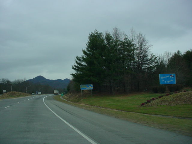 |
Welcome to Virginia sign on Interstate 77 North as the interstate enters the Old Dominion State. The Virginia Welcome Center is off to the right. (Photo taken 12/18/03) |
 |
Interstate 77 North at Exit 1 - Virginia Secondary 620. The Blue Ridge Parkway is five miles to the northwest. (Photo taken 12/18/03) |
| Interstate 77 North and Interstate 81 and U.S. 11 South | |
 |
Interstate 81 South/Interstate 77 North at Exit 80 - U.S. 52 South/VA 121 North - Fort Chiswell/Max Meadows. (Photo taken 3/20/03) |
| Interstate 77 and U.S. 52 North and Interstate 81 and U.S. 11 South | |
 |
Talk about a wrong-way fourplex! Shields for Interstate 77 North, Interstate 81 South, U.S. 11 South, and U.S. 52 North just past Exit 80. The four highways remain on the same highway for seven more miles before U.S. 11 exits off at Exit 73, which will be followed by the departure of Interstate 77 a mile later. (Photo taken 3/20/03) |
 |
Interstate 81 South/Interstate 77 North at Exit 77 - Service Rd. (Photo taken 3/20/03) |
 |
Interstate 81 South/Interstate 77 North at Exit 73 - U.S. 11 South - Wytheville. (Photo taken 3/20/03) |
| Interstate 77 and U.S. 52 North and Interstate 81 South | |
 |
Interstate 81 South/Interstate 77 North approaching Exit 72 - Interstate 77 North - 3/4 mile. This day began a little foggy, but thankfully it did not last long. (Photo taken 3/21/03) |
 |
Interstate 81 South/Interstate 77 North at Exit 72 - Interstate 77 North - Bluefield/Charleston W. Va. (Photo taken 3/21/03) |
 |
Interstate 77 North officially leaves Interstate 81 South behind here. Another lane has been set aside for those wanting to head towards the Mountain State. The wrong-way duplexing continues, as the mainline remains as Interstate 81 South and U.S. 52 North. It is easy to get confused around here! (Photo taken 3/21/03) |
| Interstate 77 North | |
 |
Interstate 77 North approaching Exit 41 - Virginia Secondary 610 - 1/2 mile. This sign is on the loop ramp from Interstate 81 North to Interstate 77 North. (Photo taken 7/7/05) |
 |
Interstate 77 North at Exit 41 - Virginia Secondary 610/Peppers Ferry Road. This is the final exit to serve the town of Wytheville and its 7,917 residents. (Photo taken 7/7/05) |
 |
Interstate 77 North at Exit 47 - Virginia Secondary 717. The road is set along the southern side of the Walker Mountains. (Photo taken 7/7/05) |
 |
Interstate 77 North as it prepares to enter the Big Walker Mountain Tunnel, one of two the interstate will see in the state. (Photo taken 7/7/05) |
 |
Interstate 77 North approaching Exit 52 - U.S. 52/Virginia 42 - 1/2 mile. The two highways share a five-mile duplex that ends in the community of Bland just to the east. (Photo taken 7/7/05) |
 |
Interstate 77 North at Exit 52 - U.S. 52/Virginia 42. U.S. 52 will closely parallel Interstate 77 from Bland through Exit 1 in West Virginia. (Photo taken 7/7/05) |
 |
Interstate 77 North approaching a truck escape ramp, 3/4 mile. (Photo taken 7/7/05) |
 |
Interstate 77 North at the truck escape ramp. Virginia Secondary 612 crosses over the interstate prior to the ramp. (Photo taken 7/7/05) |
 |
The next exit is Exit 58 and provides another ramp to U.S. 52. Go north on U.S. 52 to the Wolf Creek Indian Village and Museum. (Photo taken 7/7/05) |
 |
Interstate 77 North approaching a rest area - 2 miles. The stop is just after Exit 58. (Photo taken 7/7/05) |
 |
Interstate 77 North at Exit 58 - U.S. 52 - Bastian. The federal highway is not directly served by Exit 58; one must use Virginia Secondary 666 west for a short length before reaching U.S. 52. (Photo taken 7/7/05) |
 |
Interstate 77 North at the rest area. (Photo taken 7/7/05) |
 |
Interstate 77 North approaching Exit 62 - Virginia Secondary 606 - 1 mile. Virginia Secondary 606 connects Interstate 77 to Virginia 42, a distance of 13 miles. (Photo taken 7/7/05) |
 |
Interstate 77 North at Exit 62 - Virginia Secondary 606 - South Gap. (Photo taken 7/7/05) |
 |
Interstate 77 North approaching Exit 64 - U.S. 52/Virginia 61 - 1 mile. Virginia 61 travels 47.8 miles between Tazewell and Narrows. (Photo taken 7/7/05) |
 |
Interstate 77 North at Exit 64 - U.S. 52/Virginia 61 - Rocky Gap. The duplex between the two highways is less than one-half mile long. (Photo taken 7/7/05) |
 |
Interstate 77 North at Exit 66 - Virginia 598. U.S. 52 South is also served by this interchange. Virginia 598 represents the original route of U.S. 52 to Bluefield. The federal highway now heads north with Interstate 77 through the East River Mountain Tunnel before departing at Exit 1 in West Virginia. (Photo taken 7/7/05) |
 |
Interstate 77 and U.S. 52 North as they enter the East River Mountain Tunnel. About halfway through the tunnel, motorists will enter the state of West Virginia. The tunnel is 5,400 feet long, or just more than one mile. (Photo taken 7/7/05) |
| Scenes Related to Interstate 77 | |
 |
Virginia Secondary 620 West at Interstate 77 South. Virginia Secondary 620 is accessed from Exit 1. The Blue Ridge Parkway is just five miles ahead. (Photo taken 12/18/03) |
Page created: December 20, 2005
Last updated:
December 20, 2005