 |
Home Search OKRoads: |
|
|
Home Search OKRoads: |
Wisconsin 13
Wisconsin 13 begins at Interstate 90/Interstate 94 in Wisconsin Dells and travels northward to U.S. 2 and U.S. 53 southeast of Superior. The state highway spans 338 miles and serves Wisconsin Rapids, Marshfield, and Ashland. Part of the highway is along the shores of Lake Superior.
Pictures
| Wisconsin 13 North | |
 |
Wisconsin 13 North and Alternate Interstate 90 assurance shields as traffic from westbound Interstate 90 and Interstate 94 merges onto the state highway. The first part of the highway travels east-west. (Photo taken 7/12/05) |
 |
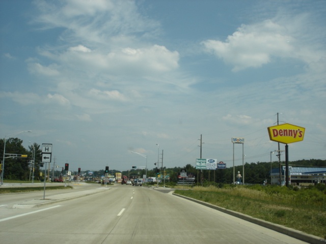
Wisconsin 13 North approaching County H. County H travels 13.9 miles from Wisconsin 13 west to the Dell Creek State Wildlife Area and Mirror Lake State Park before heading south to Wisconsin 23 in Reedsburg. (Photo taken 7/12/05) |
 |
Wisconsin 13 North at County H. (Photo taken 7/12/05) |
 |
Wisconsin 13 North approaching U.S. 12/Wisconsin 16/Wisconsin 23. Wisconsin 16 and Wisconsin 23 share 1.4 miles of roadway with Wisconsin 23 through downtown Wisconsin Dells before they split. (Photo taken 7/12/05) |
 |
Continue straight for Wisconsin 13 North, Wisconsin 16 East, and Wisconsin 23 East. (Photo taken 7/12/05) |
 |
Wisconsin 13 North approaching U.S. 12/Wisconsin 16/Wisconsin 23. (Photo taken 7/12/05) |
 |
Wisconsin 13 North at U.S. 12/Wisconsin 16/Wisconsin 23. To the left is U.S. 12 and Wisconsin 16 West. To the right is U.S. 12 East and Wisconsin 23 West on a wrong-way duplex. (Photo taken 7/12/05) |
 |
Wisconsin 13 North, Wisconsin 16 East, and Wisconsin 23 East assurance shields just past U.S. 12. Downtown Wisconsin Dells is just ahead. (Photo taken 7/12/05) |
| Wisconsin 13 South | |
 |
Wisconsin 13 South assurance shield just west of U.S. 12. This is the final assurance shield before the state highway ends in 3/4 mile. (Photo taken 7/12/05) |
 |
Wisconsin 13 South approaching County H. This is the final opportunity to turn before getting onto Interstate 90 and Interstate 94. (Photo taken 7/12/05) |
 |
Wisconsin 13 South at County H. (Photo taken 7/12/05) |
 |
Junction Interstate 90 and Interstate 94 and end Wisconsin 13 shield assembly as the state highway approaches Interstates 90 and 94 in Wisconsin Dells. (Photo taken 7/12/05) |
 |
Wisconsin 13 South approaching Interstate 90 and Interstate 94. (Photo taken 7/12/05) |
 |
Use Interstate 90 and Interstate 94 West to Tomah, which is located at the western split of the interstates 46 miles to the northwest. Madison, the state capital, is 53 miles to the south. (Photo taken 7/12/05) |
 |
Wisconsin 13 South at the gore point of the ramps to each direction of Interstate 90 and Interstate 94. (Photo taken 7/12/05) |
| Scenes Related to Wisconsin 13 | |
 |
U.S. 12 and Wisconsin 16 East at Wisconsin 13. Wisconsin 16 heads to the left along Wisconsin 13 North, and Wisconsin 23, which comes in from the left, will begin a wrong-way duplex with U.S. 12 ahead. (Photo taken 7/12/05) |
 |
U.S. 2 East and U.S. 53 South at Wisconsin 13/County Z - Port Wing/Bayfield. This marks the northern terminus of the state highway. Port Wing is 36 miles to the east, and Bayfield is 73 miles to the east. (Photo taken 8/10/04) |
Page created: March 06, 2006
Last updated:
March 06, 2006