 |
Home Search OKRoads: |
|
|
Home Search OKRoads: |
Interstate 19
At a length of just 63 miles, Interstate 19 is one of the shortest two-digit interstates in the country. It connects Interstate 10 in Tucson with Nogales and the U.S.-Mexico border. The highway is currently signed in metric units, so all exits and mile markers are based on kilometers. However, those days appear to be numbered, as mile markers have been put in place along most of Interstate 19, and the newest signs near Interstate 10 are based on mileage, even though the exit numbers are still kilometer-based.
|
Highway Information |
|
| Miles | 63.35 |
| Counties Traveled Through |
Santa Cruz, Pima |
| Cities | Nogales, Tucson |
| Major Junctions |
Interstate 10 (Exits 101A-B) |
| OKRoads Coverage | |
| Miles Driven by OKRoads (Percentage) |
63 (100%) |
| Southern End of Interstate Driven |
Nogales |
| Northern End of Interstate Driven |
Interstate 10 |
Pictures
| Northbound | |
 |
Interstate 19 North as it begins in Nogales. (Photo taken 3/15/04) |
 |
Interstate 19 North approaching Exit
1 - Western Ave. - 500 meters. (Photo taken 3/15/04) |
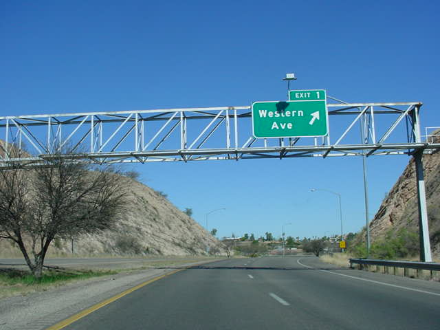 |
Interstate 19 North at Exit 1 -
Western Ave. (Photo taken 3/15/04) |
 |
Interstate 19 North at Exit 4 - AZ
189 South - Mariposa Rd. (Photo taken 3/15/04) |
 |
Interstate 19 North at Exit 12 - AZ
289 West - Ruby Road. (Photo taken 3/15/04) |
 |
Interstate 19 North at Exit 17 - Rio Rico Dr./Yavapai Dr. (Photo taken 3/15/04) |
 |
Interstate 19 North at Exit 22 -
Peck Canyon Rd. (Photo taken 3/15/04) |
 |
Interstate 19 North at Exit 25 -
Palo Parado Rd. (Photo taken 3/15/04) |
 |
Interstate 19 North at kilometer 26. (Photo taken 3/15/04) |
 |
Interstate 19 North at Exit 29 - Tumacacori/Carmen. (Photo taken 3/15/04) |
 |
Interstate 19 North at Exit 34 -
Tubac. (Photo taken 3/15/04) |
 |
Interstate 19 North at Exit 40 -
Chavez Siding Rd. (Photo taken 3/15/04) |
 |
"All Traffic Must Stop 1 km" sign on Interstate 19 North. Exit 42 is the Border Patrol checkpoint. (Photo taken 3/15/04) |
 |
Interstate 19 North at Exit 42 -
Agua Linda Rd. (Photo taken 3/15/04) |
 |
Interstate 19 North at Exit 48 -
Arivaca Rd. (Photo taken 3/15/04) |
 |
Interstate 19 North at Exit 56 -
Canoa Rd. (Photo taken 3/15/04) |
 |
Distance sign on Interstate 19 North just past Exit 56. Interstate 10 is 44 km ahead, and Tucson is 45 km away. (Photo taken 3/15/04) |
 |
Interstate 19 North at Exit 63 - Continental Rd. (Photo taken 3/15/04) |
 |
Interstate 19 North at Exit 65 - Esperanza Blvd. (Photo taken 3/15/04) |
 |
Interstate 19 North at Exit 69 -
Duval Mine Rd. (Photo taken 3/15/04) |
 |
Distance sign on Interstate 19 North just north of Green Valley. Interstate 10 is now 30 kilometers away. (Photo taken 3/15/04) |
 |
Interstate 19 North at Exit 75 - Sahuarita Rd. (Photo taken 3/15/04) |
 |
Interstate 19 North at Exit 80 -
Pima Mine Rd. (Photo taken 3/15/04) |
 |
Distance sign on Interstate 19 North just past Pima Mine Rd. AZ 86, even though it is not mentioned on the actual signs for the exit, is 14 km ahead. (Photo taken 3/15/04) |
 |
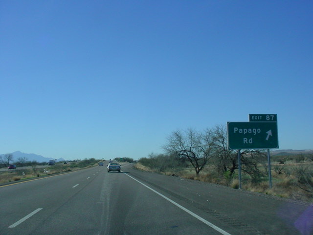
Interstate 19 North at Exit 87 -
Papago Rd. (Photo taken 3/15/04) |
 |
Interstate 19 North at Exit 92 - San Xavier Rd. (Photo taken 3/15/04) |
 |
Interstate 19 North at Exit 95 - Valencia Rd./Tucson International Airport. (Photo taken 3/15/04) |
 |
Interstate 19 North at Exit 98 - Irvington Rd. (Photo taken 3/15/04) |
 |
Interstate 19 North approaching Exit 99 - Ajo Way - 1 km, and Exits 101A-B - Interstate 10 - 3 km. The sign is missing the Interstate 10 shield. (Photo taken 3/15/04) |
 |
Interstate 19 North at Exit 99 - (AZ 86)/Ajo Way. Notice the sign for Exit 102 is in miles. There is normally a sign here for Interstate 10 East, but that ramp was closed at this time due to the reconstruction of the I-10/I-19 interchange. (Photo taken 3/15/04) |
 |
Interstate 19 North approaching Exit 102 - 29th St./22nd St./Silverlake Rd./ Starr Pass Blvd. - 1/2 mile. The lights on the right side of the sign bridge are for a future sign for the Interstate 10 East exit. (Photo taken 3/15/04) |
 |
Interstate 19 North approaching Exit 102 - 1/4 mile. When the construction is complete, the exit to Interstate 10 East will be near this point. (Photo taken 3/15/04) |
 |
Interstate 19 North at Exit 102 -
29th St./22nd St./Silverlake Rd./Starr Pass Blvd. The flyover ramp will carry Interstate 10 West to Interstate 19 South traffic. (Photo taken 3/15/04) |
 |
Close-up view of the flyover from I-10 West to I-19 South, with the Tucson skyline and the mountains providing a nice view. (Photo taken 3/15/04) |
| Southbound | |
 |
Interstate 19 South assurance shield
just south of Interstate 10. (Photo taken 3/15/04) |
 |
Interstate 19 South at Exit 99 - Ajo
Way. (Photo taken 3/15/04) |
 |
This sign informs motorists that
metric signs are used on Interstate 19. Just past that sign is a 1 km advance sign for Exit 98. (Photo taken 3/15/04) |
 |
Interstate 19 South at Exit 98 -
Irvington Rd. (Photo taken 3/15/04) |
 |
Interstate 19 South at Exit 95 -
Valencia Rd./Tucson International Airport. (Photo taken 3/15/04) |
 |
Interstate 19 South at Exit 92 - San Xavier Rd. (Photo taken 3/15/04) |
 |
Interstate 19 South at Exit 87 -
Papago Rd. (Photo taken 3/15/04) |
 |
"Mileage" sign on Interstate 19
South. I don't know what you'd call a sign that lists distances in kilometers. A "kilometerage" sign, perhaps? (Photo taken 3/15/04) |
 |
Interstate 19 South at Exit 80 -
Pima Mine Rd. (Photo taken 3/15/04) |
 |
Interstate 19 South at Exit 75 - Sahuarita Rd. (Photo taken 3/15/04) |
 |
Interstate 19 South at Exit 69 -
Duval Mine Rd. (Photo taken 3/15/04) |
 |
Interstate 19 South at Exit 65 - Esperanza Blvd. (Photo taken 3/15/04) |
|
|
Interstate 19 South at Exit 63 - Continental Rd. (Photo taken 3/15/04) |
 |
Interstate 19 South at Exit 56 -
Canoa Rd. (Photo taken 3/15/04) |
 |
Interstate 19 South at Exit 48 -
Arivaca Rd. (Photo taken 3/15/04) |
 |
Interstate 19 South at Exit 42 -
Agua Linda Rd. (Photo taken 3/15/04) |
 |
Interstate 19 South at Exit 40 -
Chavez Siding Rd. (Photo taken 3/15/04) |
 |
Interstate 19 South at Exit 34 -
Tubac. (Photo taken 3/15/04) |
 |
Interstate 19 South at Exit 29 - Tumacacori/Carmen. (Photo taken 3/15/04) |
 |
Interstate 19 South at Exit 25 -
Palo Parado Rd. (Photo taken 3/15/04) |
 |
Interstate 19 South at Exit 22 -
Peck Canyon Rd. (Photo taken 3/15/04) |
 |
Interstate 19 South at Exit 17 - Rio Rico Dr./Yavapai Dr. (Photo taken 3/15/04) |
 |
Interstate 19 South at Exit 12 - AZ 289 - Pena Blanca Lake Recreational Area. (Photo taken 3/15/04) |
 |
Guns and ammunition are illegal in Mexico, as this sign states in English and Spanish. (Photo taken 3/15/04) |
 |
Interstate 19 South at Exit 8 -
Grand Ave. This is the southbound beginning of Business Loop I-19. (Photo taken 3/15/04) |
 |
Interstate 19 South at Exit 4 - AZ
189 South. (Photo taken 3/15/04) |
 |
Interstate 19 South at Exit 1B -
Western Ave. The mountains in the distance are in Mexico. (Photo taken 3/15/04) |
 |
Interstate 19 South approaching Exit 1A - International St. - 500 meters. Downtown Nogales is 1 km away. (Photo taken 3/15/04) |
 |
Interstate 19 South at Exit 1A - International St. There is not actually a signal ahead. (Photo taken 3/15/04) |
 |
Interstate 19 South as it comes to
an end. Mexico is just a few feet to the right of this picture. There is no "END" sign at this terminus. (Photo taken 3/15/04) |
 |
The sign in the distance is for the border crossing. This view is from the curve in the distance of the above photograph. (Photo taken 3/15/04) |
Highway Links
RockyMountainRoads.com (Andy Field/Alex Nitzman)
Page created: February 15, 2005
Last updated:
February 15, 2005