 |
Home Search OKRoads:
|
|
|
Home Search OKRoads:
|
Interstate 10
Interstate 10 is the southernmost transcontinental east-west interstate in the United States. Connecting the Pacific Coast Highway in Santa Monica, California, to the Main Street of the East Coast (Interstate 95) in Jacksonville, Florida, Interstate 10 traverses many different types of terrain, from the beaches and deserts of California to more deserts in Arizona, New Mexico, and west Texas to the bayous of east Texas, Louisiana, Mississippi, Alabama, and the Florida panhandle.
|
Highway Information |
|
| States Traveled
Through (Mileage in state) |
California
(242.54) Arizona (392.33) New Mexico (164.27) Texas (881.00) Louisiana (274.42) Mississippi (77.19) Alabama (66.31) Florida (362.28) |
| Total Mileage | 2,460.34 |
| Cities | California: Santa Monica, Los Angeles, Pomona, Ontario, San Bernardino, Beaumont, Banning, Indio, Blythe Arizona: New Mexico: Texas: Louisiana: Mississippi: Alabama: Florida: |
| Source | 10/31/02 Interstate Route Log & Finder List |
| OKRoads Coverage | |
| Miles Driven by OKRoads (Percentage) |
2,028 (82.4%) |
| Western End of Interstate Driven |
Exit 124 in Arizona (Loop 303) |
| Eastern End of Interstate Driven |
Exit 296A in Florida (Interstate 75 South) |
Selected Pictures
For more pictures of Interstate 10 from a particular
state, click on the state below.
| Arizona | |
 |
Interstate 10 West at Exit 133B - Loop 101 North. (Photo taken 3/17/04) |
 |
Interstate 10 West at Exits 143A-B - Interstate 17 - Flagstaff. (Photo taken 3/16/04) |
 |
Interstate 10 West at Exit 150A - Interstate 17 North/U.S. 60 West - Flagstaff. Interstate 17 is also used as a truck route for Interstate 10 West while that interstate goes through downtown Phoenix. (Photo taken 3/16/04) |
 |
Interstate 10 West at Exit 261 -
Bus. Loop I-19 - 4th-6th Ave. The middle sign is covered due to the construction at Interstate 19 interchange. The ramp from Interstate 10 West to Interstate 19 South was closed. (Photo taken 3/16/04) |
 |
Interstate 10 West at Exit 281 - AZ
83 South - Sonoita/Patagonia. (Photo taken 3/14/04) |
| New Mexico | |
 |
Interstate 10 West at
Exit 24 - Bus. Loop I-10/U.S. 70 - E. Motel Dr. (Photo taken 3/14/04) |
 |
Interstate 10 West at
Exit 82A - U.S. 180 - Silver City. (Photo taken 3/14/04) |
 |
Interstate 10 West at
Exit 144 - Interstate 25 North - Albuquerque. (Photo taken 3/14/04) |
| Texas | |
 |
Interstate 10 West at Exit 22B -
U.S. 54/Patriot Freeway - Alamogordo/ Juarez/Ft. Bliss. (Photo taken 3/14/04) |
 |
Interstate 10 West at Exit 34 - Loop 375 - Americas Ave. (Photo taken 3/14/04) |
 |
Interstate 10 West at Exit 186 -
Interstate 10 East - San Antonio. (Photo taken 3/13/04) |
 |
Interstate 10 East at
Exit 603 - U.S. 90 East/Alternate U.S. 90 - Seguin. (Photo taken 10/18/03) |
 |
Interstate 10 East
approaching Exit 768A - Interstate 45 North, and Exit 768B - Interstate 45 South. The HOV connection to downtown is now towering over the median. (Photo taken 10/18/03) |
 |
Interstate 10 East at Exit
781B - Beltway 8 - Sam Houston Pkwy. (Photo taken 12/17/02) |
 |
Interstate 10 East/U.S. 69 North
at Exit 853A - U.S. 69 North - Lufkin. (Photo taken 12/17/02) |
| Louisiana | |
 |
Interstate 10 East at Exit
25 - Interstate 210 East - Lake Charles Loop. (Photo taken 12/17/02) |
 |
Interstate 10 East at Exit
103A - U.S. 167 South TO U.S. 90 - Lafayette. (Photo taken 12/17/02) |
 |
Interstate 10 East at Exit
155B - Interstate 110 North - Bus. District/Metro Airport. (Photo taken 12/17/02) |
 |
Interstate 10 East at Exit
159 - Interstate 12 East. Interstate 10 heads southeast at this point as it makes its way towards New Orleans. Hammond is about 35 miles away from this interchange. (Photo taken 12/17/02) |
 |
Interstate 10 West at Exit 210 -
Interstate 55 North - Hammond. The bridge is about to end for travelers staying on Interstate 10, however, for Interstate 55 North travelers there are still 23 more miles of this bridge left to go! (Photo taken 12/18/02) |
 |
Interstate 10 West at Exit 238B - Interstate 610 West - N.O. Intl. Airport/Baton Rouge. (Photo taken 12/18/02) |
| Mississippi | |
 |
Interstate 10 East at Exit 2 - MS
607 - NASA John C. Stennis Space Center/ Waveland. (Photo taken 12/13/03) |
 |
Interstate 10 East at Exit 46A - Interstate 110/MS 15 South - Biloxi/Keesler AFB. (Photo taken 12/13/03) |
| Alabama | |
 |
Interstate 10 East approaching Exit
20 - Interstate 65 North - 1 mile. (Photo taken 12/13/03) |
 |
Interstate 10 East approaching Exit
27 - U.S. 90/U.S. 98 - 3/4 mile. The sign is located during the curve into this tunnel in east Mobile. (Photo taken 12/13/03) |
| Florida | |
 |
Interstate 10 East on
the Escambia Bay bridge. Both spans of the bridge were heavily damaged during Hurricane Ivan, which swept through this area on September 15, 2004. (Photo taken 12/14/03) |
 |
Interstate 10 East as it
enters Gadsden County and the Eastern Time Zone. (Photo taken 12/14/03) |
 |
Interstate 10 East at
Exit 209A - U.S. 90 West. (Photo taken 12/14/03) |
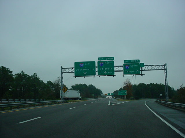 |
Interstate 10 East at
Exit 296A - Interstate 75 South - Tampa. (Photo taken 12/14/03) |
Highway Links
California:
WestCoastRoads.com (Andy Field/Alex Nitzman)
Arizona:
RockyMountainRoads.com (Andy Field/Alex Nitzman)
New Mexico:
Interstate 10 Exit List (C.C. Slater)
Texas:
AARoads.com (Andy Field/Alex Nitzman)
TxDOT Katy Freeway Construction Site
Louisiana:
SouthEastRoads.com (Andy Field/Alex Nitzman)
Mississippi:
SouthEastRoads.com (Andy Field/Alex Nitzman)
Alabama:
SouthEastRoads.com (Andy Field/Alex Nitzman)
Florida:
SouthEastRoads.com (Andy Field/Alex Nitzman)
Page created: January 31, 2005
Last updated:
April 09, 2005