 |
Home Search OKRoads: |
|
|
Home Search OKRoads: |
Interstate 40
Interstate 40 almost goes from coast to coast. Spanning its way across eight states, it connects the deserts of California and Arizona to the Ozarks of Arkansas, the Appalachians of east Tennessee and west North Carolina, and the beaches of east North Carolina.
From its beginning at Interstate 15 in Barstow, California, Interstate 40 travels through the Mojave Desert. After leaving California, the highway enters Arizona, where it encounters more desert. Near Flagstaff, the interstate climbs several thousand feet. The stretch through the Coconino National Forest is among the most scenic parts of Interstate 40 west of the Mississippi River. Soon after leaving Flagstaff, the forest ends as well and the interstate returns to high desert, where it will stay until the Texas panhandle.
Entering the panhandle of the Lone Star State, Interstate 40 enters arguably its most boring section through the plains. The drive across the Texas panhandle is less than 180 miles but seems to drag on forever. After entering Oklahoma, the terrain becomes more hilly and more scenic. After traveling through Oklahoma City, the interstate travels through scenic eastern Oklahoma. Interstate 40 stays in scenic environs through western Arkansas and Little Rock, a city in which the interstate barely skirts its northern side.
After leaving Arkansas behind, Interstate 40 enters Memphis, where a major reconstruction project is underway at the Interstate 240 interchange. Interstate 40 was originally planned to go through the center of Memphis but neighborhood opposition shot down that proposal. Interstate 40 was rerouted over the northern half of Interstate 240. The mile markers on Interstate 40 throughout the state reflect the original Memphis routing of Interstate 40, so when traveling east on Interstate 40, Exit 10 is followed by Exit 12A for Interstate 40 East, and then followed by Exit 10 again on the original Interstate 40 route. The interstate makes its way toward Nashville and Knoxville, and enters the Eastern Time Zone at the Tennessee Secondary Route 299 North interchange (Exit 340). After seeing Interstate 81's northbound beginning at Exit 421, Interstate 40 heads southeast through the Great Smoky Mountains. It is a winding, scenic section of interstate, with a speed limit of 55 through the windiest parts.
Interstate 40 continues eastward in North Carolina, connecting Asheville, Winston-Salem, Greensboro, Raleigh, Durham, and Wilmington, where Interstate 40 meets its end just shy of the Atlantic Ocean at North Carolina 132 in Wilmington. It shares a lengthy duplex with Interstate 85. The section known as "Death Valley" in Greensboro will be bypassed in the near future as a connection from the present Interstate 40 to a new routing of Interstate 85 in the southern fringes of the city. The exit numbers on the stretch formerly occupied by both Interstate 40 and Interstate 85 through Greensboro are now set to the mileposts of Business Loop I-85. The "Death Valley" section has six highways along its route at one point, all of them signed.
|
Highway Information |
|
| States Traveled
Through (Mileage in state) |
California
(154.61) Arizona (359.48) New Mexico (373.51) Texas (177.10) Oklahoma (331.03) Arkansas (284.69) Tennessee (455.28) North Carolina (419.40) |
| Total Mileage | 2,555.10 |
| Cities | California: Barstow, Needles Arizona: New Mexico: Texas: Oklahoma: Arkansas: Tennessee: North Carolina: |
| Source | 10/31/02 Interstate Route Log & Finder List |
| OKRoads Coverage | |
| Miles Driven by OKRoads (Percentage) |
2,555 (100%) |
| Western End of Interstate Driven |
Interstate 15 |
| Eastern End of Interstate Driven |
North Carolina 132 |
Selected Pictures
For more pictures of Interstate 40 from a particular
state, click on the state below.
| California | |
 |
The final
Interstate 40 West assurance shield, located just after Exit 1. The overpass in the distance is on Interstate 15. (Photo taken 6/25/03) |
 |
Interstate 40 West
at Exit 7 - Daggett. (Photo taken 6/25/03) |
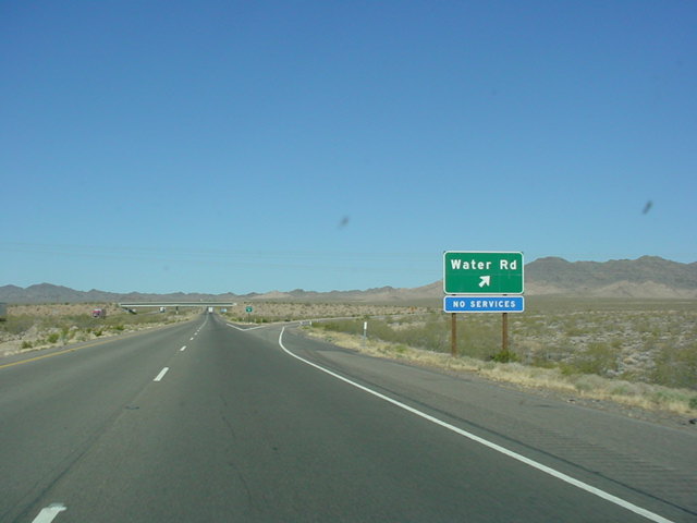 |
Interstate 40 West
at Exit 120 - Water Rd. It doesn't look like there's any water here. (Photo taken 6/25/03) |
 |
Interstate 40 West
at Exit 142 - J Street/ Downtown. (Photo taken 6/25/03) |
| Arizona | |
 |
Interstate 40 West
at Exit 9 - AZ 95 South - Lake Havasu City/Parker. (Photo taken 6/25/03) |
 |
Interstate 40 West
at Exit 48 - U.S. 93 TO AZ 68 - Beale St./Las Vegas. (Photo taken 6/24/03) |
 |
Interstate 40 West
at Exit 165 - Business Loop I-40/AZ 64 - Williams/Grand Canyon. (Photo taken 6/24/03) |
 |
Interstate 40 West
at Exit 195 - Interstate 17 South/AZ 89A - Phoenix/Flagstaff. (Photo taken 6/24/03) |
 |
Interstate 40 East at
Exit 285 - Bus. Loop I-40 East/U.S. 180 East/AZ 77 South - Petrified Forest National Park/Show Low. (Photo taken 3/19/04) |
| New Mexico | |
 |
Interstate 40 West
at Exit 16 - Business Loop I-40/NM 118 - W. Gallup. (Photo taken 6/24/03) |
 |
Interstate 40 East at Exit 85 -
Bus. Loop I-40/NM 547 - Grants/Mt. Taylor. (Photo taken 3/19/04) |
 |
Interstate 40 West
at Exit 155 - NM 448 North - Rio Rancho/Corrales. (Photo taken 6/24/03) |
 |
Interstate 40 East approaching a
bunch of exits in west Albuquerque. Interstate 25 is three miles ahead. This may be the first sign gantry I have seen that has signs for the next six exits! (Photo taken 3/19/04) |
 |
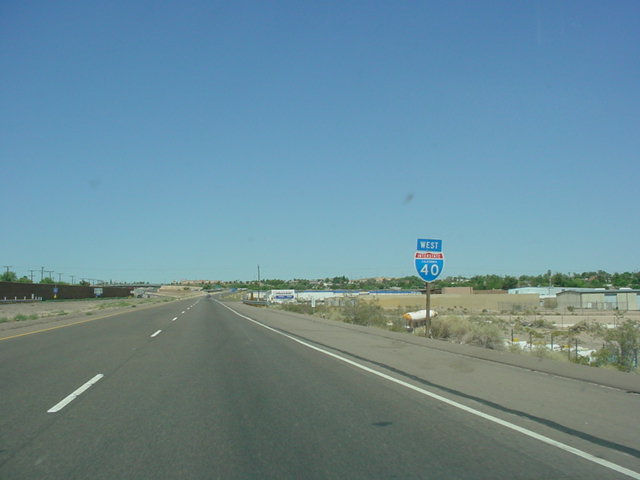
Interstate 40 East at Exit 159B - Interstate 25 South - Las Cruces, and Exit 159C - Interstate 25 North - Santa Fe. (Photo taken 3/19/04) |
 |
The highway contains six westbound lanes as Interstate 40 nears "The Big I" interchange. Exit 159D for University Ave. is 1/4 mile away, and Interstate 25 is 1/2 mile ahead. (Photo taken 6/24/03) |
 |
Interstate 40 East at unmarked Exit 272 - Bus. Loop I-40 East - Santa Rosa. (Photo taken 3/20/04) |
 |
Interstate 40 West
at Exit 335 - Business Loop I-40 West - Historical Route 66. (Photo taken 6/23/03) |
| Texas | |
 |
Interstate 40 East as it
enters the Central Time Zone at the New Mexico-Texas state line. Exit 0 for Business Spur I-40 and Glenrio is just ahead. (Photo taken 3/20/04) |
 |
Interstate 40 East at
Exit 70 - Interstate 27 South/U.S. 87 South/U.S. 60 West - Canyon/Lubbock, and U.S. 87 North/ U.S. 287 North/U.S. 60 East - Dumas/ Pampa/Downtown. (Photo taken 3/20/04) |
 |
Interstate 40 West
at Exit 70 - Interstate 27/ U.S. 87 South/U.S. 60 West - Canyon/ Lubbock, and U.S. 87/U.S. 287 North/U.S. 60 East - Dumas/Pampa/Downtown. (Photo taken 6/23/03) |
 |
Interstate 40 East at
Exit 78 - U.S. 287 South - Fort Worth. (Photo taken 3/20/04) |
 |
Interstate 40 East at
Exit 163 - U.S. 83 - Shamrock. (Photo taken 3/20/04) |
| Oklahoma | |
 |
Interstate 40 East at Exit 32 - Bus.
Loop I-40 East/OK 34 South - Elk City/ Mangum. (Photo taken 3/20/04) |
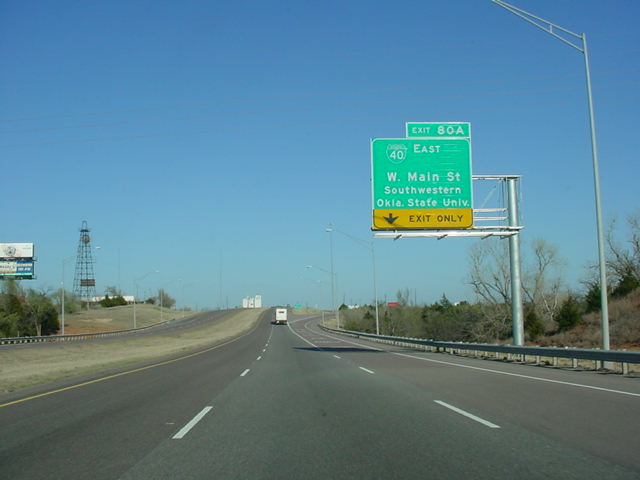 |
Interstate 40 East at Exit 80A -
Bus. Loop I-40 East - W. Main St./Southwestern Oklahoma State University. (Photo taken 3/20/04) |
 |
Interstate 40 East at unmarked Exit 119 - Bus. Loop I-40 East - El Reno. (Photo taken 3/20/04) |
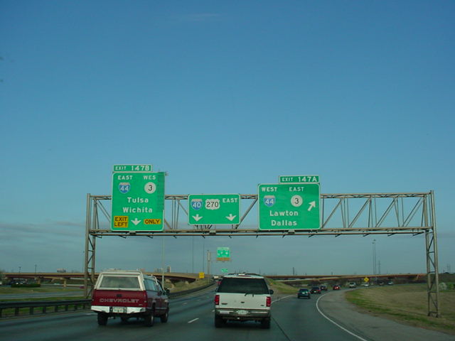 |
Interstate 40 East at Exit 147A - Interstate 44 West/OK 3 East - Lawton/ Dallas. (Photo taken 3/20/04) |
 |
Interstate 35 North
and Interstate 40 East split. For those continuing on Interstate 40, Exit 154 for Reno Ave. and Scott St. is in one mile. (Photo taken 5/19/03) |
 |
Interstate 40 West at Exit 165 -
Interstate 240 West - Lawton/Dallas. (Photo taken 12/21/03) |
 |
Interstate 40 West at Exit 181 -
U.S. 177/ U.S. 270/OK 3W - Stillwater/Tecumseh. (Photo taken 12/21/03) |
 |
Interstate 40 West at Exit 240B -
U.S. 62 East/U.S. 75 North/Bus. Loop I-40 West - Henryetta/Okmulgee. (Photo taken 12/21/03) |
| Arkansas | |
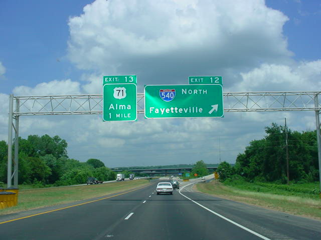 |
Interstate 40 East/Interstate 540
North at Exit 12 - Interstate 540 North - Fayetteville. (Photo taken 5/21/04) |
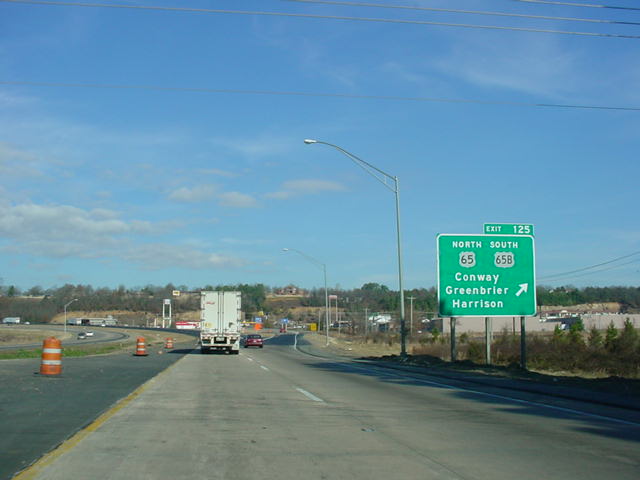 |
Interstate 40 West at Exit 125 -
U.S.
65 North/U.S. 65B South - Conway/ Greenbrier/Harrison. (Photo taken 12/21/03) |
 |
Interstate 40 West at Exit 147 - Interstate 430 South. Interstate 40 was under construction at the time of this photograph. Interstate 430 connects Interstate 40 and Interstate 30 on the west side of Little Rock. (Photo taken 7/15/04) |
 |
Interstate 40 West at Exit 153B - Interstate 30 West/U.S. 65/U.S. 67/ U.S. 167 South - Little Rock. (Photo taken 12/21/03) |
 |
Interstate 40 West at Exit 159 - Interstate 440/AR 440 - Jacksonville/ Texarkana. (Photo taken 12/21/03) |
 |
Interstate 40 West at Exit 241B - AR 1 North - Wynne. This is now Business AR 1, as AR 1 has been moved slightly to the west. (Photo taken 12/21/03) |
 |
Interstate 40 West/Interstate 55
North at Exit 277 - Interstate 55 North - Blytheville/Jonesboro. (Photo taken 7/15/04) |
 |
Interstate 40 East/Interstate 55
South at unmarked Exit 279B - Interstate 55 South - Memphis/Jackson, Mississippi. (Photo taken 7/15/04) |
| Tennessee | |
 |
Interstate 40 West
at Exit 1E - Interstate 40 West - Little Rock. The exit numbers for the Memphis beltway reset as the next exit for Interstate 240 South is Exit 30. This interchange is currently under reconstruction. (Photo taken 3/22/03) |
 |
Interstate 40 West
at Exit 10B - Interstate 40 West - Little Rock. Notice the Interstate 40 shield is missing. This could cause confusion for those unfamiliar with the area. But if you take Interstate 240 West, you will still get to Interstate 40 again, just via a different route. (Photo taken 3/22/03) |
 |
Interstate 40 West
at Exit 206 - Interstate 440 East - Knoxville. (Photo taken 3/21/03) |
 |
Interstate 40
West/Interstate 65 North at Exit 208 - Interstate 65 North - Louisville. (Photo taken 3/21/03) |
 |
Interstate 40 West
at Exit 213A - Interstate 24 East/Interstate 440 West - Chattanooga/ Memphis. (Photo taken 3/21/03) |
 |
Interstate 40 West
at Exit 340 - TN SR-299 North - Airport Rd. This is the final westbound exit in the Eastern Time Zone. There is a green sign (barely visible here) just past the overpass that indicates the change in time zone. (Photo taken 3/21/03) |
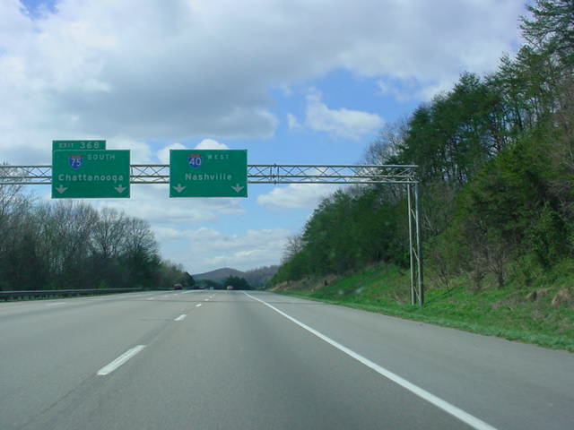 |
Interstate 40
West/Interstate 75 South at Exit 368 - Interstate 75 South - Chattanooga. (Photo taken 3/21/03) |
 |
Interstate 40 West
at Exit 385 - Interstate 75 North/Interstate 640 East - Lexington. (Photo taken 3/21/03) |
 |
Interstate 40 East at Exit 432A -
U.S. 411 South - Sevierville. U.S. 411 begins at this interchange. (Photo taken 7/6/05) |
| North Carolina | |
 |
Interstate 40 East at Exit 20 - U.S.
276 - Waynesville/Maggie Valley. This marks the northern terminus of the federal highway. (Photo taken 7/6/05) |
 |
Interstate 40 East at Exit 46A -
Interstate 26 and U.S. 74 East - Hendersonville/ Spartanburg. For several years, this was the western terminus of Interstate 26. It was extended northward to Colonial Heights, Tennessee, in 2003, and to Kingsport, TN, in 2005. (Photo taken 7/6/05) |
 |
Interstate 40 East at Exit 152A - Interstate 77 South - Charlotte. The Queen City is 40 miles to the south. (Photo taken 7/6/05) |
 |
Interstate 40 East at Exit 193A -
U.S. 52 and North Carolina 8 South - Lexington. (Photo taken 7/6/05) |
 |
Interstate 40 West at Exit 206 -
Business Loop I-40/U.S. 421 North - Kernersville/ Winston-Salem/Downtown. (Photo taken 12/18/03) |
 |
Interstate 40 East, Business Loop
I-85 North, U.S. 29 North, U.S. 70 East, U.S. 220 North, and U.S. 421 South assurance shields in Greensboro. Whew, that's a lot of highways on one road. (Photo taken 7/6/05) |
 |
Interstate 40 East at Exit 301 - Interstate 440 West and U.S. 64 East - Rocky Mount. Interstate 440 is the beltline around the north side of Raleigh. (Photo taken 7/6/05) |
 |
Interstate 40 East at Exit 420 -
U.S. 117 and North Carolina 132 North - Gordon Road. This interchange marks the eastern terminus of Interstate 40. (Photo taken 7/6/05) |
 |
Begin Interstate 40 West signage in north Wilmington as the 2,555 mile journey to Barstow kicks off. (Photo taken 7/6/05) |
Highway Links
California:
Interstate 40 @ WestCoastRoads.com (Andy Field/Alex Nitzman)
Arizona:
Interstate 40 @ RockyMountainRoads.com (Andy Field/Alex Nitzman)
New Mexico:
Interstate 40 Exit List (C.C. Slater)
Texas:
If you have a link to a good Interstate 40
Texas page, please
contact OKRoads.
(Spam filter in effect, replace # with @)
Oklahoma:
Interstate 40 @ OKHighways.com
Arkansas:
Interstate 40 Exit List (C.C. Slater)
Tennessee:
Interstate 40 @ SouthEastRoads.com (Andy Field/Alex Nitzman)
North Carolina:
Interstate 40 @ SouthEastRoads.com (Andy Field/Alex Nitzman)
Page created: May 15, 2005
Last updated:
November 03, 2005