 |
Home Search OKRoads: |
|
|
Home Search OKRoads: |
Interstate 30 Texas
Westbound
|
Highway Information |
|
| Miles | 223.74 |
| Counties Traveled Through |
Parker, Tarrant, Dallas, Rockwall, Hunt, Hopkins, Franklin, Titus, Morris, Bowie |
| Cities | Ft. Worth, Dallas, Greenville, Sulphur Springs, Mt. Pleasant, Texarkana |
| Source | 10/31/02 Interstate Route Log & Finder List |
| OKRoads Coverage | |
| Miles Driven by OKRoads (Percentage) |
224 (100%) |
| Western End of Interstate Driven |
Interstate 20 |
| Eastern End of Interstate Driven |
Arkansas State Line |
Pictures
 |
Interstate 30 West at Exit 46A -
Central Expressway. Interstate 35E is 1 1/4 miles ahead. (Photo taken 10/19/03) |
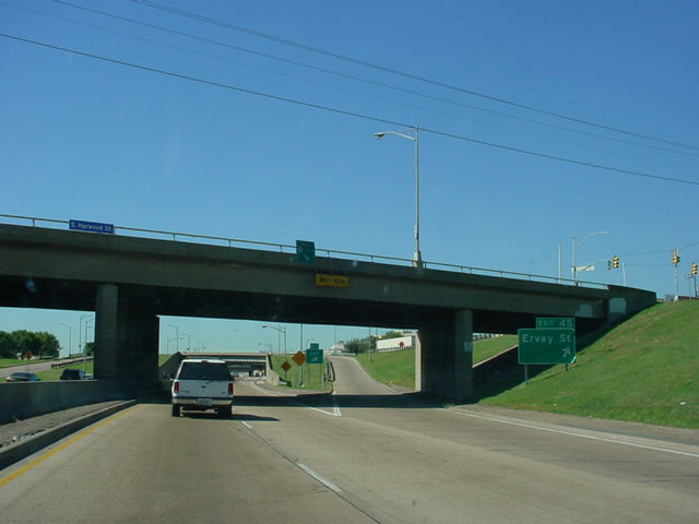 |
Interstate 30 West at Exit 45 -
Ervay St. (Photo taken 10/19/03) |
 |
Interstate 30 West approaching Exit 44A - Interstate 35E North - 3/4 mile, and Exit 44B - Interstate 35E South - 1/2 mile. (Photo taken 10/19/03) |
 |
Interstate 30 West approaching Exit 44A - 1/2 mile, and Exit 44B - 1/4 mile. (Photo taken 10/19/03) |
 |
Interstate 30 West at Exit 44B - Interstate 35E South - Waco. (Photo taken 10/19/03) |
 |
Interstate 30 West at Exit 44A - Interstate 35E North - Denton. One more gantry is in place for this exit, but I didn't get a close-up picture of it because 1) the camera was still saving this one, and 2) I had to make a lane change because I needed to get on Interstate 35E North! (Photo taken 10/19/03) |
 |
Interstate 30 West at Exit 13B - TX
199 - Henderson St. (Photo taken 7/14/04) |
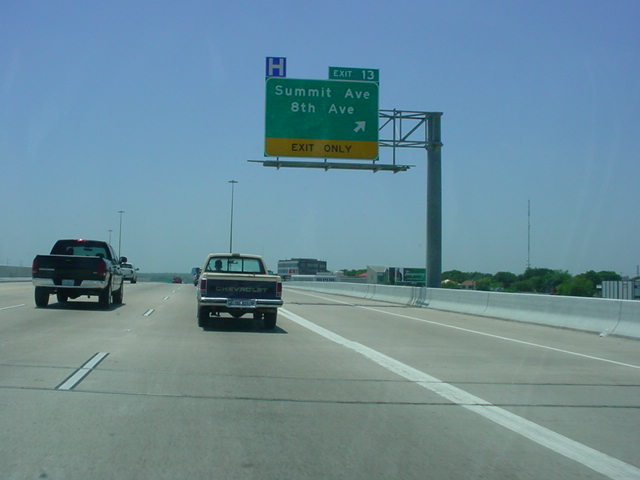 |
Interstate 30 West at Exit 13 -
Summit Ave./8th Ave. (Photo taken 7/14/04) |
 |
Interstate 30 West at unmarked Exit 12B - Forest Park Blvd. The diagram sign on the left is for the next two exits, which are very closely spaced. (Photo taken 7/14/04) |
 |
Interstate 30 West at Exit 12 -
University Dr./City Parks/Zoo/TCU. Exit 11 for Montgomery St. departs at the next sign gantry just ahead. (Photo taken 7/14/04) |
 |
Interstate 30 West at Exit 10 -
Hulen St. (Photo taken 7/14/04) |
 |
Interstate 30 West at Exit 9B - U.S.
377 South - Camp Bowie Blvd./Horne St. (Photo taken 7/14/04) |
 |
Interstate 30 West at Exit 9A -
Bryant- Irvin Rd. (Photo taken 7/14/04) |
 |
Interstate 30 West at Exit 8B -
Ridgmar Blvd./Ridglea Ave. (Photo taken 7/14/04) |
 |
Interstate 30 West at Exit 8A -
Green Oaks Rd. (Photo taken 7/14/04) |
 |
Interstate 30 West at Exit 7B - TX
183/ Spur 341. (Photo taken 7/14/04) |
 |
Interstate 30 West at Exit 7A -
Cherry Lane. Interstate 820 is 1 3/4 miles ahead. (Photo taken 7/14/04) |
 |
Interstate 30 West at Exit 6 - Las
Vegas Trail. (Photo taken 7/14/04) |
 |
Interstate 30 West at Exit 5C -
Interstate 820 South. (Photo taken 7/14/04) |
 |
Interstate 30 West at Exit 5B -
Interstate 820 North. (Photo taken 7/14/04) |

|
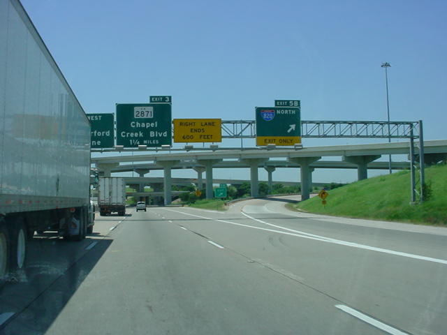
Interstate 30 West at Exit 3 - RM
2871 - Chapel Creek Blvd. (Top photo taken 12/11/03, bottom photo taken 7/14/04) |

|
Interstate 30 West at Exit 2 - Spur
580 East. (Top photo taken 12/11/03, bottom photo taken 7/14/04) |
 |
Interstate 30 West at Exit 1B -
Linkcrest Dr. (Photo taken 12/11/03) |
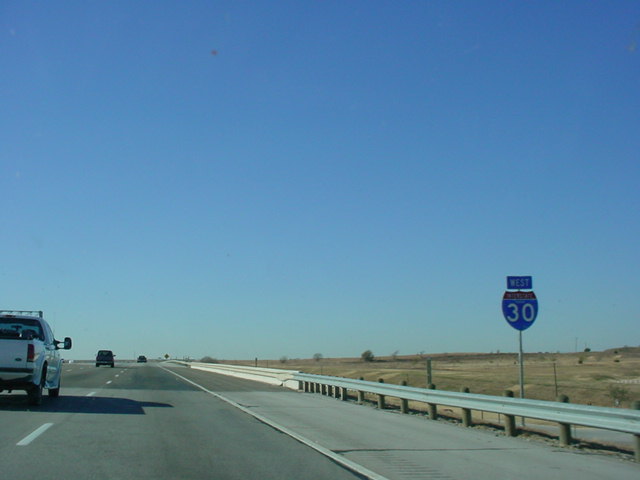 |
The final Interstate 30 assurance
shield before the highway merges onto Interstate 20. (Photo taken 12/11/03) |
 |
Mile marker 0 on Interstate 30. The overpass carries Interstate 20 West, which will merge into Interstate 30 shortly, bringing that route to an end. (Photo taken 12/11/03) |
 |
Interstate 30 West ends as
Interstate 20 West prepares to enter the picture. (Photo taken 12/11/03) |
Page created: February 24, 2005
Last updated:
February 24, 2005

