|
Home Search OKRoads: |
|
|
Home Search OKRoads: |
Interstate 80 Nebraska
Eastbound
|
Highway Information |
|
| Miles | 455.32 |
| Counties Traveled Through |
Kimball, Cheyenne, Deuel, Keith, Lincoln, Dawson, Buffalo, Hall, Hamilton, York, Seward, Lancaster, Cass, Sarpy, Douglas |
| Cities | Sidney, Ogallala, North Platte, Lexington, Kearney, Grand Island, York, Lincoln, Omaha |
| Major Junctions | Interstate 76 (Exit 102)
Interstate 180 Interstate 680 Interstate 480 |
| OKRoads Coverage | |
| Miles Driven by OKRoads (Percentage) |
102 (22%) |
| Western End of Interstate Driven |
U.S. 81 |
| Eastern End of Interstate Driven |
Iowa State Line |
Pictures
| Interstate 80 East | |
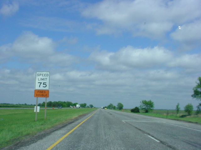 |
Speed Limit 75 sign on Interstate 80 East. (Photo taken 5/19/03) |
 |
Interstate 80 East at Exit 360 - NE 93B Link - Waco. (Photo taken 5/19/03) |
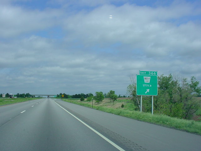 |
Interstate 80 East at Exit 366 - NE 80F Link - Utica. (Photo taken 5/19/03) |
 |
Interstate 80 East at Exit 369 - NE 80E Spur - Beaver Crossing. (Photo taken 5/19/03) |
 |
Interstate 80 East at Exit 373 - NE 80G Link - Goehner. (Photo taken 5/19/03) |
 |
Interstate 80 East at Exit 379 - NE 15 - Seward/Fairbury. (Photo taken 5/19/03) |
 |
Interstate 80 East at Exit 388 - NE 103 - Crete. (Photo taken 5/19/03) |
 |
Interstate 80 East at Exit 395 - N.W. 48th Street. The interstate is now in the state capital of Lincoln. (Photo taken 5/19/03) |
 |
Interstate 80 East at Exit 396 - U.S. 6 - West O Street. (Photo taken 5/19/03) |
 |
Interstate 80 East at Exit 397 - U.S. 77 South - Beatrice. (Photo taken 5/19/03) |
 |
Interstate 80 East mileage sign in Lincoln. Interstate 180 is in four miles. (Photo taken 5/19/03) |
 |
Interstate 80 East at Exit 399 - Lincoln Municipal Airport. (Photo taken 5/19/03) |
 |
Interstate 80 East approaching Interstate 180/U.S. 34 - 2 miles. (Photo taken 5/19/03) |
 |
Interstate 80 East approaching Exits 401A-B - Interstate 180/U.S. 34 - 1/2 mile. (Photo taken 5/19/03) |
 |
Interstate 80 East at Exit 401A - Interstate 180/U.S. 34 East - 9th St./Downtown. (Photo taken 5/19/03) |
 |
Interstate 80 East at Exit 401B - U.S. 34 West. (Photo taken 5/19/03) |
 |
Interstate 80 East at Exit 403 - 27th Street/State Fair Park. (Photo taken 5/19/03) |
 |
Interstate 80 East at Exit 405 - U.S. 77 North - 56th St. (Photo taken 5/19/03) |
 |
Interstate 80 East at Exit 409 - U.S. 6 - Waverly. (Photo taken 5/19/03) |
 |
Interstate 80 East at Exit 420 - NE 63 - Ashland. (Photo taken 5/19/03) |
 |
Interstate 80 East at Exit 426 - NE 66 - South Bend/Louisville. (Photo taken 5/19/03) |
 |
Interstate 80 East at Exit 432 - U.S. 6/NE 31 - Gretna. (Photo taken 5/19/03) |
 |
Mileage sign on Interstate 80 East as it approaches Omaha. U.S. 275/NE 92 is in 2 1/2 miles and Interstate 680 is in four miles. (Photo taken 5/19/03) |
 |
Interstate 80 East at Exit 442 - 126th St./Harrison St. (Photo taken 5/19/03) |
 |
Another mileage sign, now just two miles from U.S. 275/NE 92 and 2 1/2 miles from Interstate 680. According to this sign, 1/2 mile separates the next two interchanges from each other. (Photo taken 5/19/03) |
 |
Interstate 80 East approaching Exit 445 - U.S. 275/NE 92 - 1 mile, and Exit 446 - Interstate 680 - 2 miles. Now, there is 1 mile between the two exits! (Photo taken 5/19/03) |
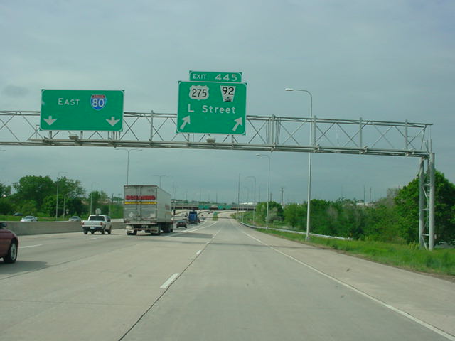 |
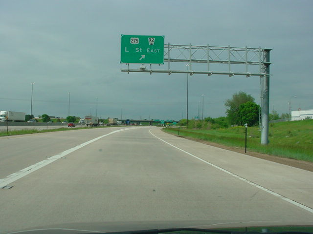
Interstate 80 East at Exit 445 - U.S. 275/NE 92 - L Street. (Photo taken 5/19/03) |
 |
Interstate 80 East approaching Exit 446 - 1 mile. The collector/distributor lanes, which I am on here, lead to U.S. 275/NE 92. (Photo taken 5/19/03) |
 |
Interstate 80 East c/d lane at U.S. 275/NE 92/L Street East exit. (Photo taken 5/19/03) |
 |
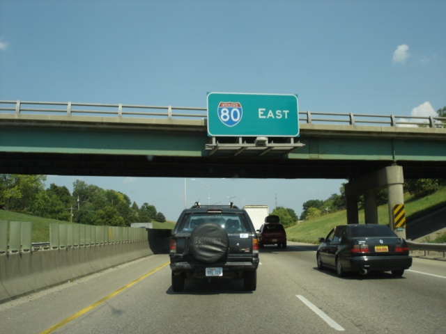
Interstate 80 East approaching Interstate 680. (Photo taken 5/19/03) |
 |
Interstate 80 East at Exit 446 - Interstate 680 North. (Photo taken 5/19/03) |
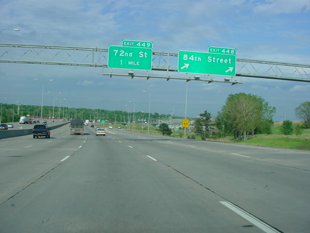 |
Interstate 80 East at Exit 448 - 84th Street. (Photo taken 5/19/03) |
 |
Interstate 80 East at Exit 449 - 72nd Street. (Photo taken 5/19/03) |
 |
Mileage sign on Interstate 80, three miles to the west of Interstate 480/U.S. 75. (Photo taken 5/19/03) |
 |
Interstate 80 East at Exit 450 - 60th Street. (Photo taken 5/19/03) |
 |
Another mileage sign indicates that Interstate 480/U.S. 75 is now two miles away. (Photo taken 5/19/03) |
 |
Interstate 80 East approaching Exit 451 - 42nd Street, and Exit 452 - Interstate 480 North - 1 1/2 miles. (Photo taken 5/19/03) |
 |
Interstate 80 East at Exit 451 - 42nd St. Exit 452 is now one mile ahead. (Photo taken 5/19/03) |
 |
Interstate 80 East approaching Exit 452 - 1/2 mile. (Photo taken 5/19/03) |
 |
Interstate 80 East approaching Exit 452 - 1/4 mile. (Photo taken 5/19/03) |
 |
Interstate 80 East at Exit 452 - Interstate 480/U.S. 75 - Eppley Airfield/Downtown/Bellevue. (Photo taken 5/19/03) |
 |
The Exit 452 off-ramp splits into northbound Interstate 480/U.S. 75 and southbound U.S. 75 here. Interstate 480 connects to downtown Omaha and Interstate 29 just east of the Missouri River. (Photo taken 5/19/03) |
 |
Interstate 80 East at Exit 453 - 24th St. The exit is partially located inside the Interstate 480/U.S. 75 interchange. Several ramps from that interchange are seen here. (Photo taken 5/19/03) |
 |
Interstate 80 East approaching the final exit in Nebraska, Exit 454 - 1 mile. Interstate 29 is two miles ahead in the state of Iowa. (Photo taken 5/19/03) |
 |
Interstate 80 East at Exit 454 - 13th Street. This exit leads to the Henry Doorly Zoo and Rosenblatt Stadium, home of the College World Series and the Omaha Royals AAA baseball team. (Photo taken 5/19/03) |

|
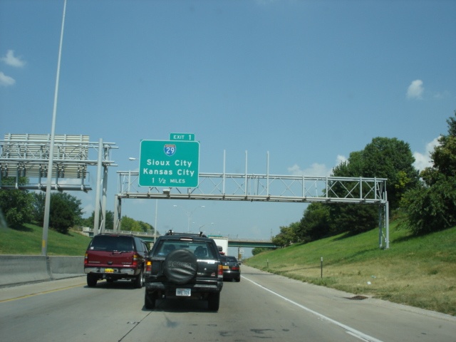
Interstate 80 East approaching Exit 1 - Interstate 29 - 1 1/2 miles. Interstate 80 will cross the Missouri River just after this bridge. (Top photo taken 5/20/03, bottom photo taken 7/13/05) |
 |
This Interstate 80 East pull-through sign is attached to the RIverview Boulevard overpass. Interstate 80 is about to cross the Missouri River and enter Council Bluffs, Iowa. (Photo taken 7/13/05) |
| Scenes Related to Interstate 80 | |
 |
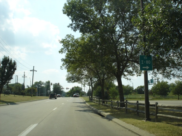
U.S. 81 North approaching Interstate 80 - 1/2 mile. (Photo taken 5/19/03) |
 |
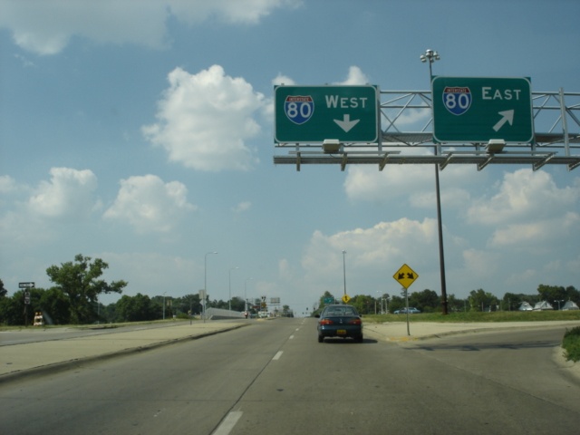
U.S. 81 North at Interstate 80 East. (Photo taken 5/19/03) |
 |
Interstate 80 trailblazer on southbound 10th Street near the Henry Doorly Zoo. Rosenblatt Stadium is visible on the top right of this picture. (Photo taken 7/13/05) |
 |
Westbound Deer Park Boulevard approaching 13th Street. The gantry seen close-up below is visible to the right. (Photo taken 7/13/05) |
 |
Northbound 13th Street at Interstate 80 East. (Photo taken 7/13/05) |
Page created: March 19, 2006
Last updated:
March 19, 2006