 |
Home Search OKRoads: |
|
|
Home Search OKRoads: |
Interstate 80 Nebraska
Westbound
|
Highway Information |
|
| Miles | 455.32 |
| Counties Traveled Through |
Kimball, Cheyenne, Deuel, Keith, Lincoln, Dawson, Buffalo, Hall, Hamilton, York, Seward, Lancaster, Cass, Sarpy, Douglas |
| Cities | Sidney, Ogallala, North Platte, Lexington, Kearney, Grand Island, York, Lincoln, Omaha |
| Major Junctions | Interstate 76 (Exit 102)
Interstate 180 Interstate 680 Interstate 480 |
| OKRoads Coverage | |
| Miles Driven by OKRoads (Percentage) |
102 (22%) |
| Western End of Interstate Driven |
U.S. 81 |
| Eastern End of Interstate Driven |
Iowa State Line |
Pictures
| Interstate 80 West | |
 |
Interstate 80 West approaching Exit 454 - 13th Street - 1 mile. This is also where the Nebraska-Iowa state line is as the interstate crosses the Missouri River. (Photo taken 7/13/05) |
 |
Interstate 80 begins its westbound journey in Nebraska in Douglas County and the state's largest city, Omaha. The city is home to 390,007 residents according to the 2000 census. (Photo taken 7/13/05) |
 |
A visitor information center is located just south of Interstate 80 off of 10th Street. (Photo taken 7/13/05) |
 |
Interstate 80 West approaching Exit 454 - 13th Street - 1/4 mile. (Photo taken 7/13/05) |
 |
Use Exit 454 to the Henry Doorly Zoo and Rosenblatt Stadium, which hosts the College World Series each June. (Photo taken 7/13/05) |
 |
Interstate 80 West at Exit 454 - 13th Street. Interstate 480 begins in 1 1/2 miles. (Photo taken 7/13/05) |
 |
Head north on 13th Street to downtown Omaha. Use 13th Street southbound to the stadium, zoo, and the city of Bellevue, population 44,382. (Photo taken 7/13/05) |
 |
A collector-distributor roadway is in place along Interstate 80 and Interstate 680 that provides access to junctions on both interstates in west Omaha. As traffic from Interstate 80 and Interstate 680 converge just behind this point, traffic wanting to access Interstate 80 West should merge to the left. (Photo taken 7/13/05) |
 |
Interstate 80 West c/d lanes approaching I Street. Two lanes are provided for the exit. (Photo taken 7/13/05) |
 |
Interstate 80 West c/d lanes at I Street. (Photo taken 7/13/05) |
 |
Interstate 80 West c/d lanes at U.S. 275/Nebraska 92/L Street West. (Photo taken 7/13/05) |
 |
Interstate 80 West c/d lanes at Q Street. The next exit is Exit 442 at 126th Street in 1 1/2 miles. Lincoln is 46 miles away. (Photo taken 7/14/05) |
 |
Interstate 80 West approaching Exit 442 - 126th Street/Harrison Street - 1 mile. Harrison Street is an east-west arterial that travels over Interstate 80 to the northeast of the interchange. Use northbound 126th Street to Harrison Street. (Photo taken 7/14/05) |
 |
Use southbound 126th Street and eastbound Giles Road to the city of La Vista (pop. 11,699) and the city of Papillion (pop. 16,363). Both are southern suburbs of Omaha. (Photo taken 7/14/05) |
 |
Interstate 80 West approaching Exit 442 - 126th Street/Harrison Street - 1/2 mile. (Photo taken 7/14/05) |
 |
Interstate 80 West at Exit 442 - 126th Street/Harrison Street. (Photo taken 7/14/05) |
 |
Interstate 80 West approaching Exit 440 - Nebraska 50/144th Street - 1 mile. (Photo taken 7/14/05) |
 |
Use Nebraska 50 South to the Platte River State Park and the Chalco Hills Recreation Area. (Photo taken 7/14/05) |
 |
Interstate 80 West approaching Exit 440 - Nebraska 50/144th Street - 1/2 mile. Nebraska 50 connects U.S. 275/Nebraska 92 to the Kansas state line. (Photo taken 7/14/05) |
 |
Interstate 80 West at Exit 440 - Nebraska 50/144th Street - Springfield. The city of Springfield (pop. 1,450) is six miles to the south. (Photo taken 7/14/05) |
 |
Interstate 80 West approaching Exit 439 - Nebraska 370. The state highway goes from U.S. 6/Nebraska 31 in Gretna to the Iowa state line. (Photo taken 7/14/05) |
 |
Interstate 80 West at Exit 439 - Nebraska 370 - Gretna. A six mile drive to the west awaits those going to the city of Gretna, home of 2,355 people. (Photo taken 7/14/05) |
 |
Interstate 80 West approaching Exit 432 - Nebraska 31 - 1500 feet. The interstate was in the process of being widened, so all traffic was shifted to the eastbound lanes. (Photo taken 7/14/05) |
 |
Interstate 80 West at Exit 432 - Nebraska 31 - Ashland. Ashland is located on U.S. 6, which intersects Nebraska 31 just north of this interchange. The city is eight miles to the west. (Photo taken 7/14/05) |
 |
Speed Limit 75 sign on Interstate 80 West just past Exit 432. (Photo taken 7/14/05) |
 |
The next exit is Exit 426 at Nebraska 66. Use Exit 426 to the Eugene T. Mahoney State Park and the Platte River State Park. (Photo taken 7/14/05) |
 |
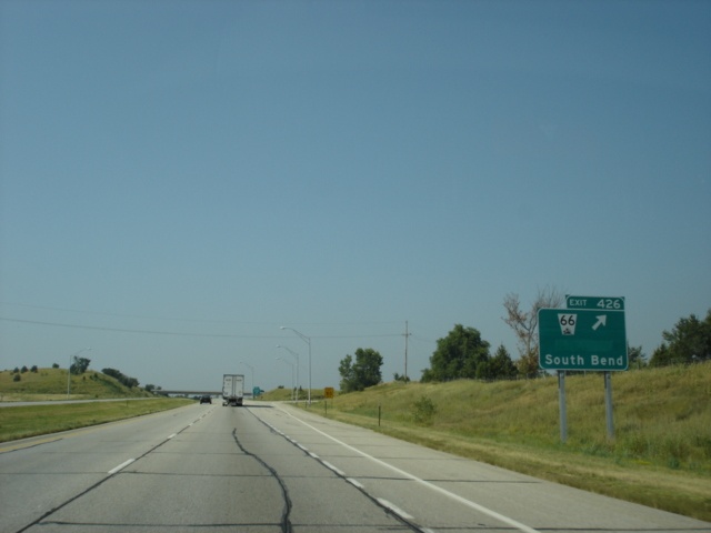
Interstate 80 West approaching Exit 426 - Nebraska 66 - 1 mile. Nebraska 66 begins at U.S. 6 in Ashland and travels east to U.S. 34/U.S. 75 in Plattsmouth. This is the eastern segment of the three-segment state highway. (Photo taken 7/14/05) |
 |
Use Exit 426 to numerous state parks and attractions. (Photo taken 7/14/05) |
 |
Interstate 80 West at Exit 426 - Nebraska 66 - South Bend. The village of 86 residents is four miles to the east. (Photo taken 7/14/05) |
 |
Interstate 80 West approaching Exit 420 - Nebraska 63 - 1 mile. The state highway extends from U.S. 34 east of Eagle to U.S. 77 south of Wahoo. (Photo taken 7/14/05) |
 |
Use Exit 420 to the World War II Library and Museum in Greenwood. (Photo taken 7/14/05) |
 |
Interstate 80 West at Exit 420 - Nebraska 63 - Greenwood. (Photo taken 7/14/05) |
 |
Use any of the next seven interchanges to the city of Lincoln. The capital city of Nebraska is home to 225,581 residents, making it the 2nd largest city in the state. Lincoln is also home to the main campus of the University of Nebraska. (Photo taken 7/14/05) |
 |
Mileage sign on Interstate 80 West, two miles east of Exit 409 (U.S. 6). (Photo taken 7/14/05) |
 |
Interstate 80 West approaching Exit 409 - U.S. 6 - 1 mile. U.S. 6 is one of four main east-west highways in Lincoln, the others being Interstate 80, U.S. 34, and Nebraska 2. (Photo taken 7/14/05) |
 |
Interstate 80 West at Exit 409 - U.S. 6 - Waverly/East Lincoln. (Photo taken 7/14/05) |
 |
Mileage sign on Interstate 80 West, three miles east of U.S. 77 North and 56th Street. (Photo taken 7/14/05) |
 |
Interstate 80 West approaching Exit 405 - U.S. 77 North - 2 miles. Nebraska Link 55X connects the interchange to U.S. 6. The link highway is not mentioned on any guide signage. (Photo taken 7/14/05) |
 |
Use Exit 405 to the Ethel S. Abbott Sports Complex, which includes 20 soccer fields and an indoor multi-purpose facility. (Photo taken 7/14/05) |
 |
Interstate 80 West approaching Exit 405 - U.S. 77 North - 1 mile. (Photo taken 7/14/05) |
 |
Use U.S. 77 North to Wahoo (pop. 3,942) and Fremont (pop. 25,174). (Photo taken 7/14/05) |
 |
Interstate 80 West approaching the Lancaster County rest area - 1 mile. (Photo taken 7/14/05) |
 |
Interstate 80 West at Exit 405 - U.S. 77 North/56th Street. (Photo taken 7/14/05) |
| Interstate 80 West and U.S. 77 South | |
 |
Interstate 80 West and U.S. 77 South at the Lancaster County rest area. The next rest area is 31 miles ahead in Seward County. (Photo taken 7/14/05) |
 |
Interstate 80 West and U.S. 77 South approaching Exit 403 - 27th Street/State Fair Park - 1 mile. The Nebraska State Fairgrounds are located three miles to the south. (Photo taken 7/14/05) |
 |
Use southbound 27th Street to the University of Nebraska, the Folsom Childrens Zoo, and the Nebraska State Historical Society Museum. (Photo taken 7/14/05) |
 |
Interstate 80 West and U.S. 77 South at Exit 403 - 27th Street - State Fair Park. (Photo taken 7/14/05) |
 |
Mileage sign on Interstate 80 West and U.S. 77 South, two miles east of Interstate 180 and U.S. 34. (Photo taken 7/14/05) |
 |
Interstate 80 West and U.S. 77 South approaching Exit 401 - Interstate 180/U.S. 34 - 1 mile. Interstate 180 connects Interstate 80 to downtown Lincoln. (Photo taken 7/14/05) |
 |
Interstate 80 West and U.S. 77 South at Exit 401 - Interstate 180/U.S. 34 - 9th Street/Downtown. (Photo taken 7/14/05) |
 |
Interstate 80 West and U.S. 77 South c/d lane at Exit 401B - U.S. 34 West. (Photo taken 7/14/05) |
 |
Interstate 80 West and U.S. 77 South c/d lane at Exit 401A - Interstate 180 South/U.S. 34 East - 9th Street/Downtown. Interstate 180 transitions into 9th Street at its southern terminus. (Photo taken 7/14/05) |
 |
Interstate 80 West and U.S. 77 South approaching Exit 399 - Lincoln Municipal Airport - 1 mile. (Photo taken 7/14/05) |
 |
An Air & Army National Guard station is located at the airport. (Photo taken 7/14/05) |
 |
Interstate 80 West and U.S. 77 South at Exit 399 - Lincoln Municipal Airport. (Photo taken 7/14/05) |
 |
Interstate 80 West and U.S. 77 South approaching Exit 397 - U.S. 77 South - 1 mile. U.S. 77 travels along the Homestead Expressway through west Lincoln. (Photo taken 7/14/05) |
 |
Interstate 80 West and U.S. 77 South at Exit 397 - U.S. 77 South. (Photo taken 7/14/05) |
| Interstate 80 West | |
 |
An Interstate 80 West pull-through panel is attached to the U.S. 77 South overpass. (Photo taken 7/14/05) |
 |
Interstate 80 West approaching Exit 395 - U.S. 6/Northwest 48th Street - 1 1/2 miles. Grand Island is 90 miles away. (Photo taken 7/14/05) |
 |
Interstate 80 West at Exit 395 - U.S. 6/Northwest 48th Street. Nebraska Link 55K connects U.S. 6 to U.S. 34, but is not signed from this interchange. (Photo taken 7/14/05) |
 |
Interstate 80 West approaching Exit 388 - Nebraska 103 - 1 mile. The northern segment of Nebraska 103 connects Nebraska 4 to Interstate 80, a distance of 39.1 miles. (Photo taken 7/14/05) |
 |
Use Nebraska 103 South for two miles to the 245-resident village of Pleasant Dale. (Photo taken 7/14/05) |
 |
Interstate 80 West at Exit 388 - Nebraska 103 - Crete. The city of 6,028 residents is 15 miles to the south. (Photo taken 7/14/05) |
 |
The next exit is Exit 382, which indirectly serves U.S. 6. Use U.S. 6 West to the Milford campus of Southeast Community College. (Photo taken 7/14/05) |
 |
Interstate 80 West at Exit 382 - U.S. 6 - Milford. The city of Milford (pop. 2,070) is four miles to the south. (Photo taken 7/14/05) |
 |
Interstate 80 West approaching Exit 378 - Nebraska 15 - 1 mile. Nebraska 15 travels from the Kansas state line to the South Dakota state line. (Photo taken 7/14/05) |
 |
Interstate 80 West at Exit 378 - Nebraska 15 - Seward/Fairbury. The city of Seward (pop. 6,319) is six miles to the north. (Photo taken 7/14/05) |
 |
Interstate 80 West approaching the Seward County rest area - 1 mile. The next rest area is just 21 miles ahead in York County. (Photo taken 7/14/05) |
 |
Interstate 80 West at the Seward County rest area. (Photo taken 7/14/05) |
 |
Interstate 80 West approaching Exit 373 - Nebraska Link 80G - 1 mile. The link highway connects Interstate 80 to U.S. 34, a distance of six miles. (Photo taken 7/14/05) |
 |
Interstate 80 West at Exit 373 - Nebraska Link 80G - Goehner. (Photo taken 7/14/05) |
 |
Interstate 80 West approaching Exit 369 - Nebraska Link 80E - 1 mile. Nebraska Link 80E connects Interstate 80 to U.S. 6 for a total length of 11.6 miles. (Photo taken 7/14/05) |
 |
The city of Friend (pop. 1,174) is at the southern terminus of Nebraska Link 80E. (Photo taken 7/14/05) |
 |
Interstate 80 West at Exit 369 - Nebraska Link 80E - Beaver Crossing. The village is home to 457 residents. (Photo taken 7/14/05) |
 |
Interstate 80 West approaching Exit 366 - Nebraska Link 80F - 1 mile. Nebraska Link 80F is another connection between Interstate 80 and U.S. 34. (Photo taken 7/14/05) |
 |
Interstate 80 West at Exit 366 - Nebraska Link 80F - Utica. The village is set at the northern terminus of the link highway. (Photo taken 7/14/05) |
 |
Interstate 80 West approaching Exit 360 - Nebraska Link 93B - 1 mile. This is yet another highway from U.S. 34 to Interstate 80. (Photo taken 7/14/05) |
 |
Interstate 80 West at Exit 360 - Nebraska Link 93B - Waco. (Photo taken 7/14/05) |
 |
Interstate 80 West approaching the York County rest area - 1 mile. The next rest area is 40 miles ahead in Hall County near Grand Island. (Photo taken 7/14/05) |
 |
Interstate 80 West at the York County rest area. (Photo taken 7/14/05) |
 |
Interstate 80 West approaching Exit 353 - U.S. 81 - 1 mile. This is a major junction along the interstate, as U.S. 81 provides a four-lane connection between Interstate 70 in Salina, Kansas, and Interstate 80. (Photo taken 7/14/05) |
 |
Interstate 80 West at Exit 353 - U.S. 81 - York/Geneva. The city of York is home to 8,081 residents and is three miles to the north. (Photo taken 7/14/05) |
 |
Geneva (pop. 2,226) is set 21 miles to the south near the intersection of U.S. 81 and Nebraska 41. McCool Junction is the name for the intersection of U.S. 81 and Nebraska Spur 93F and is six miles to the south. (Photo taken 7/14/05) |
 |
View at the end of the off-ramp to U.S. 81. Several motorist services are located around this area. (Photo taken 7/14/05) |
| Scenes Related to Interstate 80 | |
 |
U.S. 275 and Nebraska 92 East at Interstate 80 West - Lincoln. (Photo taken 7/14/05) |
 |
U.S. 81 South at Interstate 80 West. Cheyenne, Wyoming, is just 395 miles away. (Photo taken 7/14/05) |
 |
U.S. 81 South approaching Interstate 80 East. (Photo taken 7/14/05) |
 |
U.S. 81 South as it completes crossing Interstate 80 and nears the turnoff to Interstate 80 East. (Photo taken 7/14/05) |
 |
U.S. 81 South at Interstate 80 East. Lincoln is 48 miles to the east. (Photo taken 7/14/05) |
Page created: March 20, 2006
Last updated:
March 21, 2006