 |
Home Search OKRoads: |
|
|
Home Search OKRoads: |
Interstate 90 Wisconsin
Westbound - Interstate 94 West to
Minnesota State Line
|
Highway Information |
|
| Miles | 187.14 |
| Counties Traveled Through |
La Crosse, Monroe, Juneau, Sauk, Columbia, Dane, Rock |
| Cities |
La Crosse, Onalaska, Tomah, Madison, Janesville, Beloit |
| Major Junctions |
Interstate 94 (Exit 45 & Exit 138B)
Interstate 39 Interstate 43 |
| OKRoads Coverage | |
| Miles Driven by OKRoads (Percentage) |
141 (75%) |
| Western End of Interstate Driven (Section 1) |
Minnesota State Line |
| Eastern End of Interstate Driven (Section 1) |
Interstate 94 |
| Western End of Interstate Driven (Section 2) |
Interstate 43 |
| Eastern End of Interstate Driven (Section 2) |
Illinois State Line |
Pictures
Westbound:
Interstate 39 to Interstate 94 West
Interstate 94 West to Minnesota State Line
| Interstate 90 West | |
 |
Interstate 90 West approaching Exit 43 - U.S. 12/Wisconsin 16 - 1 mile. U.S. 12 and Wisconsin 16, which have duplexed since Wisconsin Dells, split 1.5 miles to the west of this interchange in Tomah. The city of Tomah is home to 8,419 residents. (Photo taken 7/12/05) |
 |
One of the stops along the Empire Builder train route, operated by Amtrak, is located in Tomah. (Photo taken 7/12/05) |
 |
Interstate 90 West at Exit 43 - U.S. 12/Wisconsin 16 - Tomah. From Tomah westward, Wisconsin 16 closely follows Interstate 90. (Photo taken 7/12/05) |
 |
Interstate 90 West approaching Exit 141 - Wisconsin 131 - 1 mile. Wisconsin 131 travels 79 miles from Wisconsin 60 near Wauzeka to U.S. 12 and Wisconsin 16 in Tomah. (Photo taken 7/12/05) |
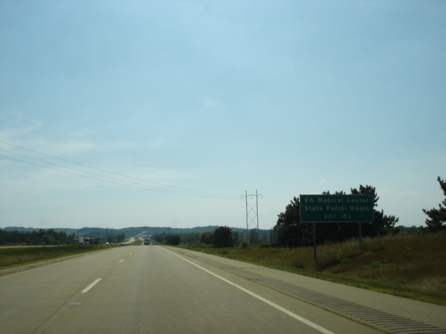 |
Use Exit 41 to the area Veterans Medical Center and Wisconsin State Patrol headquarters. (Photo taken 7/12/05) |
 |
Interstate 90 West at Exit 41 - Wisconsin 131 - Tomah/Wilton. Wilton (pop. 925) is 13 miles to the south. (Photo taken 7/12/05) |
 |
Interstate 90 West approaching Exit 28 - Wisconsin 16 - 1 mile. This is the first of two exits that serve the city of Sparta, population 8,648. Sparta is called the "Bicycling Capital of America." (Photo taken 7/12/05) |
 |
Use Wisconsin 16 West to Wisconsin 21 East to Fort McCoy. (Photo taken 7/12/05) |
 |
Interstate 90 West at Exit 28 - Wisconsin 16 - Sparta. (Photo taken 7/12/05) |
 |
Interstate 90 West approaching Exit 25 - Wisconsin 27 - 1 mile. The state highway connects Wisconsin 35 in Prairie du Chien to U.S. 2 in Brule, a distance of 294 miles. (Photo taken 7/12/05) |
 |
Use Wisconsin 27 North and Wisconsin 16 West to Rockland, located on the La Crosse-Monroe county line. (Photo taken 7/12/05) |
 |
Also use Exit 25 to the Elroy-Sparta State Trail and the La Crosse River State Trail. (Photo taken 7/12/05) |
 |
Interstate 90 West at Exit 25 - Wisconsin 27 - Sparta/Melvina. A 10-mile drive on southbound Wisconsin 27 awaits those going to Melvina. (Photo taken 7/12/05) |
 |
Interstate 90 West approaching the Monroe County rest area - 1 mile. This is the final westbound rest area in Wisconsin. (Photo taken 7/12/05) |
 |
Interstate 90 West at the Monroe County rest area. (Photo taken 7/12/05) |
 |
Interstate 90 West approaching Exit 15 - Wisconsin 162 - 1 mile. Wisconsin 162 spans 46 miles from Wisconsin 35 in Stoddard to Wisconsin 71 at Four Corners. (Photo taken 7/12/05) |
 |
Interstate 90 West at Exit 15 - Wisconsin 162 - Bangor/Coon Valley. Coon Valley is located along U.S. 14 and U.S. 61 18 miles to the south. (Photo taken 7/12/05) |
 |
Interstate 90 West approaching Exit 12 - La Crosse County C - 1 mile. County C is 14.6 miles long from County B just south of Interstate 90 to Wisconsin 108 northeast of Mindoro. (Photo taken 7/12/05) |
 |
Interstate 90 West at Exit 12 - County C - West Salem. The village of West Salem is home to 4,540 residents. (Photo taken 7/12/05) |
 |
Mileage sign on Interstate 90 West just past Exit 12. La Crosse is 13 miles away, and Rochester, Minnesota, is 76 miles away. (Photo taken 7/12/05) |
 |
The next three exits serve the city of La Crosse (pop. 51,818) and the city of Onalaska (pop. 14,839). Onalaska is mostly to the north of the interstate, while La Crosse stays mostly to the south. (Photo taken 7/12/05) |
 |
Interstate 90 West approaching Exit 5 - Wisconsin 16 - 1 mile. At this point, the state highway that follows the route of former U.S. 16 heads to the south of the interstate. (Photo taken 7/12/05) |
 |
Use Exit 5 to the Medary Trailhead of the La Crosse River State Trail. The trail is 21.5 miles long from La Crosse to Sparta. (Photo taken 7/12/05) |
 |
The University of Wisconsin-La Crosse and Viterbo University are both located in the city of La Crosse. Use Wisconsin 16 West to both campuses. (Photo taken 7/12/05) |
 |
Also use Wisconsin 16 West to the main campus of Western Wisconsin Technical College. (Photo taken 7/12/05) |
 |
A Wisconsin Department of Motor Vehicles office is also located near this exit. (Photo taken 7/12/05) |
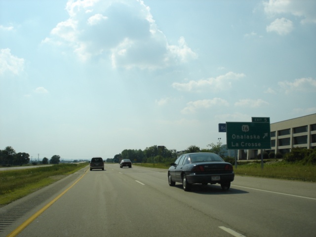 |
Interstate 90 West at Exit 5 - Wisconsin 16 - Onalaska/La Crosse. (Photo taken 7/12/05) |
 |
Interstate 90 West approaching Exit 4 - U.S. 53 North/Wisconsin 157 - 3/4 mile. Wisconsin 157 is a short 2.73-mile highway that goes from Wisconsin 35 east to U.S. 53, then duplexes with the federal highway south to Interstate 90, then finally, connects Interstate 90 to Wisconsin 16. (Photo taken 7/12/05) |
 |
Interstate 90 West approaching Exit 4 - U.S. 53 North/Wisconsin 157 - 1/4 mile. U.S. 53 and Wisconsin 157 duplex for 0.8 mile. (Photo taken 7/12/05) |
 |
Interstate 90 West at Exit 4 - U.S. 53 North/Wisconsin 157 - La Crosse/Onalaska. (Photo taken 7/12/05) |
| Interstate 90 West and U.S. 53 South | |
 |
Interstate 90 West and U.S. 53 South approaching Exit 3 - U.S. 53 South/Wisconsin 35/Great River Road - 3/4 mile. (Photo taken 7/12/05) |
 |
Another stop along the Empire Builder Amtrak route is located in La Crosse. (Photo taken 7/12/05) |
 |
The Great River State Trail continues from the end of the La Crosse River State Trail and travels 24 miles to the Trempealeau National Wildlife Refuge. (Photo taken 7/12/05) |
 |
Use Wisconsin 35 South to historic downtown La Crosse. (Photo taken 7/12/05) |
 |
Interstate 90 West and U.S. 53 South at Exit 3 - U.S. 53 South/Wisconsin 35/Great River Road - La Crosse/Onalaska. (Photo taken 7/12/05) |
| Interstate 90 West | |
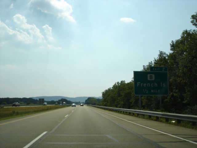 |
Interstate 90 West approaching Exit 2 - County B - 1/2 mile. County B is one of two main routes on French Island, which lies in the middle of the Mississippi River between the Minnesota state line and La Crosse. French Island is home to 4,410 residents. (Photo taken 7/12/05) |
 |
The La Crosse Municipal Airport is located on French Island just north of Interstate 90. (Photo taken 7/12/05) |
 |
Interstate 90 West at Exit 2 - County B - French Island. (Photo taken 7/12/05) |
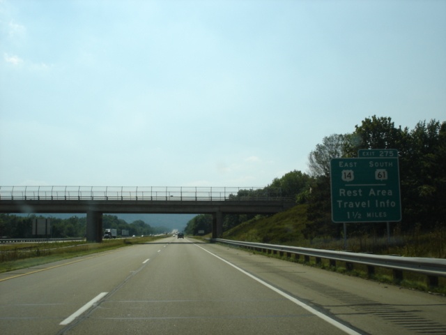 |
Interstate 90 West approaching Exit 275 - U.S. 14 East/U.S. 61 South - 1 1/2 miles. U.S. 61 is mistakenly labeled as Wisconsin 61 here, even though the exit is actually in Minnesota. (Photo taken 7/12/05) |
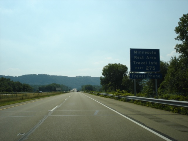 |
A travel information center is located just east of Exit 275. (Photo taken 7/12/05) |
 |
Use U.S. 14 East and U.S. 61 South for two miles to the city of La Crescent, home of 4,923 residents and known as the Apple Capital of Minnesota. (Photo taken 7/12/05) |
Page created: March 06, 2006
Last updated:
March 07, 2006