|
Home Search OKRoads: |
|
|
Home Search OKRoads: |
Interstate 635 Texas
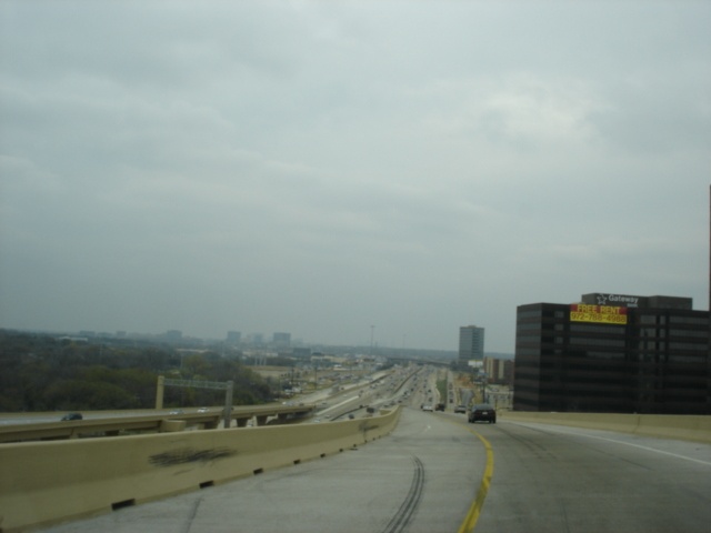
Interstate 635, also known as the Lyndon B. Johnson Freeway (or LBJ for short) is arguably Dallas' most infamous interstate. Especially between Interstate 35E and U.S. 75, the highway is prone to backups at all hours of the day. Interstate 635 makes up a loop on the eastern and northern sides of Dallas, connecting Interstate 20 to Interstate 30, U.S. 75, Interstate 35E, and TX 121. The interstate is signed east-west between TX 121 and U.S. 75, and is signed north-south between Interstate 20 and U.S. 75.
|
Highway Information |
|
| Miles | 37.00 |
| Counties Traveled Through |
Dallas |
| Cities | Dallas |
| Major Junctions |
Interstate 20 (Exit 1C)
Interstate 30 U.S. 75 Interstate 35E |
| OKRoads Coverage | |
| Miles Driven by OKRoads (Percentage) |
37 (100%) |
| Southern End of Interstate Driven |
Interstate 20 |
| Western End of Interstate Driven |
TX 121 |
Pictures
| Northbound/Westbound | |
 |
Interstate 635 North at Exit 11B -
Northwest Highway/Shiloh Rd. Northwest Highway is a major thoroughfare through north Dallas. It begins at TX 114 and eventually winds its way to its other end at Belt Line Rd., five miles to the southeast. Parts of Spur 348, Loop 12, and Spur 244 make up the Northwest Highway. Shiloh Rd, on the other hand, is a north-south arterial through west Garland and east Plano. (Photo taken 3/16/05) |
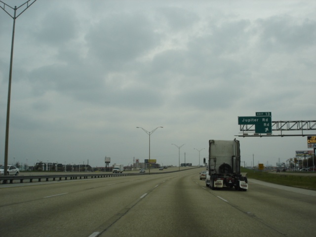 |
Interstate 635 North at Exit 13 -
Jupiter Rd./ Kingsley Rd. This exit sign is missing its lower left section. As for the streets, both streets are arterials, with Jupiter running north-south and Kingsley going east-west. (Photo taken 3/16/05) |
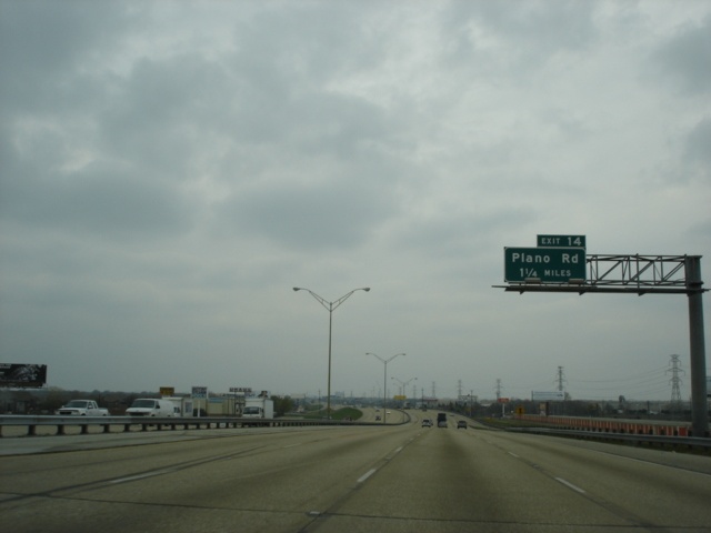 |
Interstate 635 North approaching
Exit 14 - Plano Rd. - 1 1/4 miles. We'll give you two guesses as to where Plano Rd. eventually goes. (Photo taken 3/16/05) |
 |
Interstate 635 North at Exit 14 -
Plano Rd. Once Plano Rd. enters, well, Plano, the street name changes to K Ave. (Photo taken 3/16/05) |
 |
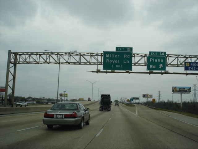
Interstate 635 North at Exit 15 -
Miller Rd./ Royal Ln. Miller Rd. ends and Royal Lane begins less than 1/4 mile to the west of this interchange. (Photo taken 3/16/05) |
 |
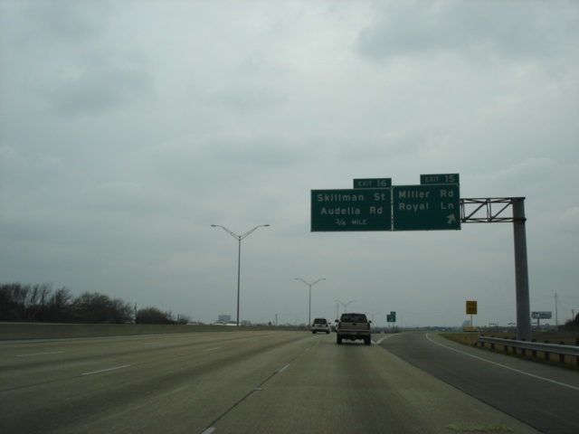
Interstate 635 North at Exit 16 -
Skillman St./ Audelia Rd. The two arterials join for this overpass, then split on each side of the interchange. Skillman St. ends less than a mile to the northeast. (Photo taken 3/16/05) |
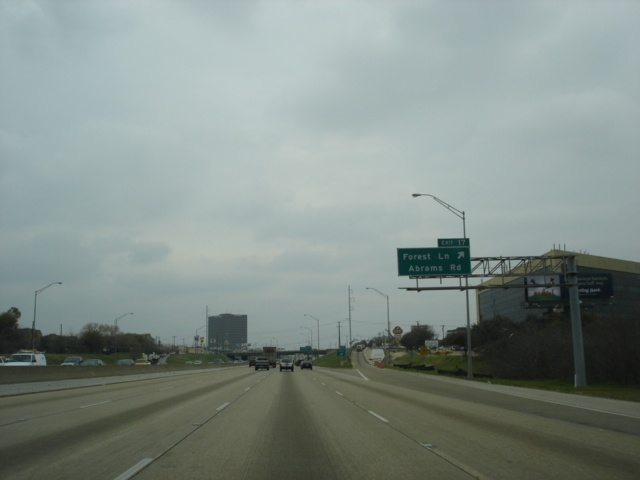 |
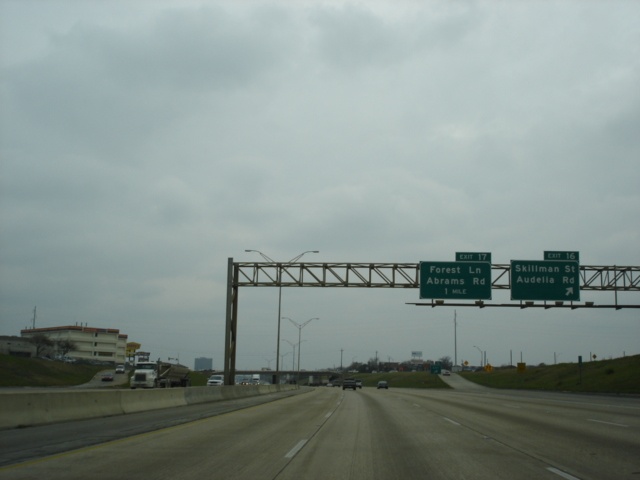
Interstate 635 North at Exit 17 -
Forest Ln./ Abrams Rd. Forest Ln. goes east-west; Abrams Rd. goes north-south. (Photo taken 3/16/05) |
 |
Interstate 635 North approaching
Exit 18A - Greenville Ave. - 1/2 mile. Greenville Ave. makes up the original U.S. 75 through north Dallas. (Photo taken 3/16/05) |
 |
Interstate 635 North at Exit 18A -
Greenville Ave. After U.S. 75 was moved a mile to the west on its present freeway alignment, the road was re-signed as TX 5. That, too, has fallen by the wayside. (Photo taken 3/16/05) |
 |
Interstate 635 North approaching
Exit 19A - U.S. 75. Reconstruction of the Interstate 635/ U.S. 75 interchange is almost complete. (Photo taken 3/16/05) |

|
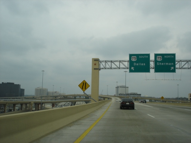
Interstate 635 North at Exit 19A -
U.S. 75. Greenville Ave. crosses over the interstate in the top picture. The ramp connecting Interstate 635 North to U.S. 75 is over a mile long. (Photos taken 3/16/05) |

|
These three pictures show the signs
on the ramp connecting Interstate 635 North to U.S. 75. For more information on the High Five interchange, visit the official TxDOT High Five interchange website. (Photos taken 3/16/05) |
 |
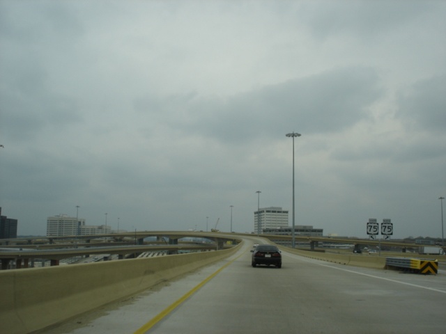
This photo shows the view of U.S. 75
South that one sees as they go from Interstate 635 North to U.S. 75 South. It is quite a view! (Photo taken 3/16/05) |
 |
Interstate 635 West at Exit 28 -
Luna Rd. (Photo taken 7/14/04) |
 |
Interstate 635 West approaching Exit 30 - President George Bush Turnpike South - 1 mile. (Photo taken 7/14/04) |
 |
Interstate 635 West at Exit 29 - Valley View Lane. (Photo taken 7/14/04) |
 |
Interstate 635 West at Exit 30 - President George Bush Turnpike South. (Photo taken 7/14/04) |
 |
Interstate 635 West at Exit 31 - MacArthur Blvd. (Photo taken 7/14/04) |
 |
Interstate 635 West at Exit 31B - Olympus Blvd. (Photo taken 7/14/04) |
 |
Interstate 635 West at Exit 33 - Belt Line Rd. (Photo taken 7/14/04) |
 |
Mileage sign on Interstate 635 West, 3 1/4 miles west of TX 121. (Photo taken 7/14/04) |
 |
Mileage sign on Interstate 635 West, two miles west of TX 121. (Photo taken 7/14/04) |
 |
Interstate 635 West at Exit 34 -
Freeport Pkwy. (Photo taken 7/14/04) |
 |
Interstate 635 West approaching Exit 35 - Royal Lane - 1/2 mile, and Exits 36A-B - TX 121 - 1 1/2 miles. (Photo taken 7/14/04) |
 |
Interstate 635 West at Exit 35 - Royal Lane. (Photo taken 7/14/04) |
 |
Interstate 635 West approaching Exit 36A - TX 121 South, and Exit 36B - TX 121 North - 3/4 mile. (Photo taken 7/14/04) |
 |
Interstate 635 West at Exit 36B - TX 121 North - Bass Pro Dr. Straight ahead is Exit 36A - TX 121 South - DFW Airport. There is no "END" sign at this terminus. (Photo taken 7/14/04) |
| Eastbound/Southbound | |
 |
Interstate 635 East
at Exit 26 - Josey Ln. (Photo taken 7/29/03) |
 |
Interstate 635 East
at Exit 25 - Webb Chapel Rd. (Photo taken 7/29/03) |
 |
Interstate 635 East
at Exit 24 - Marsh Ln. (Photo taken 7/29/03) |
 |
Interstate 635 East
at Exit 23 - Midway Rd./ Welch Rd. (Photo taken 7/29/03) |
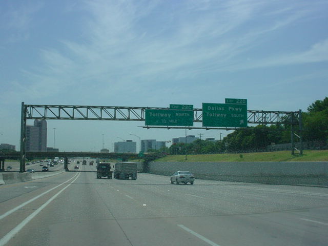 |
Interstate 635 East
at Exit 22D - Dallas Pkwy./ Tollway South. (Photo taken 7/29/03) |
 |
Interstate 635 East
at Exit 22C - Tollway North. (Photo taken 7/29/03) |
 |
Interstate 635 East
at Exit 21 - TX 289 - Preston Rd. (Photo taken 7/29/03) |
 |
Interstate 635 East
at Exit 20 - Hillcrest Rd. (Photo taken 7/29/03) |
 |
Interstate 635 East
at Exit 19B - U.S. 75 South. The interchange, also known as the High Five, is currently undergoing a major reconstruction project. (Photo taken 7/29/03) |
 |
Interstate 635 East
at Exit 19A - U.S. 75 North. This left exit no longer exists. (Photo taken 7/29/03) |
 |
Interstate 635 South
at Exit 18B - TI Boulevard. (Photo taken 7/29/03) |
 |
Interstate 635 South
at Exit 18A - Greenville Ave. (Photo taken 7/29/03) |
 |
Interstate 635 South
at Exit 17 - Abrams Rd./ Forest Ln. (Photo taken 7/29/03) |
 |
Interstate 635 South
at Exit 16 - Skillman St./ Audelia Rd. (Photo taken 7/29/03) |
 |
Interstate 635 South
at Exit 15 - Miller Rd./ Royal Ln. (Photo taken 7/29/03) |
 |
Interstate 635 South
at Exit 14 - Church Rd./ Plano Rd. (Photo taken 7/29/03) |
 |
Interstate 635 South
at Exit 13 - Kingsley Rd./ Jupiter Rd. (Photo taken 7/29/03) |
 |
Interstate 635 South
at Exit 12 - TX 78 - Garland Rd. (Photo taken 7/29/03) |
 |
Interstate 635 South
at Exit 11B - Northwest Hwy./Shiloh Rd. (Photo taken 7/29/03) |
 |
Interstate 635 South
at Exit 11A - Centerville Rd./Ferguson Rd. (Photo taken 7/29/03) |
 |
Interstate 635 South
at Exit 9B - La Prada Dr. (Photo taken 7/29/03) |
 |
Interstate 635 South at Exit 9A - Oates Dr./ Galloway Ave. comes into view. (Photo taken 7/29/03) |
 |
Interstate 635
South at Exit 8B - Interstate 30 East - Texarkana. (Photo taken 7/29/03) |
 |
Interstate 635
South at Exit 8A - Interstate 30 West - Dallas. (Photo taken 7/29/03) |
 |
Interstate 635
South at Exit 7 - Town East Blvd./Towne Centre Dr. (Photo taken 7/29/03) |
 |
Interstate 635
South at Exit 6B - U.S. 80 East - Terrell. (Photo taken 7/29/03) |
 |
Interstate 635
South at Exit 6A - U.S. 80 West - Dallas. (Photo taken 7/29/03) |
 |
Interstate 635
South at Exit 5 - Gross Rd. (Photo taken 7/29/03) |
 |
Interstate 635
South at Exit 4 - TX 352 - Scyene Rd./Military Pkwy. (Photo taken 7/29/03) |
 |
Interstate 635
South at Exit 3 - Bruton Rd. (Photo taken 7/29/03) |
 |
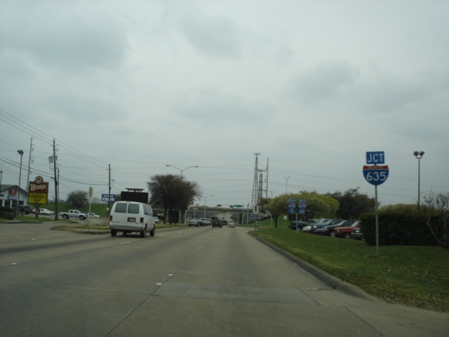
Interstate 635
South at Exit 2 - Lake June Rd. Interstate 20 is 2 1/2 miles away. (Photo taken 7/29/03) |
 |
Interstate 635
South at Exit 1B - Elam Rd. (Photo taken 7/29/03) |
 |
"END
Interstate 635 1/4 MI" sign as Interstate 20 quickly approaches. (Photo taken 7/29/03) |
 |
Interstate 635
South at Exit 1A - Seagoville Rd. Contrary to normal procedure, the next exit is Exit 1C. Elam Rd. should be Exit 1C, this exit should be Exit 1B, and Interstate 20 East should be Exit 1A. (Photo taken 7/29/03) |
 |
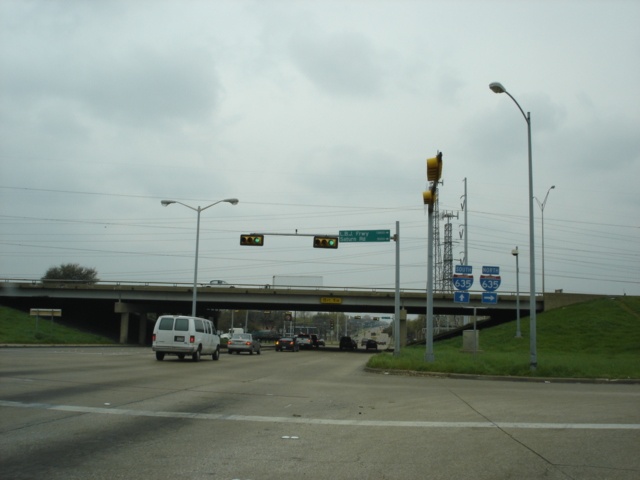
Interstate 635
South at Exit 1C - Interstate 20 East - Tyler/Shreveport. The mainline continues as Interstate 20 West. (Photo taken 7/29/03) |
 |
From the ramp to
Interstate 20 East; an "Interstate 635 ENDS" sign. End signs are rare in the Lone Star State. Also visible to the left of the "ENDS" sign is mile marker 0. (Photo taken 7/29/03) |
| Scenes Related to Interstate 635 | |
 |
Centerville Road southwestbound
approaching Interstate 635. Centerville becomes Ferguson Rd. after going under the interstate. (Photo taken 3/16/05) |
 |
Centerville Rd. at Interstate 635
North. Interstate 30 is two miles to the south. (Photo taken 3/16/05) |
Page created: May 14, 2005
Last updated:
May 14, 2005