 |
Home Search OKRoads: |
|
|
Home Search OKRoads: |
Interstate 90 Ohio
Westbound - Pennsylvania State Line to
Interstate 271
|
Highway Information |
|
| Miles | 244.75 |
| Counties Traveled Through |
Williams, Fulton, Lucas, Wood, Ottawa, Sandusky, Erie, Lorain, Cuyahoga, Lake, Ashtabula |
| Cities |
Toledo, Elyria, Cleveland, Ashtabula, Conneaut |
| Major Junctions |
Interstate 75 (Exit 64) Interstate 280 Interstate 80 Interstate 71 Interstate 490 Interstate 77 Interstate 271 |
| OKRoads Coverage | |
| Miles Driven by OKRoads (Percentage) |
75 (31%) |
| Western End of Interstate Driven |
Interstate 71 |
| Eastern End of Interstate Driven |
Pennsylvania State Line |
Pictures
Westbound:
Pennsylvania State Line to Interstate 271
Interstate 271 to Interstate 71
| Interstate 90 West | |
 |
Welcome to Ohio sign as Interstate 90 West enters the Buckeye State in Ashtabula County. The first interchange is three miles ahead at Ohio 7. (Photo taken 7/10/05) |
 |
Interstate 90 West approaching the Ohio tourist information center, rest area, and weigh station - 1 mile. (Photo taken 7/10/05) |
 |
The next rest area is 45 miles ahead in Lake County. (Photo taken 7/10/05) |
 |
Interstate 90 West at the Ashtabula County rest area and weigh station. (Photo taken 7/10/05) |
 |
Interstate 90 West approaching Exit 241 - Ohio 7 - 1/2 mile. Ohio 7 travels along the Ohio-Pennsylvania border before reaching the shores of the Ohio River. From there, the state highway stays close to the river's shore and ends at U.S. 52 near Chesapeake. It is the longest highway in the state at a length of 345 miles. (Photo taken 7/10/05) |
 |
Interstate 90 West at Exit 241 - Ohio 7 - Andover/Conneaut. The city of Conneaut is home to 12,485 residents. Andover is 22 miles to the south. (Photo taken 7/10/05) |
 |
Interstate 90 West approaching Exit 235 - Ohio 84/Ohio 193 - 1 mile. The state highways share less than a mile of roadway from this interchange northward. Ohio 193 meets its northern terminus at Ohio 531 three miles to the north in North Kingsville. (Photo taken 7/10/05) |
 |
Interstate 90 West approaching Exit 235 - Ohio 84/Ohio 193 - 1/2 mile. North Kingsville village has a population of 2,658. (Photo taken 7/10/05) |
 |
Interstate 90 West at Exit 235 - Ohio 84/Ohio 193 - North Kingsville. The highways split on the south side of this interchange. (Photo taken 7/10/05) |
 |
Interstate 90 West approaching Exit 228 - Ohio 11 - 2 miles. Ohio 11 is an all-freeway route from U.S. 30 near Lisbon to Ohio 531 in Ashtabula. (Photo taken 7/10/05) |
 |
Interstate 90 West approaching Exit 228 - Ohio 11 - 1 mile. The city of Ashtabula (pop. 20,962) is five miles to the northwest. (Photo taken 7/10/05) |
 |
Use Exit 228 to Ohio 11 South to Ohio 46. Ohio 46 begins two miles to the south of the Interstate 90/Ohio 11 cloverleaf interchange. (Photo taken 7/10/05) |
 |
Interstate 90 West at Exit 228 - Ohio 11 - Ashtabula/Youngstown. A collector/distributor system is in place on Interstate 90. (Photo taken 7/10/05) |
 |
Interstate 90 West c/d lane at Ohio 11 North - Ashtabula. If numbered, this would be Exit 228B. (Photo taken 7/10/05) |
 |
Interstate 90 West c/d lane at Ohio 11 South to Ohio 46 - Youngstown/Jefferson. Jefferson village, population 3,572, is the seat of Ashtabula County and is seven miles to the south. The city of Youngstown (pop. 82,026) is 57 miles to the south. (Photo taken 7/10/05) |
 |
Interstate 90 West approaching Exit 223 - Ohio 45 - 1 mile. Ohio 45 begins at Ohio 531 and travels south to Ohio 7 near Wellsville. The state highway travels through Warren and Salem along the way. (Photo taken 7/10/05) |
 |
Use Ohio 45 South to Austinburg, home of the Grand River Academy, an all-boys boarding high school. (Photo taken 7/10/05) |
 |
Use Ohio 45 north and Ohio 531 east to Kent State University Ashtabula. (Photo taken 7/10/05) |
 |
Interstate 90 West approaching Exit 223 - Ohio 45 - 1/2 mile. Warren (pop. 46,832) is 39 miles to the south. (Photo taken 7/10/05) |
 |
Interstate 90 West at Exit 223 - Ohio 45 - Warren. (Photo taken 7/10/05) |
 |
Interstate 90 West approaching Exit 218 - Ohio 534 - 1 mile. The westbound lanes were being resurfaced during the summer of 2005, but two lanes were provided in each direction throughout the work zone. (Photo taken 7/10/05) |
 |
Interstate 90 West approaching Exit 218 - Ohio 534 - 1/2 mile. This marked the return of traffic to the regular westbound lanes. (Photo taken 7/10/05) |
 |
Interstate 90 West at Exit 218 - Ohio 534 - Geneva. Ohio 534 transitions into the eastbound beginning of Ohio 531 six miles to the north. (Photo taken 7/10/05) |
 |
Interstate 90 West enters Lake County near mile marker 214. The Laketran Park & Ride lot is located in the vicinity of the first westbound Lake County interchange at Exit 212 for Ohio 528. (Photo taken 7/10/05) |
 |
Interstate 90 West approaching Exit 212 - Ohio 528 - 1 1/4 mile. Ohio 528 spans 29.3 miles from U.S. 20 in Madison to Ohio 88 near Parkman. (Photo taken 7/10/05) |
 |
Interstate 90 West approaching Exit 212 - Ohio 528 - 1/2 mile. Madison village (pop. 2,921) is less than a mile to the north. (Photo taken 7/10/05) |
 |
Interstate 90 West at Exit 212 - Ohio 528 - Thompson/Madison. (Photo taken 7/10/05) |
 |
Mileage sign on Interstate 90 West just past Exit 212. Painesville is 15 miles ahead, and Cleveland is just 40 miles away. (Photo taken 7/10/05) |
 |
Interstate 90 West approaching Exit 205 - Vrooman Road - 1 mile. Trucks are prohibited from going north on Vrooman Road from Interstate 90, as the street travels through the Masons Landing and Indian Point parks on its way to Ohio 84. (Photo taken 7/10/05) |
 |
Interstate 90 West approaching Exit 205 - Vrooman Road - 1/2 mile. (Photo taken 7/10/05) |
 |
Interstate 90 West at Exit 205 - Vrooman Road. (Photo taken 7/10/05) |
 |
Interstate 90 West approaching Exit 200 - Ohio 44 - 1 1/4 mile. Ohio 44 is a four-lane divided highway between Interstate 90 and its northern terminus at the entrance to the Headlands Beach State Park. (Photo taken 7/10/05) |
 |
Interstate 90 West approaching Exit 200 - Ohio 44 - 1/2 mile. This is the main exit for the city of Painesville (pop. 17,503). (Photo taken 7/10/05) |
 |
Use Ohio 44 south and Auburn Road north to the Auburn Career Center. (Photo taken 7/10/05) |
 |
Interstate 90 West at Exit 200 - Ohio 44 - Chardon/Painesville. The city of Chardon (pop. 5,156) is seven miles to the south. Chardon changed from a village to a city after the 2000 census results indicated a population exceeding 5,000 residents. (Photo taken 7/10/05) |
 |
Interstate 90 West approaching the Lake County rest area - 1 mile. This is the final rest area on westbound Interstate 90 before reaching Cleveland. (Photo taken 7/10/05) |
 |
The next rest area is 56 miles ahead just after the merge of Interstate 90 onto the Ohio Turnpike. (Photo taken 7/10/05) |
 |
Interstate 90 West at the Lake County rest area. (Photo taken 7/10/05) |
 |
Interstate 90 West approaching Exit 195 - Ohio 615 - 1 mile. Ohio 615 is 6.9 miles long from Ohio 306 in Kirtland to Ohio 283 in Mentor-on-the-Lake. (Photo taken 7/10/05) |
 |
Use northbound Ohio 615 to the city of Mentor (pop. 50,278) and southbound Ohio 615 to Kirtland Hills village. (Photo taken 7/10/05) |
 |
Interstate 90 West approaching Exit 195 - Ohio 615 - 1/2 mile. The interchange was opened on November 23, 2003, and provides another access point in western Lake County. (Photo taken 7/10/05) |
 |
Interstate 90 West at Exit 195 - Ohio 615 - Center Street. (Photo taken 7/10/05) |
 |
Interstate 90 West approaching Exit 193 - Ohio 306 - 1 mile. The state highway extends from Ohio 43 in Aurora to Ohio 283 in Mentor. (Photo taken 7/10/05) |
 |
Use Exit 193 to the Lake Metro Farmpark, the James A. Garfield National Historic Site, and the Holden Arboretum. (Photo taken 7/10/05) |
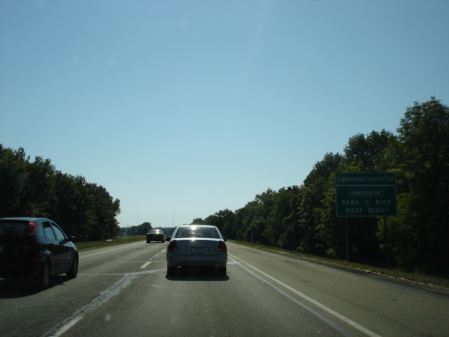 |
Also use Exit 193 to Lakeland Community College and a Laketran Park & Ride facility. (Photo taken 7/10/05) |
 |
Interstate 90 West at Exit 193 - Ohio 306 - Kirtland/Mentor. The city of Kirtland has a population of 6,670. (Photo taken 7/10/05) |
 |
Mileage sign on Interstate 90 West just past Exit 193. Cleveland is 21 miles ahead. Interstate 271 begins in four miles. The northernmost segment of Interstate 271 is split into express and local lanes. The express lanes begin first in 2 3/4 miles. The local lanes begin in 4 miles. (Photo taken 7/10/05) |
 |
Interstate 90 West enters the city of Willoughby as the two-mile advance sign for the express lanes of Interstate 271 appears. Willoughby has a population of 22,621 according to the 2000 census. (Photo taken 7/10/05) |
 |
Use Interstate 271 South to Interstate 77 South to Akron. The city is 44 miles to the south. (Photo taken 7/10/05) |
 |
The first exit on Interstate 271 Express is at Chagrin Boulevard (Ohio 87), which is the southern end of the express lanes, 11 miles from Interstate 90. (Photo taken 7/10/05) |
 |
Interstate 90 West approaching Exit 190 - Interstate 271 South Express - 1 mile. (Photo taken 7/10/05) |
 |
Interstate 90 West approaching Exit 189 - Ohio 91 - 1 mile. This interchange is between the express and local lanes exits off of Interstate 90 westbound. Ohio 91 goes from U.S. 224 in Lakemore to Ohio 283 in Eastlake. (Photo taken 7/10/05) |
 |
Use Ohio 91 North to Classic Park, home of the Lake County Captains single-A minor league baseball team. The stadium opened in April 2003 and has a seating capacity of 7,273. (Photo taken 7/10/05) |
 |
This diagrammatical sign about 3/4 mile before the beginning of Interstate 271 Express shows how the lanes split ahead. (Photo taken 7/10/05) |
 |
Interstate 90 West approaching Exit 190 - Interstate 271 Express South - 1/4 mile. Columbus, the capital city of Ohio, is 155 miles to the southwest. (Photo taken 7/10/05) |
 |
Interstate 90 West at Exit 190 - Interstate 271 Express South - Columbus. Interstate 271 is 46.06 miles and provides a bypass to the east and south of Cleveland. (Photo taken 7/10/05) |
 |
Interstate 90 West at Exit 189 - Ohio 91 - Willoughby Hills/Willoughby. The overpass seen here is Maplegrove Road. (Photo taken 7/10/05) |
 |
Interstate 90 West approaching Exit 188 - Interstate 271 South - 1/2 mile. Hazardous material vehicles are prohibited from using Interstate 90 through Cleveland. (Photo taken 7/10/05) |
 |
Stay in the left two lanes for Interstate 271 South through Cleveland's eastern suburbs, including Highland Heights, Mayfield Heights, Pepper Pike, Beachwood, and Bedford Heights. (Photo taken 7/10/05) |
 |
Interstate 90 West approaching Exit 188 - Interstate 271 South - 1/4 mile. The express lanes are off to the left. (Photo taken 7/10/05) |
 |
Interstate 90 West at Exit 188 - Interstate 271 Local South - All Exits. The first exit is four miles ahead at Wilson Mills Road. (Photo taken 7/10/05) |
Page created: February 01, 2006
Last updated:
February 02, 2006