 |
"Welcome to
Indiana" sign on Interstate 69 South. The interstate spans 158 miles in the Hoosier State. |
 |
Interstate 69 South
at Exit 157 - Lake George Rd./Jamestown. The Indiana Toll Road is 1 1/4 miles ahead. |
 |
Interstate 69 South
approaching Exit 156 - Interstate 80/Interstate 90 - 1/2 mile. |
 |
Interstate 69 South
at Exit 156 - Interstate 80/Interstate 90 - Toll Road - Chicago/ Toledo. |
 |
Gore point signage
at Exit 156. The Indiana Toll Road goes across the northern part of Indiana from Chicago to the Ohio State Line, where the highway becomes the Ohio Turnpike. |
 |
Interstate 69 South
at Exit 154 - IN 127/ TO IN 727 - Angola. |
 |
Interstate 69 South
at Exit 150 - Co. Rd. 200 W. |
 |
Interstate 69 South
at Exit 148 - U.S. 20 - Angola/Lagrange. |
 |
Interstate 69 South
at Exit 140 - IN 4 - Ashley/Hudson. |
 |
Interstate 69 South
at Exit 134 - U.S. 6 - Waterloo/Kendallville. |
 |
Interstate 69 South
at Exit 129 - IN 8 - Auburn/Garrett. |
 |
Interstate 69 South
at Exit 126 - Co. Rd. 11-A. |
 |
Interstate 69 South
at Exit 116 - IN 1 North - Dupont Rd. Interstate 469 begins in 1 mile. |
 |
Interstate 69 South
approaching Exit 115 - Interstate 469/U.S. 30 East - 1/2 mile. |
 |
Interstate 69 South
at Exit 115 - Interstate 469/U.S. 30 East. The sign on the left is inaccurate, as U.S. 27 has been truncated to Interstate 69 four miles down the road. Shouldn't the sign give preference to Interstate 69 South anyways? |
 |
Interstate 69 South
at Exits 112B-A - Coldwater Rd. |
 |
The off-ramp for
Exits 112B-A split here; Exit 112A for South Coldwater Rd., and Exit 112B for North Coldwater Rd. |
 |
Interstate 69 South
at Exit 111B - IN 3 North - Kendallville. |
 |
Interstate 69 South
at Exit 111A - U.S. 27 South - Ft. Wayne. |
 |
Interstate 69 South
at Exit 109B - U.S. 30 West/U.S. 33 North - Columbia City/ Elkhart. |
 |
Interstate 69 South
at Exit 109A - IN 930/ Ft. Wayne. IN 930 runs along the route that U.S. 30 once took through Ft. Wayne. |
 |
Interstate 69 South
at Exit 105B - IN 14 West - South Whitley. |
 |
Mileage sign on
Interstate 69 South at mile marker 101. Interstate 469 is six miles ahead. |
 |
Interstate 69 South
at Exit 99 - Lower Huntington Rd./Airport Expressway. |
 |
Mileage sign on
Interstate 69 South, two miles to the north of Interstate 469. |
 |
Interstate 69 South
approaching Exit 96B - West Lafayette Center Rd. - 1 mile, and Exit 96A - Interstate 469/U.S. 24 East/U.S. 33 South - 1 1/2 miles. |
 |
Interstate 69 South
approaching Exit 96B - 1/2 mile, and Exit 96A - 1 mile. |
 |
Interstate 69 South
at Exit 96B - West Lafayette Center Rd. A General Motors plant is located just west of this interchange. |
 |
The first of two
signs for Exit 96A - Interstate 469/U.S. 24 East/U.S. 33 South. |
 |
And here is the
other sign for Exit 96A. The bridge in the background carries Lafeyette Center Rd. eastbound traffic to Interstate 69 North. |
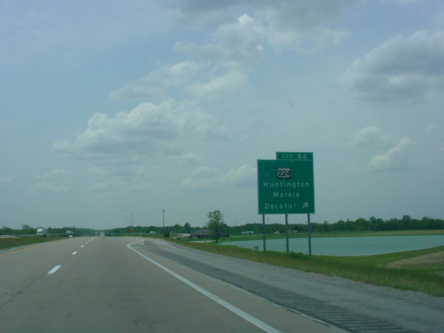 |
Interstate 69 South
at Exit 86 - U.S. 224 - Huntington/Markle/Decatur. |
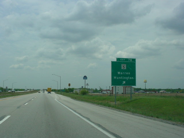 |
Interstate 69 South
at Exit 78 - IN 5 - Warren/Huntington. |
 |
Interstate 69 South
at Exit 73 - IN 218/IN 5 - Van Buren/Warren/Berne. |
 |
Interstate 69 South
at Exit 64 - IN 18 - Montpelier/Marion. |
 |
Interstate 69 South
at Exit 59 - U.S. 35 North/IN 22 - Upland/Gas City. |
 |
Interstate 69 South
at Exit 55 - IN 26 - Hartford City/Fairmount. |
 |
Interstate 69 South
at Exit 45 - U.S. 35 South/IN 28 - Alexandria/Albany. |
 |
Interstate 69 South
at Exit 41 - IN 332 - Frankton/Muncie. |
 |
Interstate 69 South
at Exit 34 - IN 32/TO IN 67 North - Muncie/Anderson. |
 |
Interstate 69 South
at Exit 26 - IN 9 North/ IN 109 South - Anderson. |
 |
Interstate 69 South
at Exit 22 - IN 9/67 South - Pendleton/Anderson. |
 |
Interstate 69 South
at Exit 19 - IN 38 - Pendleton/Noblesville. |
 |
Mileage sign on
Interstate 69 South, 19 miles to the north of Interstate 465. |
 |
Interstate 69 South
at Exit 14 - IN 13 - Fortville/Lapel. |
 |
Mileage sign on
Interstate 69 South, 13 miles to the north of Interstate 465. |
 |
Interstate 69 South
at Exit 10 - IN 238 - Noblesville. |
 |
Mileage sign on
Interstate 69 South, nine miles to the north of Interstate 465. |
 |
Interstate 69 South
at Exit 5 - 116th St./ Fishers. |
 |
Interstate 69 South
at Exit 3 - 96th St. Interstate 465 is two miles ahead. |
 |
Interstate 69 South
at Exit 1 - 82nd St./ Castleton. |
 |
Interstate 69 South
approaching Exit 0 - Interstate 465/IN 37 - 3/4 mile. |
 |
Interstate 69 South
at Exit 0 - Interstate 465/IN 37. |
 |
The final off-ramp
from Interstate 69 splits into Interstate 465/IN 37 South and Interstate 465 West. |