 |
CA 58 East in Santa
Margarita. The highway turns back to the east after a short north-south stretch. That turn is not signed from CA 58 East, so unless you are familiar with the area, you will probably wind up on the wrong road. |
 |
"Next Services
82 Miles" sign just east of Santa Margarita. The next 82 miles are full of curves and mountains, except for a stretch in the Carrizo Plain. |
 |
CA 58 East at CA 229. |
 |
View from CA 58
East in the Sierra Madre Mountains. |
 |
CA 58 East
assurance shield in the Carrizo Plain. The Temblor Range is in the distance. |
 |
View from CA 58
East in the Temblor Range. The curves in this range are much more frequent and sharper than those in the Sierra Madre. |
 |
In the middle of
the mountains lies the Kern County Line. |
 |
Hairpin turn on CA
58 East in the Temblors. |
 |
Just a little bit
later, there's another hairpin! |
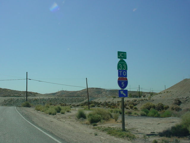 |
CA 58 East at CA 33. |
 |
CA 33/CA 58
assurance shields near McKittrick. |
 |
CA 58 East/CA 33
North at CA 33 North. |
 |
Mileage sign on CA
58 East. CA 58's time through the mountains is over. Bakersfield lies 30 miles ahead. |
 |
CA 58 East at Interstate 5 South. |
 |
CA 58 East at Interstate 5 North. |
 |
CA 58 East at CA 43. |
 |
CA 43/CA 58 assurance shields. |
 |
CA 43 South/CA 58
East at CA 58 East - Bakersfield. |
 |
CA 58 East
approaching CA 58 East/ CA 99 South in Bakersfield. |
 |
CA 58 East at CA 99
South/CA 58 East. |
 |
Freeway entrance
signage as CA 58 East prepares to merge onto CA 99 South. |
 |
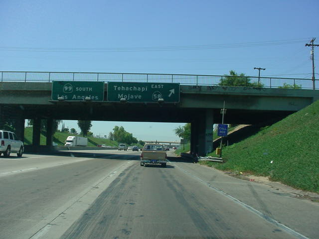
CA 99 South/CA 58
East at Exit 25 - California Ave./Civic Center. |
 |
CA 99 South/CA 58
East at Exit 24 - CA 58 East - Tehachapi/Mojave. |
 |
The second sign on
CA 99 South/CA 58 East for Exit 24 has CA 58 East - Stockdale Highway. |
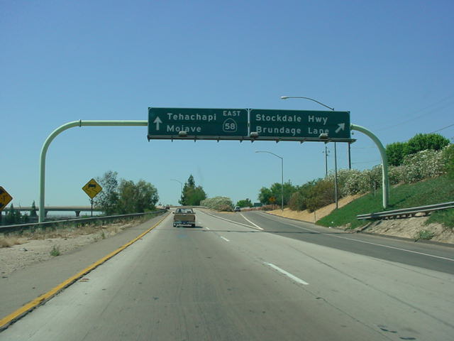 |
CA 58 East at the
Stockdale Highway/ Brundage Lane exit. The exit is only accessed from the ramp from CA 99 South to CA 58 East. |
 |
CA 58 East at Exit
111 - H Street/ Chester Ave. |
 |
CA 58 East at Exit
112 - CA 204 - Union Ave. |
 |
CA 58 East at Exit 113 - Cottonwood Rd. |
 |
CA 58 East at Exit
114 - Mt. Vernon Ave. |
 |
CA 58 East at Exit 115 - Oswell St. |
 |
CA 58 East at Exit 116 - Fairfax Rd. |
 |
CA 58 East at Exit
117 - CA 184 - Weedpatch Hwy./Lamont. |
 |
CA 58 East at Exit
119 - Edison Rd./ Edison. |
 |
CA 58 East at Exit
121 - Comanche Dr./Arvin. |
 |
CA 58 East at Exit
123 - Tower Line Rd. |
 |
CA 58 East at Exit 127 - Gen. Beale Rd. |
 |
CA 58 East
assurance shield near mile 130. |
 |
CA 58 East at Exit 139 - Keene. |
 |
CA 58 East at Exit 142 - Broome Rd. |
 |
CA 58 East at Exit
148 - CA 202 - Tehachapi. |
 |
CA 58 East at Exit 149 - Mill St. |
 |
CA 58 East
approaching Exit 151 - Tehachapi Blvd. - 1 mile. |
 |
Then you get to the
actual exit, and there is no exit number, and the sign says Monolith instead of Tehachapi Blvd. |
 |
CA 58 East
approaching Exit 156 - Sand Canyon Rd. - 1 mile. |
 |
CA 58 East at Exit
156 - Sand Canyon Rd. |
 |
CA 58 East at Exit 159 - Cameron Rd. |
 |
CA 58 East at CA 14 North in Mojave. |
 |
CA 58 East/CA 14
South at CA 58 East in Mojave. |
 |
Another view of CA
58 East/CA 14 South at CA 58 East. |
 |
CA 58 East at Exit 186 - Edwards AFB. |
 |
CA 58 East at Exit 188 - Clay Mine Rd. |
 |
CA 58 East at Exit
193 - Twenty Mule Team Dr. |
 |
CA 58 East
assurance signage near Boron. |
 |
CA 58 East at Exit
194 - Gephart Rd./ Rocket Site Rd. |
 |
CA 58 East at Exit
196 - Borax Rd/ Route 58 Business. |
 |
CA 58 East at Exit 199 - Boron. |
 |
CA 58 East at U.S. 395. |
 |
CA 58 East at W.
Main Street exit in Barstow. |
 |
CA 58 East
approaching Interstate 15 - 1 mile. |
 |
CA 58 East
approaching Interstate 15 - 1/2 mile. |
 |
"Interstate 40
East Use Interstate 15 North" sign on CA 58 East about 1/4 mile west of Interstate 15. CA 58 between Barstow and Bakersfield may become a westward extension of Interstate 40 someday. |
 |
CA 58 East at
Interstate 15. Las Vegas is about two hours north of here, while San Bernardino is about 45 minutes to the south. |