|
Interstate 64 West at Exit 281 - VA
165 - Military Hwy. |
 |
Interstate 64 West at Exit 279B -
Norview Ave. EAST/Norfolk Int'l Airport. |
 |
Interstate 64 West at Exit 279A -
Norview Ave. WEST. |
 |
Interstate 64 West at Exit 278 - VA
194 North - Chesapeake Blvd. |
 |
Interstate 64 West approaching Exits
277 B-A - VA 168 North/Tidewater Dr. - 1/2 mile, and Exit 276B - Interstate 564 TO VA 406 - 2 miles. |
 |
Interstate 64 West at Exit 277B - VA
168 North - Tidewater Dr. |
 |
Interstate 64 West at Exit 277A - VA
168 South - Tidewater Dr. |
 |
Interstate 64 West at Exit 276C - VA
165 TO U.S. 460 West - Little Creek Rd. Of course, I ran out of disk space with this picture, so I didn't get a picture of the sign for Interstate 564 (Exit 276B). |
 |
Interstate 64 West at Exit 276A -
U.S. 460 East - Granby St. |
 |
Interstate 64 West at Exit 274 -
Naval Station/Bay Ave. |
 |
"Check Gas - Tunnel - 3 miles" sign
on Interstate 64 West. |
 |
Interstate 64 West at Exit 273 - 4th
View St./Ocean View. |
 |
Interstate 64 West approaching an inspection station - 1 1/4 miles. |
 |
Interstate 64 West approaching Exit
272 - 1/2 mile. |
 |
Interstate 64 West at the tunnel
inspection station. |
 |
Interstate 64 West at Exit 272 - W.
Ocean View Ave./Willoughby Spit. This is the final interchange before the 4-mile-long Hampton Roads Bridge-Tunnel begins. |
 |
Hampton Roads Bridge-Tunnel sign as
it begins. (From here on, the bridge-tunnel will be referred to as HRBT) |
 |
Interstate 64 West on the HRBT. |
 |
Interstate 64 West as it prepares to
enter the lone tunnel on the HRBT. |
 |
The south portal of the westbound tunnel. |
 |
View from inside the tunnel. |
 |
The light at the end of the tunnel. |
 |
Interstate 64 West towards the end
of the HRBT. |
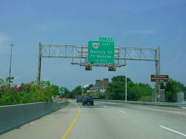 |
Interstate 64 West approaching Exit
268 - VA 169 East - 1/2 mile. |
 |
Interstate 64 West at Exit 268 - VA
169 East - Mallory St./Ft. Monroe. |
 |
Interstate 64 West at Exit 267 -
U.S. 60/VA 143 - Woodland Rd./Hampton University. |
 |
Interstate 64 West at Exit 265B - VA
134 West - Armistead Ave./La Salle Ave. |
 |
Interstate 64 West at Exit 265A - VA
134 East - Armistead Ave./La Salle Ave. Interstate 664 is 1/2 mile ahead. |
 |
Interstate 64 West at Exit 264 -
Interstate 664 South - Downtown Newport News/ Suffolk. |
 |
Interstate 64 West at Exit 263B -
U.S. 258 North/VA 134 South - Mercury Blvd./ Hampton Coliseum. |
 |
Interstate 64 West at Exit 263A -
U.S. 258 South - Mercury Blvd./James River Bridge. |
 |
Interstate 64 West at Exit 262B - VA
134 North - NASA/Poquoson. |
 |
Interstate 64 West at Exit 261A -
Hampton Roads Center Parkway West. |
 |
Interstate 64 West at Exit 258B -
U.S. 17 North - J Clyde Morris Boulevard/Yorktown. |
 |
Interstate 64 West at Exit 258A -
U.S. 17 South - J Clyde Morris Boulevard. |
 |
Interstate 64 West at Exit 256B - VA
171 East - Victory Blvd. |
 |
Interstate 64 West at Exit 256A -
Oyster Point Road West. |
 |
Interstate 64 West at Exits 255B-A -
VA 143 - Jefferson Ave. |
 |
Interstate 64 West at Exit 255B - VA
143 East - Jefferson Ave. |
 |
Interstate 64 West at Exit 255A - VA
143 West - Jefferson Ave. |
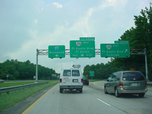 |
Interstate 64 West at Exit 250B - VA
105 East - Ft. Eustis Blvd./Yorktown. |
 |
Interstate 64 West at Exit 250A - VA
105 West - Ft. Eustis Blvd./Ft. Eustis. |
 |
Interstate 64 West at Exit 247 - VA
238 - Yorktown/Lee Hall. |
 |
Interstate 64 West at Exit 243B - VA
143 West - Williamsburg. |
 |
Interstate 64 West at Exit 243A - TO
U.S. 60 - Busch Gardens. |
 |
Interstate 64 West at Exit 242B - VA
199 East - Colonial Parkway/Yorktown. |
 |
Interstate 64 West at Exit 242A - VA
199 West - Williamsburg/Jamestown. |
 |
Interstate 64 West at Exit 238 - VA
143 East - Camp Peary/Colonial Williamsburg. |
 |
Interstate 64 West at Exit 234B - CR
646 West. |
 |
Interstate 64 West at Exit 234A - VA
199 East - Lightfoot. |
 |
Interstate 64 West at Exit 231B - CR
607 - Croaker. |
 |
Interstate 64 West at Exit 231A - CR
607 TO VA 30 - Norge/Toano. |
 |
Interstate 64 West at Exit 227 - VA
30 - West Point/Toano. |
 |
Interstate 64 West at Exit 220 - VA
33 East - West Point. |
 |
Interstate 64 West at Exit 214 - VA
155 - New Kent CH/Providence Forge. |
 |
Interstate 64 West at Exit 211 - VA
106 - Talleysville/Roxbury. |
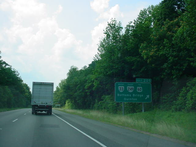 |
Interstate 64 West at Exit 205 - VA
33 West/VA 249 East/TO U.S. 60 - Bottoms Bridge/Quinton. |
 |
Interstate 64 West approaching Exit
200 - Interstate 295/U.S. 60 - 2 miles. |
 |
Interstate 64 West approaching Exit
200 - 1 mile. |
 |
Interstate 64 West approaching Exit
200 - 1/4 mile. |
 |
Interstate 64 West approaching Exit 200. |
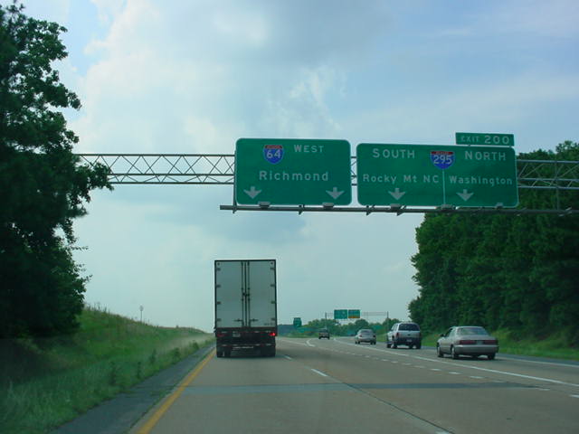 |
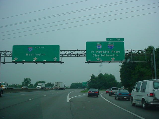
Interstate 64 West at Exit 200 -
Interstate 295 - Rocky Mount NC/Washington. |
 |
Interstate 64 West at Exit 197B - VA
156 North - Highland Springs. |
 |
Interstate 64 West at Exit 197A - VA
156 South - Sandston. |