 |
Home Search OKRoads: |
|
|
Home Search OKRoads: |
Interstate 20 Texas
Big Spring to Abilene
|
Highway Information |
|
| Miles | 636.08 |
| Counties Traveled Through |
Reeves, Ward, Crane, Ector, Midland, Martin, Howard, Mitchell, Nolan, Taylor, Callahan, Eastland, Erath, Palo Pinto, Parker, Tarrant, Dallas, Kaufman, Van Zandt, Smith, Gregg, Harrison |
| Cities | Pecos, Monahans, Odessa, Midland, Big Spring, Colorado City, Sweetwater, Abilene, Fort Worth, Dallas, Longview, Marshall |
| Major Junctions |
Interstate 10
Interstate 30 Interstate 820 Interstate 35W Interstate 820 Interstate 35E Interstate 45 Interstate 635 |
| OKRoads Coverage | |
| Miles Driven by OKRoads (Percentage) |
636 (100%) |
| Western End of Interstate Driven |
Interstate 10 |
| Eastern End of Interstate Driven |
Louisiana State Line |
Pictures
Eastbound:
U.S. 69 to Louisiana State Line
Westbound:
Spur 408 to Interstate 820 (western junction)
 |
Interstate 20 East at Exit 181A - Farm to Market Road 700. FM 700 is a partial loop around Big Spring. (Photo taken 3/18/05) |
 |
Interstate 20 East approaching Exit 181B - Refinery Road - 1/2 mile. The east side of Big Spring is known for its refineries. It's quite a welcome to the city when coming from the east. (Photo taken 3/18/05) |
 |
Interstate 20 East at Exit 181B - Refinery Road. (Photo taken 3/18/05) |
 |
Interstate 20 East approaching Exit 182 - Midway Road - 1/2 mile. (Photo taken 3/18/05) |
 |
Interstate 20 East at Exit 182 - Midway Road. (Photo taken 3/18/05) |
 |
Interstate 20 East approaching Exit 184 - Moss Lake Road/Sand Springs - 1/2 mile. (Photo taken 3/18/05) |
 |
Interstate 20 East at Exit 184 - Moss Lake Road/Sand Springs. (Photo taken 3/18/05) |
 |
Interstate 20 East approaching Exit 186 - Salem Road - 1/2 mile. (Photo taken 3/18/05) |
 |
Interstate 20 East at Exit 186 - Salem Road. (Photo taken 3/18/05) |
 |
Interstate 20 East approaching Exit 188 - Farm to Market Road 820 - 1 mile. FM 820 connects Interstate 20 and Texas 350. (Photo taken 3/18/05) |
 |
Interstate 20 East at Exit 188 - Farm to Market Road 820 - Coahoma. According to the 2000 census, Coahoma has a population of 932. (Photo taken 3/18/05) |
 |
Interstate 20 East approaching Exit 189 - McGregor Road - 1/2 mile. This exit serves east Coahoma. (Photo taken 3/18/05) |
 |
Interstate 20 East approaching Exit 191 - Rest Area - 2 miles. (Photo taken 3/18/05) |
 |
Interstate 20 East at Exit 189 - McGregor Road. (Photo taken 3/18/05) |
 |
Interstate 20 East approaching Exit 190 - Snyder Field Road - 1/4 mile. There are several exits to a field road in this part of Texas. (Photo taken 3/18/05) |
 |
Interstate 20 East at Exit 190 - Snyder Field Road. (Photo taken 3/18/05) |
 |
Interstate 20 East at Exit 191 - Rest Area. The next rest area is 66 miles ahead. (Photo taken 3/18/05) |
 |
Interstate 20 East approaching Exit 192 - Farm to Market Road 821 - 3/4 mile. (Photo taken 3/18/05) |
 |
Interstate 20 East at Exit 192 - Farm to Market Road 821. FM 821 heads southward and westward to U.S. 87 near Forsan. (Photo taken 3/18/05) |
 |
Interstate 20 East approaching Exit 194A - East Howard Field Road - 1/2 mile. (Photo taken 3/18/05) |
 |
Interstate 20 East at Exit 194A - East Howard Field Road. (Photo taken 3/18/05) |
 |
Interstate 20 East at Exit 195 - Frontage Road. (Photo taken 3/18/05) |
 |
Interstate 20 East approaching Exit 199 - Iatan Road - 1 mile. (Photo taken 3/18/05) |
 |
Interstate 20 East at Exit 199 - Iatan Road. (Photo taken 3/18/05) |
 |
Interstate 20 East approaching Exit 200 - Conaway Road - 3/4 mile. (Photo taken 3/18/05) |
 |
Interstate 20 East at Exit 200 - Conaway Road. (Photo taken 3/18/05) |
 |
Interstate 20 East approaching Exit 206 - Business Loop I-20/Farm to Market Road 670 - 1 mile. This business loop serves the city of Westbrook, home of 203 residents. (Photo taken 3/18/05) |
 |
Interstate 20 East at Exit 206 - Business Loop I-20/Farm to Market Road 670 - Westbrook. FM 670 connects to Texas 163 nine miles to the south. This particular business loop is just one mile long. (Photo taken 3/18/05) |
 |
Interstate 20 East at Exit 207 - Business Loop I-20. The next eastbound business loop begins just six miles ahead in Colorado City. (Photo taken 3/18/05) |
 |
Interstate 20 East approaching Exit 209 - Dorn Road - 1 mile. (Photo taken 3/18/05) |
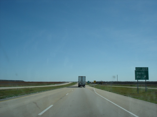 |
Interstate 20 East at Exit 209 - Dorn Road. (Photo taken 3/18/05) |
 |
Interstate 20 East approaching Exit 210 - Farm to Market Road 2836 - 1 mile. (Photo taken 3/18/05) |
 |
Interstate 20 East at Exit 210 - Farm to Market Road 2836. FM 2836 connects to Texas 163 southwest of Colorado City. (Photo taken 3/18/05) |
 |
Interstate 20 East approaching Exit 212 - Farm to Market Road 1229 - 1 mile. (Photo taken 3/18/05) |
 |
Interstate 20 East at Exit 212 - Farm to Market Road 1229. (Photo taken 3/18/05) |
 |
Interstate 20 East approaching Exit 213 - Business Loop I-20 East - 3/4 mile. (Photo taken 3/18/05) |
 |
Interstate 20 East approaching Exit 213 - Business Loop I-20 East - Next Exit. The sign bridge ahead is at the exit ramp's departure from the interstate. (Photo taken 3/18/05) |
 |
Interstate 20 East at Exit 213 - Business Loop I-20 East - Colorado City. The city is so named because of its proximity to the Colorado River. Over 4,000 people call Colorado City home. (Photo taken 3/18/05) |
 |
Interstate 20 East approaching Exit 215 - Farm to Market Road 3525 - 1/2 mile. Two facilities of the Texas Department of Criminal Justice are located in Colorado City, the 80 John Wallace Unit and the Dick Ware Unit. (Photo taken 3/18/05) |
 |
Interstate 20 East at Exit 215 - Farm to Market Road 3525. This may be the first time we have seen prison facilities on a BGS for an exit. (Photo taken 3/18/05) |
 |
Interstate 20 East approaching Exit 216 - Texas 208 North/Business Texas 208 South - 1 mile. (Photo taken 3/18/05) |
 |
Interstate 20 East at Exit 216 - Texas 208 North/Business Texas 208 South. Texas 208 heads to the east parallel to Interstate 20 for less than a mile. A 21 mile northbound drive on Texas 208 separates Colorado City and Snyder. (Photo taken 3/18/05) |
 |
Interstate 20 East approaching Exit 217 - Texas 208 South - 3/4 mile. The state highway continues its southern track to San Angelo. (Photo taken 3/18/05) |
 |
Interstate 20 East at Exit 217 - Texas 208 South - San Angelo. This sign mistakenly labels this as Texas 208 East. San Angelo is 74 miles to the south. (Photo taken 3/18/05) |
 |
Interstate 20 East approaching Exit 219 - Business Loop I-20 West - 1 mile. (Photo taken 3/18/05) |
 |
Interstate 20 East at Exit 219 - Business Loop I-20 West - Country Club Road. The next business loop is just five miles ahead, serving Loraine. (Photo taken 3/18/05) |
 |
Interstate 20 East approaching Exit 220 - Farm to Market Road 1899 - 1 mile. (Photo taken 3/18/05) |
 |
Interstate 20 East at Exit 220 - Farm to Market Road 1899. (Photo taken 3/18/05) |
 |
Interstate 20 East approaching Exit 221 - Lasky Road - 3/4 mile. (Photo taken 3/18/05) |
 |
Interstate 20 East at Exit 221 - Lasky Road. (Photo taken 3/18/05) |
 |
Interstate 20 East approaching Exit 223 - Lucas Road - 3/4 mile. (Photo taken 3/18/05) |
 |
Interstate 20 East at Exit 223 - Lucas Road. (Photo taken 3/18/05) |
 |
Interstate 20 East approaching Exit 224 - Business Loop I-20 - 3/4 mile. (Photo taken 3/18/05) |
 |
Interstate 20 East at Exit 224 - Business Loop I-20 East - Loraine. (Photo taken 3/18/05) |
 |
Interstate 20 East approaching Exit 225 - Farm to Market Road 644 - 3/4 mile. (Photo taken 3/18/05) |
 |
Interstate 20 East at Exit 225 - Farm to Market Road 644. (Photo taken 3/18/05) |
 |
Interstate 20 East at Exit 226B - Wimberley Road. (Photo taken 3/18/05) |
 |
Interstate 20 East at Exit 227 - Narrell Road. (Photo taken 3/18/05) |
 |
Interstate 20 East approaching Exit 230 - Farm to Market Road 1230 - 1 mile. (Photo taken 3/18/05) |
 |
Interstate 20 East at Exit 230 - Farm to Market Road 1230. (Photo taken 3/18/05) |
 |
Interstate 20 East at Exit 235 - Business Loop I-20 - Roscoe. The city is home of the westbound split of U.S. 84 and Interstate 20, which occurs on the east side of town. (Photo taken 3/18/05) |
 |
Interstate 20 East approaching Exit 236 - Farm to Market Road 608 - 1 mile. FM 608 is known as Main Street through Roscoe. (Photo taken 3/18/05) |
 |
Interstate 20 East at Exit 236 - Farm to Market Road 608 - Roscoe. (Photo taken 3/18/05) |
 |
Interstate 20 East approaching Exit 237 - Cemetery Road - 1 mile. Use Cemetery Road north to get to U.S. 84 West. There is no direct connection between Interstate 20 East and U.S. 84 West. (Photo taken 3/18/05) |
 |
Interstate 20 East at Exit 237 - Cemetery Road. (Photo taken 3/18/05) |
 |
Interstate 20 East approaching Exit 238B - Blackland Road - 1 mile. Exit 238A is reserved for the westbound-only exit to U.S. 84. (Photo taken 3/18/05) |
 |
Interstate 20 East at Exit 238B - Blackland Road. The embankment on the left is U.S. 84. The federal highway will be duplexed with Interstate 20 for the next 41 miles. (Photo taken 3/18/05) |
 |
Interstate 20 and U.S. 84 East at Exit 238C - Frontage Road. (Photo taken 3/18/05) |
 |
Interstate 20 and U.S. 84 East at Exit 239 - May Road. (Photo taken 3/18/05) |
 |
Interstate 20 and U.S. 84 East approaching Exit 240 - Loop 170 - 1/2 mile. We are entering the city of Sweetwater, population 11,415. (Photo taken 3/18/05) |
 |
Interstate 20 and U.S. 84 East at Exit 240 - Loop 170. The state highway is a short route connecting Interstate 20 and the Sweetwater business loop to the Sweetwater city airport. (Photo taken 3/18/05) |
 |
Interstate 20 and U.S. 84 East at Exit 241 - Business Loop I-20 East - Sweetwater. (Photo taken 3/18/05) |
 |
Interstate 20 and U.S. 84 East approaching Exit 242 - Hopkins Road - 1/2 mile. (Photo taken 3/18/05) |
 |
Interstate 20 and U.S. 84 East at Exit 242 - Hopkins Road. (Photo taken 3/18/05) |
 |
Interstate 20 and U.S. 84 East approaching Exit 243 - Hillsdale Road/Robert Lee Street - 1/2 mile. (Photo taken 3/18/05) |
 |
Interstate 20 and U.S. 84 East at Exit 243 - Hillsdale Road/Robert Lee Street. (Photo taken 3/18/05) |
 |
Interstate 20 and U.S. 84 East approaching Exit 244 - Business Texas 70 North/Texas 70 South - 1/2 mile. (Photo taken 3/18/05) |
 |
Interstate 20 and U.S. 84 East at Exit 244 - Business Texas 70 North/Texas 70 South. In recent years, a new bypass of Sweetwater was built on its eastern side, and Texas 70 was relocated onto it. The state highway begins north of Bronte at U.S. 277 and does not meet its other end until U.S. 83 just south of Perryton near the Oklahoma-Texas border in the panhandle. (Photo taken 3/18/05) |
 |
Interstate 20 East, U.S. 84 East, and Texas 70 North approaching Exit 246 - Alabama Avenue - 1 1/4 miles. The street is a main east-west arterial through south Sweetwater. (Photo taken 3/18/05) |
 |
Interstate 20 East, U.S. 84 East, and Texas 70 North at Exit 246 - Alabama Avenue. (Photo taken 3/18/05) |
 |
Interstate 20 & U.S. 84 East and Texas 70 North approaching Exit 247 - Business Loop I-20 West/Texas 70 North - 1 mile. Both highways are mistakenly signed as north-south highways, even though the business loop runs east-west. (Photo taken 3/18/05) |
 |
Interstate 20 & U.S. 84 East and Texas 70 North at Exit 247 - Business Loop I-20 West/Texas 70 North - Sweetwater/Roby. Roby, located at the intersection of U.S. 180 and Texas 70, is 21 miles to the north. (Photo taken 3/18/05) |
 |
Interstate 20 and U.S. 84 East approaching Exit 249 - Farm to Market Road 1856 - 1 mile. (Photo taken 3/18/05) |
 |
Interstate 20 and U.S. 84 East at Exit 249 - Farm to Market Road 1856. FM 1856 connects to Texas 70 south of Sweetwater. (Photo taken 3/18/05) |
 |
Interstate 20 and U.S. 84 East approaching Exit 251 - Eskota Road - 1 mile. (Photo taken 3/18/05) |
 |
Interstate 20 and U.S. 84 East at Exit 251 - Eskota Road. (Photo taken 3/18/05) |
 |
Interstate 20 and U.S. 84 East approaching Exit 255 - Adrian Road - 1 mile. (Photo taken 3/18/05) |
 |
Interstate 20 and U.S. 84 East at Exit 255 - Adrian Road. (Photo taken 3/18/05) |
 |
Interstate 20 and U.S. 84 East approaching Exit 256 - Stink Creek Road - 1/2 mile. Wonder if the creek actually stinks... (Photo taken 3/18/05) |
 |
Interstate 20 and U.S. 84 East at Exit 256 - Stink Creek Road. (Photo taken 3/18/05) |
 |
Interstate 20 and U.S. 84 East approaching Exit 258 - White Flat Road - 3/4 mile. (Photo taken 3/18/05) |
 |
Interstate 20 and U.S. 84 East at Exit 258 - White Flat Road. (Photo taken 3/18/05) |
 |
Interstate 20 and U.S. 84 East approaching Exit 259 - Sylvester Road - 3/4 mile. (Photo taken 3/18/05) |
 |
Interstate 20 and U.S. 84 East at Exit 259 - Sylvester Road. (Photo taken 3/18/05) |
 |
Interstate 20 and U.S. 84 East approaching unmarked Exit 261 - Business Loop I-20 - 1 mile. This is the only advance signage for the exti. (Photo taken 3/18/05) |
 |
Interstate 20 and U.S. 84 East at Exit 261 - Business Loop I-20 East - Trent. (Photo taken 3/18/05) |
 |
Interstate 20 and U.S. 84 East approaching Exit 262 - Farm to Market Road 1085 - 1 mile. (Photo taken 3/18/05) |
 |
Interstate 20 and U.S. 84 East at Exit 262 - Farm to Market Road 1085. Use FM 1085 North to get to Sylvester. (Photo taken 3/18/05) |
 |
Interstate 20 and U.S. 84 East approaching Exit 263 - Business Loop I-20 West - 1/2 mile. (Photo taken 3/18/05) |
 |
Interstate 20 and U.S. 84 East at Exit 263 - Business Loop I-20 West. (Photo taken 3/18/05) |
 |
Interstate 20 and U.S. 84 East approaching Exit 264 - Noodle Dome Road - 1 mile. (Photo taken 3/18/05) |
 |
Interstate 20 and U.S. 84 East at Exit 264 - Noodle Dome Road. (Photo taken 3/18/05) |
 |
Interstate 20 and U.S. 84 East approaching Exit 266 - Derstine Road - 1 mile. (Photo taken 3/18/05) |
 |
Interstate 20 and U.S. 84 East at Exit 266 - Derstine Road. (Photo taken 3/18/05) |
 |
Interstate 20 and U.S. 84 East approaching Exit 267 - Business Loop I-20 - 1 mile. (Photo taken 3/18/05) |
 |
Interstate 20 and U.S. 84 East at Exit 267 - Business Loop I-20 - Merkel. The city has a population of 2,637. (Photo taken 3/18/05) |
 |
Interstate 20 and U.S. 84 East approaching Exit 269 - Farm to Market Road 126 - 1 mile. (Photo taken 3/18/05) |
 |
Interstate 20 and U.S. 84 East at Exit 269 - Farm to Market Road 126. FM 126 northbound travelers will eventually reach U.S. 83 near Hamlin. (Photo taken 3/18/05) |
 |
Interstate 20 and U.S. 84 East approaching Exit 270 - Business Loop I-20 West/Farm to Market Road 1235 North - 3/4 mile. (Photo taken 3/18/05) |
 |
Interstate 20 and U.S. 84 East at Exit 270 - Business Loop I-20 West/Farm to Market Road 1235 North. (Photo taken 3/18/05) |
 |
Interstate 20 and U.S. 84 East approaching Exit 272 - Wimberly Road - 1 mile. (Photo taken 3/18/05) |
 |
Interstate 20 and U.S. 84 East at Exit 272 - Wimberly Road. (Photo taken 3/18/05) |
 |
Interstate 20 and U.S. 84 East approaching Exit 274 - Wells Lane - 3/4 mile. (Photo taken 3/18/05) |
 |
Interstate 20 and U.S. 84 East at Exit 274 - Wells Lane. (Photo taken 3/18/05) |
 |
Interstate 20 and U.S. 84 East approaching Exit 277 - Business Loop I-20 East/Farm to Market Road 707 - 1 mile. (Photo taken 3/18/05) |
 |
Interstate 20 and U.S. 84 East at Exit 277 - Business Loop I-20 East/Farm to Market Road 707 - Tye. The next two interchanges also serve Business Loop I-20. (Photo taken 3/18/05) |
 |
Interstate 20 and U.S. 84 East at Exit 278 - Business Loop I-20. (Photo taken 3/18/05) |
 |
Interstate 20 and U.S. 84 East at Exit 279 - Business Loop I-20/U.S. 84 East - Abilene. This ends the 41-mile duplex of Interstate 20 and U.S. 84. (Photo taken 3/18/05) |
 |
Interstate 20 East approaching Exit 280 - Farm to Market Road 3438/Fulwiler Road/Dyess Air Force Base - 3/4 mile. (Photo taken 3/18/05) |
 |
Interstate 20 East at Exit 280 - Farm to Market Road 3438. Use Fulwiler Road southbound to get to Dyess Air Force Base. (Photo taken 3/18/05) |
 |
Interstate 20 East approaching Exit 282 - Shirley Road - 1 mile. (Photo taken 3/18/05) |
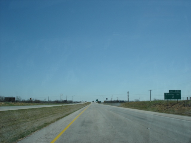 |
Interstate 20 East at Exit 282 - Shirley Road. (Photo taken 3/18/05) |
 |
Interstate 20 East approaching Exit 283A - U.S. 83/U.S. 277 South - 3/4 mile. (Photo taken 3/18/05) |
 |
Interstate 20 East at Exit 283A - U.S. 83/U.S. 277 South - Ballinger/San Angelo. Ballinger is 58 miles to the south and is located along a short U.S. 67/U.S. 83 duplex. Continue on U.S. 67 South from Ballinger for another 31 miles and motorists will reach San Angelo. (Photo taken 3/18/05) |
 |
Interstate 20 East at Exit 283B - U.S. 83/U.S. 277 North - Anson. The county seat of Jones County is 19 miles to the north. The city is home to 2,556 residents and the northern split of U.S. 83 and U.S. 277. For photos of U.S. 277 between Abilene and Wichita Falls, please visit the U.S. 277 Texas guide. (Photo taken 3/18/05) |
Page created: June 28, 2005
Last updated:
July 02, 2005