 |
Home Search OKRoads: |
|
|
Home Search OKRoads: |
Interstate 40 North Carolina
Eastbound - Statesville to Greensboro
|
Highway Information |
|
| Miles | 419.40 |
| Counties Traveled Through |
Haywood, Buncombe, McDowell, Burke, Catawba, Iredell, Davie, Forsyth, Guilford, Alamance, Orange, Durham, Wake, Johnston, Sampson, Duplin, Pender, New Hanover |
| Cities |
Asheville, Morganton, Hickory, Statesville, Winston-Salem, Greensboro, Burlington, Durham, Raleigh, Smithfield, Wilmington |
| Major Junctions |
Interstate 26/ Interstate 240 (Exits 46A-B)
Interstate 77 Interstate 85 Interstate 540 Interstate 440 Interstate 95 |
| OKRoads Coverage | |
| Miles Driven by OKRoads (Percentage) |
419 (100%) |
| Western End of Interstate Driven |
Tennessee State Line |
| Eastern End of Interstate Driven |
North Carolina 132 |
Pictures
Eastbound:
Tennessee State Line to Canton
Interstate 40/Interstate 85 duplex
Interstate 85 North to Interstate 95
| Interstate 40 East | |
 |
Interstate 40 East approaching Exit 162 - U.S. 64 - 2 miles. Interstate 40 and U.S. 64 closely parallel each other between Exit 150 and Exit 170. (Photo taken 7/6/05) |
 |
Interstate 40 East approaching Exit 162 - U.S. 64 - 1 mile. There are no control cities used because of the proximity of the two federal highways. (Photo taken 7/6/05) |
 |
Use U.S. 64 west to the community of Cool Springs. (Photo taken 7/6/05) |
 |
Interstate 40 East at Exit 162 - U.S. 64. The two highways will meet yet again at the next exit six miles ahead. (Photo taken 7/6/05) |
 |
Interstate 40 East approaching Exit 168 - U.S. 64 - 1 mile. U.S. 64 enters the town of Mocksville three miles to the east of the approaching interchange. Mocksville, which has a population of 4,178 according to the 2000 census, is the seat of Davie County. (Photo taken 7/6/05) |
 |
Interstate 40 East at Exit 168 - U.S. 64 - Mocksville. (Photo taken 7/6/05) |
 |
Interstate 40 East approaching Exit 170 - U.S. 601 - 1/2 mile. The federal highway travels through two states, and both end with Carolina. (Photo taken 7/6/05) |
 |
Interstate 40 East at Exit 170 - U.S. 601 - Mocksville/Yadkinville. Salisbury is just 18 miles to the south. The seat of Yadkin County is a 15 mile northbound drive from here. (Photo taken 7/6/05) |
 |
Interstate 40 East approaching Exit 174 - Farmington Road - 1 mile. Farmington Road connects to U.S. 158 just one-quarter mile to the south of Exit 174. U.S. 158 begins at U.S. 64 and U.S. 601 in Mocksville and parallels Interstate 40 to the south between Mocksville and Winston-Salem. (Photo taken 7/6/05) |
 |
Interstate 40 East at Exit 174 - Farmington Road. A left turn at the end of the off-ramp will lead to the community of Farmington in four miles at the North Carolina 801 intersection. (Photo taken 7/6/05) |
 |
Interstate 40 East approaching the Davie County rest area - 2 miles. (Photo taken 7/6/05) |
 |
Interstate 40 East approaching the Davie County rest area - Next Right. The next rest area is near Burlington on the Interstate 40/Interstate 85 duplex. (Photo taken 7/6/05) |
 |
Gore point signage at the Davie County rest area. This is halfway between Exit 174 and Exit 180. (Photo taken 7/6/05) |
 |
Interstate 40 East approaching Exit 180 - North Carolina 801 - 1 1/4 miles. North Carolina 801 is a north-south highway shaped a bit like a boomerang. From its southern terminus at North Carolina 152 in Mooresville, the state highway travels northeast to U.S. 64 in Fork, then heads almost due north to Interstate 40, then heads due west to U.S. 601 six miles west of Farmington, where North Carolina 801 meets its northern end. (Photo taken 7/6/05) |
 |
Interstate 40 East at Exit 180 - North Carolina 801 - Tanglewood/Bermuda Run. Bermuda Run is located near the U.S. 158/North Carolina 801 intersection just south of this interchange. The Tanglewood Park and Golf Course are located one mile southeast of Exit 180. (Photo taken 7/6/05) |
 |
Although the semi truck is blocking the way here, an extra eastbound lane is added as we enter Forsyth County. Exit 184 serves Lewisville Clemmons Road and is one mile ahead. (Photo taken 7/6/05) |
 |
Interstate 40 East approaching Exit 184 - Lewisville Clemmons Road - 1/2 mile. Interstate 40 is now in the village of Clemmons, which had an estimated population of 16,276 in 2004, an increase from the 2000 census count of 13,827 people. (Photo taken 7/6/05) |
 |
U.S. 421 ties into the Exit 188 interchange with Business Loop Interstate 40. Since there is no direct ramp between Interstate 40 East and U.S. 421 North, one must use Lewisville Clemmons Road north to make the connection. (Photo taken 7/6/05) |
 |
Interstate 40 East at Exit 184 - Lewisville Clemmons Road. (Photo taken 7/6/05) |
 |
Interstate 40 East approaching Exit 188 - Business Loop Interstate 40 East and U.S. 421 South - 2 miles. U.S. 421 stays on the business loop through Winston-Salem, then joins mainline Interstate 40 at the eastern terminus of the business loop. (Photo taken 7/6/05) |
 |
Take Business Loop Interstate 40 East to Exit 2B (North Carolina 67 north) to Wake Forest University and the Lawrence Joel Veterans Memorial Coliseum, better known as the LJVM Coliseum. The arena hosts Wake Forest Demon Deacon basketball, concerts, and conventions throughout the year. (Photo taken 7/6/05) |
 |
Wake Forest University Baptist Medical Center is located just off of Exit 4A (Cloverdale Avenue) of the business loop. (Photo taken 7/6/05) |
 |
Interstate 40 East enters the city of Winston-Salem. With a population of over 190,000, it is the 5th largest city in the state. (Photo taken 7/6/05) |
 |
Interstate 40 East approaching Exit 188 - Business Loop Interstate 40 East and U.S. 421 South - 1 mile. (Photo taken 7/6/05) |
 |
Use Business Loop Interstate 40 East to downtown Winston-Salem. The business loop is the original alignment of Interstate 40 through the city before it was bypassed beginning in late 1992 with the completion of the new Interstate 40 south of downtown. (Photo taken 7/6/05) |
 |
Interstate 40 East approaching Exit 188 - Business Loop Interstate 40 East and U.S. 421 South - 1/2 mile. Downtown Winston-Salem is also mentioned both here and on the next set of signs just before the split. (Photo taken 7/6/05) |
 |
Interstate 40 East widens to four lanes as Business Loop Interstate 40 prepares to begin. The two left lanes become the beginning of the loop, while the two right lanes continue the mainline of Interstate 40. Greensboro is now the control city, as we are now just 32 miles from the downtown of that city. (Photo taken 7/6/05) |
 |
Interstate 40 East at Exit 188 - Business Loop Interstate 40 East/U.S. 421 South - Winston-Salem. The business loop is 18 miles long. (Photo taken 7/6/05) |
 |
Interstate 40 eastbound temporarily narrows to two lanes as the one-half mile advance signage for the next exit appears. Exit 190 provides access to U.S. 158, which has run parallel to the interstate since Mocksville. (Photo taken 7/6/05) |
 |
Interstate 40 East approaching Exit 190 - U.S. 158 - 1/4 mile. Two lanes are gained from the Business Loop Interstate 40/U.S. 421 interchange, but the far right lane will exit to U.S. 158 shortly. (Photo taken 7/6/05) |
 |
Hanes Mall is located on the northeast corner of the Interstate 40/U.S. 158 interchange. Use U.S. 158 East to the Forsyth Memorial Hospital, located near the North Carolina 67 intersection. (Photo taken 7/6/05) |
 |
Interstate 40 East at Exit 190 - U.S. 158/Stratford Road. U.S. 158 spends its entire length in North Carolina, spanning from U.S. 64 and U.S. 601 in Mocksville to the outer banks. (Photo taken 7/6/05) |
 |
Interstate 40 East approaching Exit 192 - North Carolina 150 - 1 mile. Peters Creek Parkway is a major north-south arterial through Winston-Salem. As for the state highway, it eventually duplexes with the business loop between exits 5 and 15. (Photo taken 7/6/05) |
 |
Use North Carolina 150 north and Silas Creek Parkway west to Forsyth Technical Community College. (Photo taken 7/6/05) |
 |
Interstate 40 East approaching Exit 192 - North Carolina 150 - 1/2 mile. The southern terminus of North Carolina 67 is less than one-tenth of a mile north of Exit 192. (Photo taken 7/6/05) |
 |
Interstate 40 East at Exit 192 - North Carolina 150/Peters Creek Parkway/Downtown. Our picture turned out a bit blurry, but we can say that a trumpet interchange is located here due to the proximity of Silas Creek Parkway to the north. (Photo taken 7/6/05) |
 |
The next interchange is a cloverleaf at U.S. 52 and North Carolina 8. Use Exit 193B (U.S. 52/North Carolina 8 North) to Smith Reynolds Airport. A tourist information center is located near downtown Winston-Salem. (Photo taken 7/6/05) |
 |
Interstate 40 East approaching Exits 193A-B - U.S. 52/North Carolina 8 - 1 mile. U.S. 311 is only mentioned with shield assemblies at the interchange, but the federal highway comes in from the north and will share a short duplex with Interstate 40. (Photo taken 7/6/05) |
 |
U.S. 52 between Interstate 40 and Interstate 85 was approved as a future Interstate 285 during 2005. Upon completion of upgrades of some non-Interstate-standard portions of the freeway, the interstate will be signed around the year 2010. North of Interstate 40, U.S. 52 may become part of an extended Interstate 74. Higher education institutions located off of the future Interstate 74 near downtown Winston-Salem area include the North Carolina School of the Arts, Salem College, and Winston-Salem State University. (Photo taken 7/6/05) |
 |
Interstate 40 East at Exit 193A - U.S. 52/North Carolina 8 South - Lexington. The city of Lexington represents the southern terminus of future Interstate 285, and is 17 miles to the south. Lexington is also the southern end of the U.S. 52/North Carolina 8 duplex, which extends 22 miles from Lexington to Winston-Salem. (Photo taken 7/6/05) |
 |
Interstate 40 East at Exit 193B - U.S. 52/U.S. 311/North Carolina 8 North - Mount Airy. Again, our apologies for the blurriness of the picture, but we hadn't quite got all the kinks worked out of the new camera at that point. Shield assemblies, barely visible to the right, point the way to U.S. 311 North. Mount Airy, famous for being home of the Andy Griffith Show, is 39 miles to the northwest. (Photo taken 7/6/05) |
| Interstate 40 East and U.S. 311 South | |
 |
Interstate 40 East and U.S. 311 South approaching Exit 195 - North Carolina 109 - 1/4 mile. The state highway begins here and goes south through Thomasville, Troy, and Wadesboro before entering the state of South Carolina. (Photo taken 7/6/05) |
 |
Interstate 40 East at Exit 195 - North Carolina 109 - Clemmonsville Road/Thomasville. The sign held a U.S. 311 shield underneath the "NORTH" banner before U.S. 311 was rerouted onto U.S. 52 and North Carolina 8 through central Winston-Salem. (Photo taken 7/6/05) |
 |
Interstate 40 East and U.S. 311 South assurance shields just past Exit 195. The two federal highways prepare to split in one-half mile, as the BGS indicates ahead. (Photo taken 7/6/05) |
 |
Interstate 40 East and U.S. 311 South at Exit 196 - U.S. 311 South - High Point. Future Interstate 74 will depart a short duplex with Interstate 40 here and head southeast to High Point and Asheboro, where it will meet Interstate 73. High Point is just 10 miles from Exit 196. (Photo taken 7/6/05) |
| Interstate 40 East | |
 |
Interstate 40 East narrows to two lanes as we approach Exit 201, Union Cross Road, two miles. The street connects Union Cross, Mathis, and Kernersville. (Photo taken 7/6/05) |
 |
Interstate 40 East approaching Exit 201 - Union Cross Road - 1 mile. (Photo taken 7/6/05) |
 |
Interstate 40 East at Exit 201 - Union Cross Road. (Photo taken 7/6/05) |
 |
Interstate 40 East approaching Exit 203 - North Carolina 66 - 1 1/2 miles. North Carolina 66 begins at U.S. 311 near High Point and travels north through Kernersville, Walkertown, and Rural Hall. (Photo taken 7/6/05) |
 |
Interstate 40 East approaching Exit 203 - North Carolina 66 - 1 mile. The highway is four lanes divided between Interstate 40 and the business loop, which at this point is two miles to the north. (Photo taken 7/6/05) |
 |
Interstate 40 East at Exit 203 - North Carolina 66 - Kernersville/High Point. This is the final exit before the eastern terminus of the business loop. There is no direct access from eastbound Interstate 40 to the westbound business loop. Interstate 40 will enter Guilford County shortly. (Photo taken 7/6/05) |
 |
Interstate 40 East approaching Exit 208 - Sandy Ridge Road - 2 miles. (Photo taken 7/6/05) |
 |
Use Sandy Ridge Road south for 1/3 mile to the Piedmont Triad Farmers Market, one of five state-owned farmers markets. (Photo taken 7/6/05) |
 |
Interstate 40 East approaching Exit 208 - Sandy Ridge Road - 1 mile. The second overpass ahead carries the easternmost section of Business Loop Interstate 40. (Photo taken 7/6/05) |
 |
Along with the merge of Business Loop Interstate 40 onto Interstate 40 is U.S. 421 South, which duplexes with the business loop's entire length. Exit 208 is one-half mile ahead. An extra eastbound lane is added here prior to the merge of Business Loop Interstate 40 East and U.S. 421 South onto Interstate 40. (Photo taken 7/6/05) |
| Interstate 40 East and U.S. 421 South | |
 |
Another mention of the farmers market is given for those coming from the business loop. (Photo taken 7/6/05) |
 |
Interstate 40 East and U.S. 421 South at Exit 208 - Sandy Ridge Road. The interstate between the business loop and U.S. 220 was expanded during 2003 and 2004. (Photo taken 7/6/05) |
 |
Use any of the next 11 interchanges for the city of Greensboro. The city has a population of over 230,000, and is the 3rd largest city in the Tar Heel State, behind only Charlotte (594,359) and Raleigh (326,653). (Photo taken 7/6/05) |
 |
In lieu of standalone shields, little green signs (LGS) are used along parts of Interstate 40 through the Triad. Here, a LGS indicates the duplex of Interstate 40 East and U.S. 421 South. (Photo taken 7/6/05) |
 |
Interstate 40 East and U.S. 421 South are five lanes wide as we approach Exit 210 - North Carolina 68 - 1 mile. The state highway provides the main route between Interstate 40 and Piedmont Triad International Airport. (Photo taken 7/6/05) |
 |
Interstate 40 East and U.S. 421 South at Exit 210 - North Carolina 68 - High Point/Piedmont Triad International Airport. The city of High Point (pop. 92,857) is four miles to the south. (Photo taken 7/6/05) |
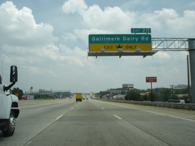 |
Interstate 40 East and U.S. 421 South approaching Exit 211 - Gallimore Dairy Road - 1/2 mile. The single-point urban interchange (SPUI) is a recent addition to the freeway. (Photo taken 7/6/05) |
 |
Interstate 40 East and U.S. 421 South at Exit 211 - Gallimore Dairy Road. (Photo taken 7/6/05) |
 |
Interstate 40 East approaching Exit 213 - Guilford College Road - 1 1/4 miles. Sign supports are already in place for the near future, when Interstate 40 will exit off to the right and bypass the city of Greensboro to the south. See the Greensboro's Future Freeways page at NCRoads.com for more information and maps of the Greensboro area. (Photo taken 7/6/05) |
 |
This picture shows the progress of construction on the interchange that will eventually tie together Interstates 40, 73, and 840, and Business Loop Interstate 40. (Photo taken 7/6/05) |
 |
Use Guilford College Road north and New Garden Road east to the Guilford Courthouse National Military Park. It was designated as a national military park in 1917 because it was the site of a hotly-contested Revolutionary War battle. (Photo taken 7/6/05) |
 |
Take Guilford College Road southbound to Jamestown and Guilford Technical Community College. Head north to Guilford College. (Photo taken 7/6/05) |
 |
Interstate 40 East and U.S. 421 South approaching Exit 213 - Guilford College Road - 1/4 mile. (Photo taken 7/6/05) |
 |
Interstate 40 East and U.S. 421 South at Exit 213 - Guilford College Road. (Photo taken 7/6/05) |
 |
Interstate 40 East and U.S. 421 South approaching Exits 214A-B - Wendover Avenue - 1/4 mile. The right lane becomes exit only for Exit 214B (eastbound Wendover Avenue). (Photo taken 7/6/05) |
 |
Interstate 40 East and U.S. 421 South at Exit 214A - Wendover Avenue westbound. Wendover Avenue is a major east-west arterial through Greensboro. (Photo taken 7/6/05) |
 |
Interstate 40 East and U.S. 421 South at Exit 214B - Wendover Avenue eastbound. Motorists taking this exit will meet U.S. 220 in six miles. (Photo taken 7/6/05) |
 |
The next exit is Exit 216, serving North Carolina 6 East. The Greyhound and Amtrak stations are located near the corner of North Carolina 6 (Patterson Street) and Holden Road. (Photo taken 7/6/05) |
 |
Interstate 40 East and U.S. 421 South approaching Exit 216 - North Carolina 6 East - 1/4 mile. The state highway serves as a connection into downtown Greensboro from either direction of Interstate 40. It connects to the interstate at each end. (Photo taken 7/6/05) |
 |
Greensboro is home to several academic institutions, including the University of North Carolina-Greensboro, Greensboro College, Bennett College, and North Carolina Agricultural & Technical State University. (Photo taken 7/6/05) |
 |
Interstate 40 East and U.S. 421 South at Exit 216 - North Carolina 6 East - Greensboro/Coliseum Area. The Greensboro Coliseum Complex plays host to numerous events and includes the War Memorial Auditorium, Special Events Center, and Pavilion. (Photo taken 7/6/05) |
 |
Interstate 40 East and U.S. 421 South approaching Exit 217 - High Point Road/Coliseum Area - 1/2 mile. Traffic becomes heavy as we approach the junction of Business Loop Interstate 85. (Photo taken 7/6/05) |
 |
Interstate 40 East and U.S. 421 South at Exit 217 - High Point Road/Coliseum Area. U.S. 220 South is 1 1/4 miles ahead. (Photo taken 7/6/05) |
 |
Interstate 40 East and U.S. 421 South approaching Exit 218A - U.S. 220 - 1/2 mile, and Exit 218B - Freeman Mill Road - 3/4 mile. Interstate 85 South is mentioned here because it is less than five miles to the south. The remaining signs, however, mention the business loop instead of the interstate. Interstate 85 was rerouted to the south of Greensboro in early 2004 on an alignment that Interstate 40 will soon be on as well once the connection between the current Interstate 40 and Interstate 85 is complete. (Photo taken 7/6/05) |
 |
Use U.S. 220 South to Pinehurst, site of the 2005 U.S. Open golf championship. Take Exit 218B to the Historic Blandwood Mansion. (Photo taken 7/6/05) |
 |
To the North Carolina Zoological Park, take U.S. 220 South to Asheboro. To the coliseum area, use Freeman Mill Road north to Coliseum Boulevard. (Photo taken 7/6/05) |
 |
Interstate 40 East and U.S. 421 South at Exit 218A - U.S. 220 South TO Business Loop Interstate 85 South. Asheboro is 25 miles to the south. (Photo taken 7/6/05) |
 |
Interstate 40 East and U.S. 421 South at Exit 218B - Freeman Mill Road. Business Loop Interstate 85 is less than one mile away. (Photo taken 7/6/05) |
| Interstate 40 East, U.S. 220 North, and U.S. 421 South | |
 |
Interstate 40 East, U.S. 220 North, and U.S. 421 South approaching Exit 219 - Business Loop Interstate 85/U.S. 29 South/U.S. 70 West - 1/4 mile. Business Loop Interstate 85 is the original route of Interstate 85 through Greensboro. (Photo taken 7/6/05) |
 |
Interstate 40 East, U.S. 220 North, and U.S. 421 South at Exit 219 - Business Loop Interstate 85/U.S. 29 South/U.S. 70 West - Charlotte. An 88 mile drive separates Charlotte from this interchange. (Photo taken 7/6/05) |
 |
Mile markers from Business Loop Interstate 85 are used for the exit numbers on the duplexed Interstate 40/Business Loop Interstate 85 stretch. Here, we see the departure to the left for Exit 36, Randleman Road. Just ahead, motorists on Business Loop Interstate 85 are given a right-hand exit to Randleman Road. We are about to see three other highways added to the freeway, for a total of six highways on one road! And five of the six are regularly signed along the short multiplexed stretch! As we will see in just a few more pictures, a shield assembly does have reassurance shields for all six highways! (Photo taken 7/6/05) |
| Interstate 40 and U.S. 70 East, Business Loop Interstate 85, U.S. 29, and U.S. 220 North, and U.S. 421 South | |
 |
Interstate 40 and U.S. 70 East, Business Loop Interstate 85, U.S. 29, and U.S. 220 North, and U.S. 421 South (whew, that's a lot to type) approaching Exit 37/Old Exit 125 - South Elm-Eugene Street/Downtown Greensboro - 1/2 mile. The right lane prepares to end as the freeway's eastbound/northbound/southbound lanes prepare to go under Randleman Road. (Photo taken 7/6/05) |
 |
Use Exit 37/Old Exit 125 to the same four colleges used accessed via Interstate 40's Exit 216. (Photo taken 7/6/05) |
 |
Interstate 40 and U.S. 70 East, Business Loop Interstate 85, U.S. 29, and U.S. 220 North, and U.S. 421 South at Exit 37/Old Exit 125 - South Elm-Eugene Street/Downtown Greensboro. The old exit numbers are those of mainline Interstate 85. (Photo taken 7/6/05) |
 |
And here it is, the shield assembly to top all shield assemblies. All six highways have full shield setups here, with correct cardinal directions and highway types. The Business Loop Interstate 85 shield, the newest of the bunch, is about half the size of the others, however. (Photo taken 7/6/05) |
 |
The speed limit is 55 through this section of interstate, also known as "Death Valley" due to the many serious accidents that have happened here over the years. Use Exit 38/Old Exit 126 (U.S. 421 South) to the town of Liberty, located east of the U.S. 421/North Carolina 49 interchange 17 miles to the southeast, and Siler City, at the juncture of U.S. 64 and U.S. 421, 30 miles away. (Photo taken 7/6/05) |
 |
Interstate 40 and U.S. 70 East, Business Loop Interstate 85, U.S. 29, and U.S. 220 North, and U.S. 421 South approaching Exit 38/Old Exit 126 - U.S. 421 South - 1/4 mile, and Exit 39 - U.S. 29 North/U.S. 70 East/U.S. 220 North - 1/2 mile. The sexiplex of highways will become a simple duplex within the next mile. (Photo taken 7/6/05) |
 |
North of Interstate 40/Business Loop Interstate 85/all the other highways, the arterial into downtown Greensboro is known as Martin Luther King Jr. Drive. (Photo taken 7/6/05) |
 |
Interstate 40 and U.S. 70 East, Business Loop Interstate 85, U.S. 29, and U.S. 220 North, and U.S. 421 South at Exit 38/Old Exit 126 - U.S. 421 South - Sanford. A 52 mile drive to the southeast lies between Greensboro and Sanford. (Photo taken 7/6/05) |
| Interstate 40 and U.S. 70 East, and Business Loop Interstate 85, U.S. 29, and U.S. 220 North | |
 |
Interstate 40 and U.S. 70 East, and Business Loop Interstate 85, U.S. 29, and U.S. 220 North at Exit 39 - U.S. 29 North/U.S. 70 East/U.S. 220 North - Reidsville. The three federal highways share 3.3 more miles of roadway before going their separate ways. Reidsville is set near the junction of U.S. 29 and U.S. 158, 24 miles to the north. Motorists coming from U.S. 421 are provided a separate ramp to U.S. 29 North/U.S. 70 East/U.S. 220 North, as is barely visible on the right. (Photo taken 7/6/05) |
| Interstate 40 East and Business Loop Interstate 85 North | |
 |
Interstate 40 East and Business Loop Interstate 85 North are now without the other U.S. highways as they approach Exit 41/Old Exit 128, North Carolina 6 - 1 1/2 miles. The state highway has both ends at Interstate 40 and is mainly a connector from Interstate 40 to downtown Greensboro. In any other state, North Carolina 6 would be a really good candidate for Business Loop Interstate 40, but this is North Carolina, where the original freeway alignments through cities are considered the business loops. (Photo taken 7/6/05) |
 |
Interstate 40 East and Business Loop Interstate 85 North shields on a LGS as we near Exit 41/Old Exit 128. (Photo taken 7/6/05) |
 |
Interstate 40 East and Business Loop Interstate 85 North approaching Exit 41/Old Exit 128 - North Carolina 6 - 1 mile. (Photo taken 7/6/05) |
 |
Interstate 40 East and Business Loop Interstate 85 North at Exit 41/Old Exit 128 - North Carolina 6 - East Lee Street. (Photo taken 7/6/05) |
 |
Interstate 40 East and Business Loop Interstate 85 North approaching Exit 43/Old Exit 130 - McConnell Road - 1 1/2 miles. The east-west arterial runs in the freeway's shadow between Exits 41 and 43. (Photo taken 7/6/05) |
 |
Interstate 40 East and Business Loop Interstate 85 North approaching Exit 43/Old Exit 130 - McConnell Road - 1/2 mile, and Exit 44 - Interstate 85 South/To U.S. 70 - 1 mile. The Exit 44 interchange also marks the future southern terminus of Interstate 785, which will connect Interstate 40 and Interstate 85 to Danville, Virginia, along the U.S. 29 corridor. (Photo taken 7/6/05) |
 |
Interstate 40 East and Business Loop Interstate 85 North at Exit 43/Old Exit 130 - McConnell Road. Exit 44 is 1/2 mile ahead. (Photo taken 7/6/05) |
 |
Interstate 40 East and Business Loop Interstate 85 North at Exit 44 - Interstate 85 South/To U.S. 70. Currently, the only section of future Interstate 785 built that connects to the interstate system extends northward from Exit 44 to U.S. 70, which is two miles to the north. For the next 31 miles, Interstate 40 and Interstate 85 are duplexed, and Interstate 85's mile markers are used for the exit numbers. (Photo taken 7/6/05) |
Page created: November 12, 2005
Last updated:
November 13, 2005