OKRoads
Trip pages:
Summaries:
Days 4-5
(I-19 Sidetrip;
Tucson to Phoenix)
Day One:
Oklahoma: I-35
Texas: I-35 | I-35W
Day Two:
Texas: I-35W | I-30 |
I-20 | I-10
Day Three:
Texas: I-10
New Mexico: I-10
Arizona: I-10
Day Four:
Arizona: I-19
Day Five:
Arizona: I-10 | I-17
Day Six:
Arizona: I-10 |
I-17 |
AZ 51 | Loop 101 |
Loop 202 | U.S. 60
Day Seven:
Arizona: AZ 51 | AZ
143 |
AZ 153 | Loop 202 |
Loop 303
Day Eight:
Arizona: I-17 | I-40
New Mexico: I-40
Day Nine:
New Mexico: I-40
Texas: I-40
Oklahoma: I-40 | I-44
Delaware State Highway
Terminus Gallery & Guides
Roadtrips:
2002
2003
2004
Other Pages
SPRING TRAINING 2004 ROADTRIP
Interstate 10 Arizona
Interstate 10 is the main east-west interstate of the southern United States, connecting Los Angeles, Phoenix, Tucson, El Paso, San Antonio, Houston, Baton Rouge, New Orleans, Biloxi, Mobile, Pensacola, and Jacksonville. During Days Two, Three, Four, and Five of the Spring Training 2004 Roadtrip, I drove Interstate 10 from Interstate 20 near Kent, Texas, to Loop 303 in Goodyear, Arizona.
New Mexico State Line to Tucson
Pictures taken March 14, 2004
 |
Interstate 10 West as it enters the
Grand Canyon State. The first exit in Arizona is just 1/4 mile ahead. |
 |
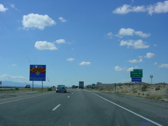
Interstate 10 West at Exit 390 - Cavot Rd. |
 |
Interstate 10 West at Exit 382 -
Bus. Loop I-10 - Portal Rd./San Simon. |
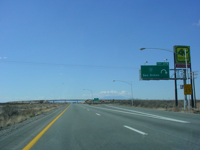 |
Interstate 10 West at Exit 378 -
Bus. Loop I-10 - San Simon. |
 |
Interstate 10 West at Exit 366 -
Bus. Loop I-10 - Bowie. |
 |
Interstate 10 West at Exit 362 -
Bus. Loop I-10 - Bowie. |
 |
Interstate 10 West at Exit 355 -
U.S. 191 North - Safford. |
 |
Interstate 10 West at Exit 352 -
U.S. 191 North - Safford. U.S. 191 has two branches in this area, so there are two exits for the same highway. The two branches meet two miles north of Interstate 10. |
 |
Interstate 10 West at Exit 344 -
Bus. Loop I-10 West - Willcox. |
 |
Interstate 10 West at Exit 340 - AZ 186 - Rex Allen Dr./Fort Grant Rd. |
 |
Interstate 10 West at Exit 336 -
Bus. Loop I-10 - Willcox. |
 |
Interstate 10 West at Exit 331 -
U.S. 191 South - Sunsites/Douglas. |
 |
Interstate 10 West at Exit 322 -
Johnson Rd. |
 |
Interstate 10 West at mile marker
320. This is a rare scenic portion of Interstate 10 in this part of the country. |
 |
Interstate 10 West at Exit 318 -
Dragoon Rd. |
 |
Interstate 10 West at Exit 312 - Sibyl Rd. |
 |
Interstate 10 West at Exit 306 -
Bus. Loop I-10/AZ 80 - Pomerene Rd./ Benson. |
 |
Interstate 10 West at Exit 304 -
Ocotillo St./Benson. |
 |
Interstate 10 West at Exit 302 - AZ
90 South - Ft. Huachuca/Sierra Vista. |
 |
Mileage sign on Interstate 10 West
just west of Benson. Interstate 19 is 41 miles ahead. |
 |
Interstate 10 West at Exit 299 -
Skyline Rd. |
 |
Interstate 10 West at Exit 297 -
J-Six Ranch Rd./Mescal Rd. The next gas is 28 miles ahead in southeast Tucson. |
 |
Mileage sign on Interstate 10 West. AZ 83 South is 15 miles ahead. |
 |
Interstate 10 West at Exit 292 -
Empirita Rd. |
 |
Mileage sign just west of Empirita
Rd. Interstate 19 is now 31 miles away. |
 |
Interstate 10 West at Exit 289 -
Marsh Station Rd. This section of Interstate 10 will soon be realigned. Currently, this stretch of highway is substandard, with minimal shoulders and bridge clearance. The speed limit drops to 65 during this short stretch. |
 |
Interstate 10 West at Exit 281 - AZ
83 South - Sonoita/Patagonia. |
 |
Interstate 10 West at Exit 279 -
Vail Rd./Wentworth Rd. |
 |
Mileage sign on Interstate 10 West,
19 miles east of Interstate 19. |
 |
Interstate 10 West at Exit 275 -
Houghton Rd. |
 |
Interstate 10 West at Exit 273 - Rita Rd. |
 |
Interstate 10 West at Exit 270 - Kolb Rd. |
 |
Interstate 10 West at Exit 269 -
Wilmot Rd. |
 |
Interstate 10 West at Exit 268 -
Craycroft Rd. |
 |
Interstate 10 West at Exit 267 -
Valencia Rd./Tucson International Airport. |
 |
Interstate 10 West at Exit 265 -
Alvernon Way North. |
 |
Interstate 10 West at Exit 264 -
Irvington Rd./Palo Verde Rd. |
 |
Interstate 10 West at Exit 263 - Ajo
Way/ Kino Pkwy. |
 |
Interstate 10 West at Exit 262 - Park Ave. |
Tucson to Phoenix
Pictures taken March 16, 2004
 |
Interstate 10 West at Exit 261 -
Bus. Loop I-19 - 4th-6th Ave. The middle sign is covered due to the construction at Interstate 19 interchange. The ramp from Interstate 10 West to Interstate 19 South was closed. |
 |
Interstate 10 West as it goes under the new Interstate 19 North overpass. |
 |
Interstate 10 West at Exit 258 - Congress St./Broadway Blvd./St. Marys Rd. |
 |
Interstate 10 West at Exit 257 - Speedway Blvd./University of Arizona. |
 |
Interstate 10 West at Exit 256 - Grant Rd. |
 |
Interstate 10 West at Exit 255 - AZ
77 North - Miracle Mile. |
 |
Interstate 10 West at Exit 254 -
Prince Rd. |

|
Interstate 10 West at Exit 252 - El Camino Del Cerro/Ruthrauff Rd. |
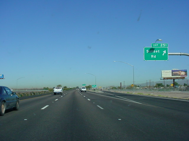 |
Interstate 10 West at Exit 251 -
Sunset Rd. |
 |
Interstate 10 West at Exit 250 - Orange Grove Rd. |
 |
Interstate 10 West at Exit 248 - Ina Rd. |
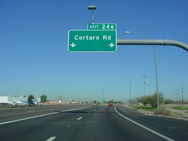 |
Interstate 10 West at Exit 246 - Cortaro Rd. |
 |
Interstate 10 West at Exit 240 - Tangerine Rd. |
 |
Mileage sign on Interstate 10 West just past Exit 240. Forty miles separate this sign from Interstate 8. |
 |
Interstate 10 West at Exit 236 - Marana. |
 |
Interstate 10 West at Exit 232 - Pinal Air Park Rd. |
 |
Interstate 10 West at Exit 226 - Red Rock. |
 |
Interstate 10 West at Exit 219 - Picacho Peak Rd. |
 |
Interstate 10 West at Exit 212 - Picacho. |
 |
Interstate 10 West at Exit 211B - AZ 87 North - Coolidge/Florence. |
 |
Interstate 10 West at Exit 208 - Sunshine Blvd. |
 |
Interstate 10 West at Exit 203 - Toltec Rd. |
 |
Mileage sign on Interstate 10 West just north of Exit 203. Interstate 8 is just three miles away. |
 |
Interstate 10 West approaching Exit 199 - Interstate 8 West - 2 miles. |
 |
Interstate 10 West approaching Exit 200 - Sunland Gin Rd./Arizona City - 1/2 mile, and Exit 199 - 1 mile. |
 |
Interstate 10 West at Exit 200 - Sunland Gin Rd./Arizona City. Interstate 8 begins in 1/2 mile. |
 |
Interstate 10 West at Exit 199 - Interstate 8 West - San Diego. |
 |
Interstate 10 West at Exit 198 - Jimmie Kerr Blvd. |
 |
Interstate 10 West at Exit 194 -
Bus. Loop I-10/AZ 287 - Casa Grande/ Coolidge. The next services are in 35 miles, which would be in the Phoenix suburb of Chandler. |
 |
Interstate 10 West at Exit 190 - McCartney Rd. |
 |
Interstate 10 West at Exit 185 - AZ 187/AZ 387 - Sacaton/Florence. |
 |
Interstate 10 West at Exit 175 - AZ 587 North - Chandler/Gilbert. |
 |
Interstate 10 West at Exit 167 -
Riggs Rd. |
 |
Interstate 10 West at Exit 164 -
Queen Creek Rd. |
 |
Interstate 10 West at Exit 162 -
Wild Horse Pass Blvd./Sundust Rd. |
 |
Interstate 10 West approaching Exit 161 - Loop 202 East/Pecos Rd. - 1/4 mile. |
 |
Interstate 10 West at Exit 161 -
Loop 202 East/Pecos Rd. |
 |
Interstate 10 West at Exit 160 - Chandler Blvd. |
 |
Interstate 10 West at Exit 159 - Ray Rd. |
 |
Interstate 10 West at Exit 158 - Warner Rd. |
 |
Interstate 10 West at Exit 157 - Elliot Rd./Guadalupe. |
 |
Interstate 10 West approaching Exit 155 - Baseline Rd. - 1 3/4 miles, and Exit 154 - U.S. 60 East - 2 miles. |
 |
Interstate 10 West approaching Exit 155 - 1/2 mile, and Exit 154 - 3/4 mile. (or 3/4 miles as the sign says!) |
 |
Interstate 10 West at Exit 155 - Baseline Rd. |
 |
Interstate 10 West at Exit 154 - U.S. 60 East - Mesa/Globe. |
 |
Interstate 10 West c/d lane at U.S. 60 East. |
 |
Interstate 10 West approaching Exit 153B - Broadway Rd./52nd St. - 1 3/4 miles, and Exit 153A - AZ 143 North - 2 miles. |
 |
Interstate 10 West approaching Exit 153B - 1/2 mile, and Exit 153A - 3/4 mile. |
 |
Interstate 10 West approaching Exit 153B - 1/4 mile, and Exit 153A - 1/2 mile. |
 |
Interstate 10 West at Exit 153B - Broadway Rd./52nd St. |
 |
Interstate 10 West at Exit 153A - AZ 143 North - Sky Harbor Airport. |
 |
Interstate 10 West at Exit 152 - 40th St. |
 |
Mileage sign on Interstate 10 West, two miles east of Interstate 17. |
 |
Interstate 10 West at Exit 151 - University Dr./32nd St. |
 |
Interstate 10 West approaching Exit 150A - Interstate 17 North/U.S. 60 West - 1 1/2 miles. |
 |
Interstate 10 West approaching Exit 150B - 24th St. - 3/4 mile, and Exit 150A - 1 mile. |
 |
Interstate 10 West at Exit 150B - 24th St. |
 |
Interstate 10 West at Exit 150A - Interstate 17 North/U.S. 60 West - Flagstaff. Interstate 17 is also used as a truck route for Interstate 10 West while that interstate goes through downtown Phoenix. |
 |
Interstate 10 West at Exit 149 - Buckeye Rd./Sky Harbor International Airport. |
 |
Interstate 10 West at Exit 148 - Jefferson St./Washington St. AZ 51 North and Loop 202 East are 1/2 mile ahead. |
 |
Interstate 10 West at Exit 147A-B - AZ 51 North/Loop 202 East. |
 |
Interstate 10 West c/d lane at Exit 147A - Loop 202 East. |
 |
Mileage sign on Interstate 10 West inside the Interstate 10/AZ 51/Loop 202 interchange. The next two exits are for 7th St. and 7th Ave. Confused? |
 |
Interstate 10 West at Exit 145 - 7th St. |
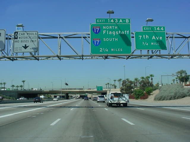 |
Interstate 10 West approaching Exit 144 - 7th Ave. - 3/4 mile, and Exit 143A-B - Interstate 17 - 2 1/4 miles. |
 |
Interstate 10 West approaching Exit 144 - 1/2 mile. Interstate 10 enters a tunnel here. This was the final section of Interstate 10 to be completed. |
 |
Interstate 10 West at Exit 144 - 7th Ave. |
 |
Interstate 10 West approaching Exit 143C - 19th Ave./Grand Ave. - 1 mile, and Exits 143A-B - 1 1/4 miles. |
 |
Interstate 10 West approaching Exit 143C - 1/4 mile, and Exits 143A-B - 1/2 mile. |
 |
Interstate 10 West at Exit 143C -
19th Ave./Grand Ave. |
 |
Interstate 10 West approaching Exits 143A-B - 1/4 mile. |
 |
Interstate 10 West at Exits 143A-B - Interstate 17 - Flagstaff. |
 |
The Interstate 17 off-ramp as it splits into Exit 143A - Interstate 17 North - Flagstaff, and Exit 143B - Interstate 17 South. |
 |
Mileage sign on Interstate 10 West just past Interstate 17. Loop 101 is eight miles ahead, AZ 85, which connects to Interstate 8 as part of the most direct route from Phoenix to San Diego, is 29 miles ahead, and Los Angeles is only 371 miles away. |
 |
Interstate 10 West at Exit 141 - 35th Ave. |
 |
Interstate 10 West at Exit 140 - 43rd Ave. |
 |
Interstate 10 West at Exit 139 - 51st Ave. |

51st Ave. to Loop 101
Pictures taken March 17, 2004
 |
Interstate 10 West at Exit 138 -
59th Ave. |
 |
Interstate 10 West at Exit 137 -
67th Ave. |
 |
Interstate 10 West at Exit 136B -
75th Ave. |
 |
Interstate 10 West at Exit 136A -
79th Ave. This exit is for HOV vehicles only. |
 |
Interstate 10 West at Exit 135 -
83rd Ave. |
 |
Interstate 10 West approaching Exit 134 - 91st Ave. - 3/4 mile, and Exit 133B - Loop 101 North - 1 1/2 miles. |
 |
Interstate 10 West approaching Exit 134 - 1/4 mile, and Exit 133B - 1 mile. |
 |
Interstate 10 West at Exit 134 -
91st Ave. |
 |
Interstate 10 West approaching Exit 133B - 1/4 mile. |
 |
Interstate 10 West at Exit 133B - Loop 101 North. |
Loop 101 to Loop 303
Pictures taken March 18, 2004
 |
Interstate 10 West at Exit 133A -
99th Ave./107th Ave. |
 |
Interstate 10 West at Exit 131 -
115th Ave. |
 |
Interstate 10 West at Exit 129 -
Dysart Rd. |
 |
Interstate 10 West at Exit 128 - Litchfield Rd. |
 |
Interstate 10 West at Exit 126 - PebbleCreek Parkway/Estrella Parkway. |
 |
Interstate 10 West at Exit 124 - TO Loop 303 - Cotton Lane. |