OKRoads.com
Trip pages:
Note: All pages are for Texas highways unless otherwise specified.
Day One:
Interstate 35 Oklahoma |
Interstate 35 |
Interstate 35E
Day Two:
Interstate 35 |
U.S. 59 |
TX 44 |
TX 358 |
TX 286 |
Interstate 37
Day Three:
Interstate 35 |
U.S. 281 |
Interstate 410 |
Interstate 10 |
Interstate 45
Day Four:
Interstate 45 |
Interstate 30 |
Interstate 35E |
Interstate 35 |
Interstate 35 Oklahoma
Delaware State Highway
Terminus Gallery & Guides
Roadtrips:
Spring Training 2004 Roadtrip
Coming soon!
Seattle Trip
Coming soon!
Other Pages
SOUTH TEXAS ROADTRIP
Interstate 35 Texas (Page Two)
Interstate 35 goes from Laredo, Texas, to Duluth, Minnesota. The highway travels 504 miles in the state of Texas. On Day Two of the South Texas Roadtrip, I drove Interstate 35 from San Antonio to Laredo.
This page covers pictures taken of Interstate 35 from Day Two. For pictures from Day Three and Day Four, please see the Interstate 35 Texas (Page Three) page.
San Antonio to Laredo
Pictures taken October 17, 2003
 |
Interstate 35 South
(upper level) approaching Exit 156 - Interstate 10 - Next Right. The upper level narrows to one lane just past Interstate 10. |
 |
Interstate 35 South at
Exit 156 - Interstate 10 West/U.S. 87 North - El Paso. |
 |
Interstate 35 South at
Exit 155C - W. Houston St./Commerce St. |
 |
Interstate 35 South at
Exit 149 - Hutchins Blvd. The Motel 6 I stayed at is just ahead to the left. |
 |
Interstate 35 South at
Exit 148B - Palo Alto Rd. |
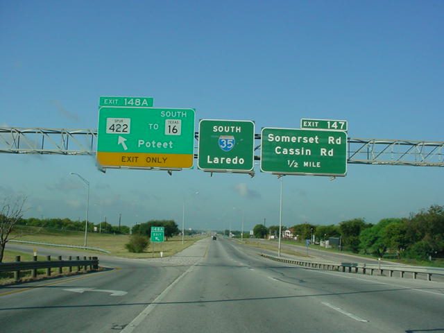 |
Interstate 35 South at
Exit 148A - TX Spur 422/TO TX 16 South - Poteet. |
 |
Interstate 35 South at
Exit 147 - Somerset Rd./Cassin Rd. |
 |
Interstate 35 South
approaching Exit 145A - Interstate 410/TX 16 - 2 miles. |
 |
Interstate 35 South at
Exit 145B - TX Loop 353 North. Interstate 410 is 6/10 mile ahead. |
 |
Interstate 35 South at
Exit 145A - Interstate 410/TX 16. OK, so this is the final advance sign, but this picture didn't finish being saved onto the disk in time for me to get the actual exit. |
 |
Interstate 35 South at
Exit 144 - Fischer Rd. |
 |
Interstate 35 South at
Exit 141 - Von Ormy/Benton City Rd. |
 |
Interstate 35 South at
Exit 140 - TX Loop 1604 - Anderson Loop/ Somerset. |
 |
Interstate 35 South at
Exit 139 - Kinney Rd. |
 |
Interstate 35 South at
Exit 137 - Shepherd Rd. |
 |
Interstate 35 South at
Exit 135 - Luckey Rd. |
 |
Interstate 35 South at
Exit 133 - TX 132 South - Lytle. |
 |
Interstate 35 South
approaching Exit 127 - FM 471 - Natalia - 1/2 mile. At the time, this was the final signage for this exit. |
 |
Interstate 35 South at
Exit 124 - FM 463 - Bigfoot Rd./Devine. |
 |
Interstate 35 South at
Exit 122 - TX 173 - Devine/Jourdanton. |
 |
Interstate 35 South at
Exit 114 - FM 462 - Bigfoot/Yancey. |
 |
Interstate 35 South at
Exit 111 - U.S. 57 - Eagle Pass. It was at this point that I began to enter some clouds and mist. |
 |
Interstate 35 South at
Exit 104 - Bus. Loop I-35 South. |
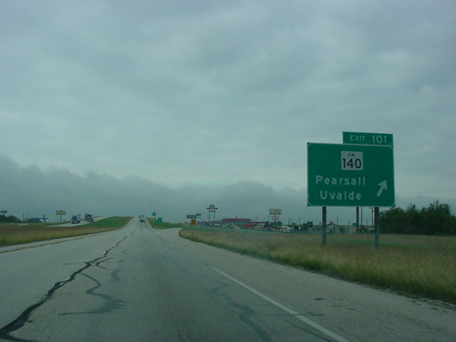 |
Interstate 35 South at
Exit 101 - FM 140 - Pearsall/Uvalde. |
 |
Interstate 35 South at
Exit 99 - FM 1581 - Divot. |
 |
Interstate 35 South at
Exit 91 - FM 1583 - Derby. |
 |
Interstate 35 South at
Exit 86 - Bus. Loop I-35 South - Dilley. |
 |
Interstate 35 South at
Exit 85 - FM 117 - Batesville. |
 |
Interstate 35 South at
Exit 82 - Bus. Loop I-35 North - County Line Rd. |
 |
Speed Limit 75 sign on
Interstate 35 South just after entering La Salle County. The county has a low enough population density that the speed limit is 75. The truck speed limit, however, remains 70. |
 |
Interstate 35 South at
Exit 77 - FM 469 - Millett. |
 |
Interstate 35 South at
Exit 74 - Gardendale. (I apologize for the poor quality of some of these pictures) |
 |
Interstate 35 South at
Exit 69 - Bus. Loop I-35 South - Cotulla. |
 |
Interstate 35 South at
Exit 65 - Bus. Loop I-35 North. |
 |
Interstate 35 South at
Exit 56 - FM 133 - Artesia Wells/Catarina. |
 |
Interstate 35 South at
Exit 48 - Carman Creek Interchange. |
 |
Interstate 35 South at
Exit 39 - TX 44 - Encinal. |
 |
Interstate 35 South at
Exit 32 - San Roman Interchange. |
 |
Mileage sign on
Interstate 35 South, just south of Exit 32. This is the first mileage sign I have ever seen that lists a distance to Monterrey, Mexico. It's 174 miles away from this point. |
 |
Interstate 35 South at
Exit 27 - Callaghan Interchange. |
 |
Interstate 35 South
approaching Exit 24 - Camino Colombia Toll Road - 1 mile. |
 |
Interstate 35 South
approaching Exit 24 - 1/2 mile. The toll road was sold to the Texas DOT a couple months after I was in the area. The toll road did not have much traffic on it, and really didn't have much use. |
 |
Interstate 35 South at
Exit 24 - Camino Colombia Toll Road. |
 |
The Camino Colombia Toll
Road overpass from Interstate 35 South. The vehicle on top of the bridge is a Border Patrol SUV. |
 |
Interstate 35 South at
Exit 18 - U.S. 83 North - Carrizo Springs/Uvalde. |
 |
Interstate 35 South at
the parking area just south of U.S. 83. The structure to the left is the Border Patrol checkpoint on Interstate 35/ U.S. 83 North. |
 |
Interstate 35 South at
Exit 13 - Uniroyal Interchange. |
 |
Interstate 35 South at
the TX Loop 20 - World Trade Bridge exit. |
 |
A look at the flyover
ramps at the TX Loop 20 interchange. |
 |
Interstate 35 South at
Exit 7 - Shiloh Dr./Las Cruces Dr. |
 |
Interstate 35 South at
Exit 4 - FM 1472 - Del Mar Blvd./Santa Maria Ave. |
 |
Interstate 35 South at
Exit 3B - Bus. Loop I-35 - San Bernardo Ave./Mann Rd. |
 |
Interstate 35 South at
Exit 3A - Calton Rd. |
 |
Interstate 35 South at
Exit 2 - U.S. 59 - Freer/Corpus Christi/Houston. This interchange marks the southern terminus of U.S. 59. |
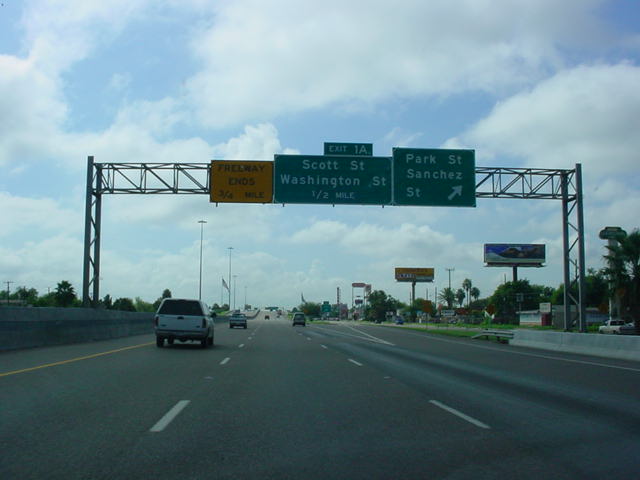 |
Interstate 35 South at
unmarked Exit 1B - Park St./Sanchez St. Interstate 35 ends in 3/4 mile. |
 |
Interstate 35 South at
unmarked Exit 1A - Scott St./Washington St. The end of Interstate 35 is now 1/2 mile away. |
 |
"Freeway Ends 1/4 mile"
sign on Interstate 35 South. |
 |
Interstate 35 South
approaching U.S. 83 and the Mexico International Bridges. The speed limit has dropped from 65 to 45, and will eventually go down to 30. |
 |
Traffic begins to back
up as Interstate 35 comes to an end. Just across the median is the northbound beginning of Interstate 35. |
 |
Sign gantry just past
the stoplight at the southern terminus. Mexico is just about 1/2 mile ahead. |
 |
Switching directions
now, we see the northbound beginning of Interstate 35. U.S. 59 is also signed here, even though it actually begins two miles to the north. One more stoplight separates U.S. 83 from the beginning of Interstate 35. |
 |
Shield assembly at the
gore point as Interstate 35 North begins. |
 |
The first Interstate
35/U.S. 83 North assurance shields. In just 504 more miles, Interstate 35 will leave the state of Texas. |
 |
Interstate 35 North
approaching Exit 2 - U.S. 59 - 3/4 mile. |
 |
Interstate 35 North at
Exit 2 - U.S. 59 - Freer/Corpus Christi/Houston. |
 |
Interstate 35 North
frontage road at U.S. 59. U.S. 59 is signed east- west for several miles. |