OKRoads
Trip pages:
Summaries:
Days 6-8
(Palm Bay to Charlotte)
Day One:
Oklahoma: I-44
Texas: I-44 | U.S. 287 |
I-35W | I-820 |
I-30 | I-20
Day Two:
Texas: I-20
Louisiana: I-20 |
I-49 |
I-220/LA 3132
Day Three:
Louisiana: I-49 | I-10
Mississippi: I-10
Alabama: I-10
Florida: I-10
Day Four:
Florida: I-10 | I-75 |
I-4
Day Five:
Florida: I-4 | I-75 |
FL 826 | FL 836 |
I-95
Day Six:
Florida: I-95
Georgia: I-95 |
I-16 | I-75
Day Seven:
Georgia: I-475 | I-75 |
I-85
South Carolina: I-85
North Carolina: I-85 |
I-485 | I-277 |
NC 16
Day Eight:
North Carolina: U.S. 74 |
U.S. 1 | U.S. 220 |
I-73 |
I-40 | Bus. I-40 |
U.S. 52 |
I-74 | I-77
Day Nine:
North Carolina: I-85
South Carolina: I-85 |
Business Loop I-85 | I-585
Georgia: I-85 | I-285 |
I-75
Tennessee: I-75 | I-24
Day Ten:
Tennessee: I-24
Kentucky: I-24
Illinois: I-24 | I-57
Missouri: I-57 | I-55
Arkansas: I-55
Day Eleven:
Arkansas: I-40
Oklahoma: I-40 | I-240
Delaware State Highway
Terminus Gallery & Guides
Roadtrips:
2002
2003
2004
Other Pages
FLORIDA TRIP
U.S. 220 North Carolina
U.S. 220 goes from U.S. 1 in Rockingham, North Carolina, to NY 17 (future Interstate 86) in Waverly, New York. On Day Eight of the Florida Trip, I drove U.S. 220 from U.S. 1 to Interstate 40.
Note: Pictures from the Interstate 73 part of U.S. 220 in central North Carolina are on the Interstate 73 page. Pictures from Future Interstate 73 between Business U.S. 220 and Interstate 40 are on this page.
U.S. 1 to Interstate 40
Pictures taken December 18, 2003
 |
U.S. 220 North at Midway Rd. |
 |
U.S. 220 North at Business U.S. 74.
The signs here, however, still sign the highway as U.S. 74. If there were tabs with "Business" on top of the direction tabs, this sign assembly would be correct. |
 |
U.S. 220 North at NC 73 West.
Another "Future I-73/74 Corridor" sign is just ahead. |
 |
U.S. 220 North/NC 73 East at NC 73 East. |
 |
U.S. 220 North at Alternate U.S.
220. Interstate 73 begins just ahead. |
| INTERSTATE 73/INTERSTATE
74 (See Interstate 73 page for pictures) |
|
 |
U.S. 220 North at McDowell Road. |
 |
U.S. 220 North at U.S. 64 East/NC 49 North - Raleigh. |
 |
U.S. 220 North at U.S. 64 West/NC 49 South - Charlotte/Lexington. |
 |
U.S. 220 North at NC 42 - Asheboro. |
 |
U.S. 220 North at Presnell St. |
 |
U.S. 220 North at TO Business U.S.
220 - Vision Drive/N. Fayetteville St. |
 |
U.S. 220 North at Spero Rd. |
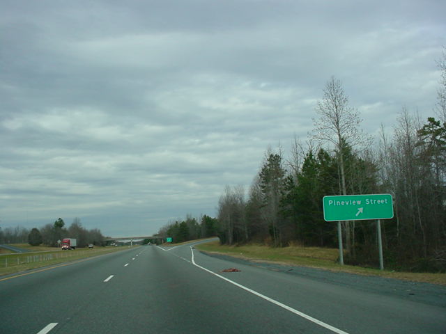 |
U.S. 220 North at Pineview Street. |
 |
U.S. 220 North at U.S. 311 -
Randleman/ High Point. |
 |
Interstate 74 will go along U.S. 311
from here to High Point, so this "END Future Interstate 74" shield is posted at the U.S. 311 interchange. |
 |
U.S. 220 North at Randleman. The
Richard Petty Museum is located in Randleman. |
 |
U.S. 220 North at Level Cross. |
 |
U.S. 220 North at NC 62 - Climax/High Point. |
 |
U.S. 220 North at Old Randleman Rd. |
 |
U.S. 220 North at what is now
Interstate 85. At this time, construction was almost complete on the Greensboro bypass, which is what this is. |
 |
U.S. 220 North approaching Exit 79A
- Interstate 85/U.S. 29/U.S. 70 - 1/2 mile. (Sorry for the blurriness) |
 |
U.S. 220 North at Exit 79A -
Interstate 85/ U.S. 29 North/U.S. 70 East - Burlington. This exit now leads to Business Loop I-85. |
 |
U.S. 220 North at Exit 79B -
Interstate 85/ U.S. 29 South/U.S. 70 West - High Point/ Charlotte. |
 |
U.S. 220 North at Exit 80 - Creek
Ridge Rd. Interstate 40 is 1/2 mile ahead. |
 |
U.S. 220 North approaching Exit 81 -
U.S. 220 North/TO Interstate 40 - 1/4 mile. |
 |
U.S. 220 North at Exit 81 -
Interstate 40/U.S. 220 - Winston-Salem/Burlington. |
 |
U.S. 220 North at Interstate 40.
U.S. 220 North duplexes with Interstate 40 East for about five miles. |